
Puuc Route
The Puuc Route traces a band of low limestone hills in southwest Yucatán where Classic Maya cities took shape in stone and light. In a land with few surface waters, people mastered rain capture and storage, building vaulted palaces and long mosaic façades that still hold the heat of the day and the cool of the night. Sacbe causeways once linked towns across dry forest and fields, tying daily life to ritual cycles that honored the bringer of rain.
Traveling this route offers a clear window into Puuc style and the networks that sustained it. The architecture is precise, the distances are short, and the story is regional rather than imperial. Each stop adds a piece of the whole, from mask covered fronts to quiet plazas where corbel vaults frame the sky.
| Location | Low limestone hills of southwest Yucatán, along Hwy 261 between Muna and Oxkutzcab. |
| Major Sites | Uxmal, Kabah, Sayil, Xlapak, Labná |
| Civilization | Maya. Puuc florescence c. 700–950 CE. |
| Entry Ticket | INAH tickets at each site. Uxmal has separate state and federal fees. Cash recommended. |
| Best Season to Visit | Dry Nov–Apr: clear, lower humidity. Hottest Apr–May: start early. Rainy May–Oct: green, afternoon showers; storms highest Aug–Oct. |
| Base Towns | Mérida for tours and rentals. Santa Elena as a simple central base. Also Muna, Ticul, Oxkutzcab, or on-site Uxmal lodges. |
| Transport | Rental car simplest. Buses to Uxmal or Muna, then taxis or colectivos. Sunday second-class “Ruta Puuc” loop. Tours and private drivers available. |
| Highlights | Uxmal pyramid and Nunnery Quadrangle; Kabah mask wall; Labná arch and sacbe; Sayil Great Palace viewpoints; Chaac and lattice mosaics. |
Why Visit the Puuc Route
The ruins are reason enough, but they are also an excuse to experience more.
Walk past crisp mosaic façades and quiet plazas set in dry forest. Follow ancient sacbe causeways through small towns where Yucatecan food, markets, and craftwork shape daily life. Read Chaac masks and rain symbols, then link them to caves, chultunes, and a landscape built around water.
The Puuc Route is more than a checklist. It is a compact region where architecture, ritual, and living culture still meet. From Mérida it is easy to reach by road, second class bus, or rental car, and simple to explore in a long day or a few unhurried ones.
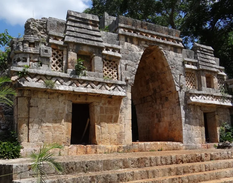
Plan your visit: jump to the individual Puuc ruin guides, Uxmal, Kabah, Sayil, Xlapak, and Labná for site access information and tips, and visit the Maya civilization overview to place the Puuc hills in the wider story of the ancient Americas.
History of the Puuc Region
People lived in the Puuc hills long before the Classic Maya period, but the region reached its height between roughly 700 and 950 CE. During that time, cities like Uxmal, Kabah, Sayil, Labná, and Xlapak formed a dense ceremonial and political network across the dry limestone uplands of northwest Yucatán. Raised sacbeob linked palace groups, plazas, temples, and administrative compounds, creating a connected landscape of movement, ritual, and elite power.
The environment shaped everything. Unlike other Maya regions, the Puuc hills lacked major rivers and natural cenotes, forcing communities to engineer systems for collecting and storing rainwater. Chultunes, bottle-shaped underground cisterns cut into the limestone, became essential for survival. That dependence on seasonal rain helps explain why Chaac, the Maya rain god, dominates so much of the region’s architecture. His masks appear stacked across façades, corners, and rooflines, transforming entire buildings into symbolic appeals for water and fertility.
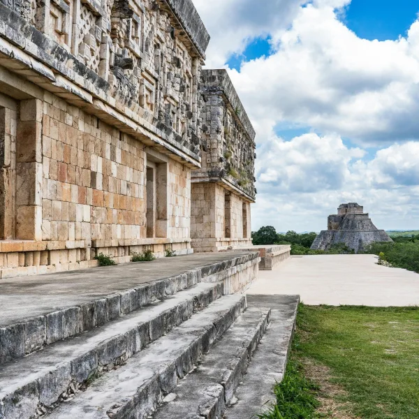
Puuc builders developed one of the most sophisticated architectural systems in the ancient Americas. Structures combined rubble-and-concrete cores with thin veneer stones precisely fitted into geometric mosaics, lattice panels, and elaborate friezes. Corbel vaults, columned galleries, and carefully balanced façades gave the cities a sense of rhythm and symmetry that still defines the region today.
After about 900 CE, many Puuc cities began to decline. Political fragmentation, environmental stress, shifting trade networks, and changing regional alliances gradually weakened the hill country centers. Some sites remained active into the Postclassic era, especially Uxmal, but the great building phase had ended. Forest growth slowly reclaimed plazas and roadways until explorers, illustrators, and archaeologists brought renewed attention to the region during the nineteenth and twentieth centuries. Today, the Puuc hills preserve one of the clearest surviving architectural landscapes of the ancient Maya world.
The Puuc Style
The Puuc style represents one of the most refined architectural traditions in the ancient Maya world, flourishing between roughly 600 and 950 CE in the limestone hills of northwest Yucatán. Cities like Uxmal, Kabah, Sayil, and Labná transformed the region into a landscape of carefully balanced plazas, elevated sacbeob, ornate façades, and long palace complexes built with extraordinary precision. The word “Puuc” means “hill” in Yucatec Maya, reflecting the rolling terrain that shaped settlement, movement, and construction across the region.
Puuc architecture is defined by contrast. Lower walls were often left smooth and restrained, while upper façades became dense displays of carved stone mosaics, lattice panels, geometric friezes, and repeated masks of Chaac, the Maya rain god. Across the region, architecture functioned as both engineering and symbolism, turning palace fronts and ceremonial buildings into statements about power, water, order, and ritual life.
Rather than relying on massive cut blocks alone, Puuc builders perfected a rubble-and-concrete core faced with thin veneer stones fitted so precisely that many details remain sharp more than a thousand years later. Corbel vaults, colonnaded entrances, elevated causeways, and carefully aligned sightlines gave these cities a distinctive sense of rhythm and proportion that still defines the Puuc landscape today.
The style also reflects adaptation to a difficult environment. In a region without major rivers or abundant cenotes, communities depended on rain capture systems and underground chultunes carved into the limestone. Water shaped settlement patterns, religious imagery, and urban planning alike, helping explain why the imagery of Chaac appears so persistently across the stonework of the Puuc world.
To spot Puuc architecture on site, look for these key features
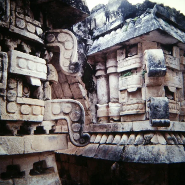
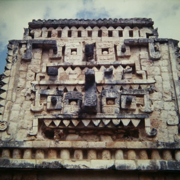
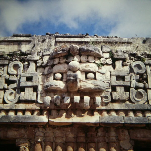
- Chaac Masks: Long-nosed rain god faces stacked along corners, doorways, and rooflines. Some buildings contain dozens of them.
- Geometric Mosaics: Intricate latticework, stepped fret patterns, and carved stone panels covering upper façades.
- Two-Zone Walls: Smooth lower walls contrasted against highly ornamented upper sections divided by a projecting cornice.
- Columns and Corbel Arches: Colonnaded entrances paired with vaulted interior chambers built without true arches.
- Chultunes: Underground bottle-shaped cisterns engineered to collect and store rainwater in the dry Puuc hills.
Who is Chaac?
Chaac is the Maya rain bringer, vital in a landscape with few rivers and cenotes. In the Puuc hills, communities depended on seasonal rains, chultunes, and careful storage, so façades filled with Chaac imagery signaled prayers for water and protection. Artists carved long curling noses, shell earflares, and stacked masks into wide friezes, pairing the god with serpents, cloud bands, and lattice panels that evoke storms and falling rain.
Across the region, Chaac appears in repeating patterns that feel almost rhythmic. The god’s lightning axe, the four directional aspects of Chaac, and annual rain rites tie architecture to climate and ritual time. Travelers can read these symbols as a living language about survival in a dry country. For deeper context, use the Puuc ruin guides to spot common Chaac motifs and understand how water shaped daily life here.
How to Visit the Puuc Route
Smart logistics for Uxmal, Kabah, Sayil, Xlapak, and Labná in one or two days.
- Base: Mérida has the most tours, rentals, and lodging. For a central base, Santa Elena offers simple stays near the midpoint.
- Tours: Day tours, private drivers, and small group excursions are available from Mérida. Book ahead in high season.
- Transport: Rental car is simplest. By public transport, bus to Uxmal or Muna, then taxis or colectivos to the smaller sites.
- Route order: Start at Uxmal at opening time, then continue to Kabah, Sayil, Xlapak, Labná. Reverse if staying in Santa Elena.
- Hours and tickets: INAH sites typically run 8:00 to 17:00 with last entry near 16:00. Carry cash for smaller sites and parking.
- Heat planning: Arrive early, pack water, sun protection, and plan a shaded midday break. Late afternoon light flatters Puuc stonework.
- Services: Fuel up in Mérida, Muna, or Ticul. Cell signal can be weak; download offline maps and keep small bills for snacks.
Things to See on the Puuc Route
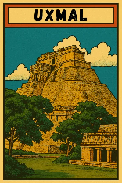
- Study the Pyramid of the Magician at Uxmal
Follow the ground-level route around the oval pyramid, then enter the Nunnery Quadrangle to examine its precise mosaic façades. - Face the Mask Wall at Kabah’s Codz Pop
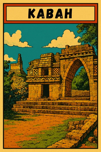
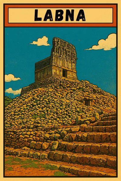
Stand before the repeated stone masks traditionally linked to Chaac, covering one of the Puuc region’s densest carved façades. - Pass Through Labná’s Iconic Arch
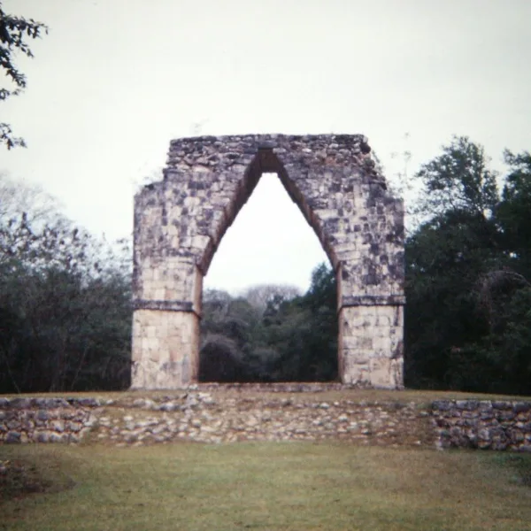
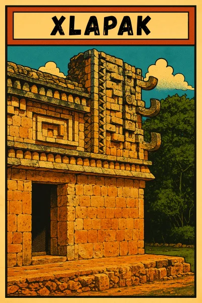
Walk beneath the freestanding arch and follow the ancient sacbé toward the palace complex. - Study the Small Palace at Xlapak
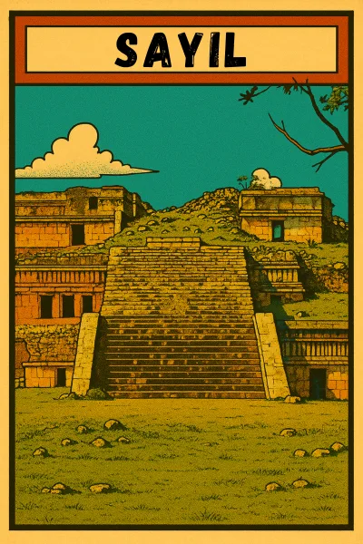
Examine lattice panels, corner masks, and fitted stonework at a scale that keeps the Puuc details close. - Read the Façade of Sayil’s Great Palace
Follow the marked route for clear views of the three-tiered palace, its columns, doorways, and broad mosaic bands.
Best Time to Visit the Puuc Route
The Puuc hills can be visited year round, but conditions shift with the seasons. Dry season (November to April) brings clearer skies, lower humidity, and the most comfortable site time, though midday sun is intense. Hottest months (April to May) call for early starts, shade breaks, and extra water. Rainy season (May to October) brings greener hills and fewer visitors, with frequent afternoon showers. Hurricane risk (June to November, highest August to October) can affect travel, so check forecasts and plan morning visits. Weekdays are quieter than weekends, and sunrise or late afternoon light shows Puuc stonework at its best.

Insider Explorer Advice
Common Puuc Route Mistakes
The route appears compact on a map, but each archaeological zone requires its own pace and attention.
- Overloading the Day: Five sites and the driving between them leave little room for close observation.
- Starting Too Late: Exposed plazas and limestone paths become harder to walk as the heat builds.
- Assuming Climbing Is Allowed: Uxmal’s major monuments are now viewed from ground level, and access rules vary by site.
- Ignoring Closing Times: Uxmal and Xlapak close earlier than Kabah, Sayil, and Labná, making route order important.
- Skipping the Smaller Sites: Sayil, Xlapak, and Labná reveal forms and details that Uxmal cannot represent alone.
- Not Carrying Cash: Smaller site entrances, food stops, and roadside services may not accept cards.
What Makes the Puuc Different
The Puuc is both a low hill region and an architectural tradition shaped by scarce surface water, precise stonework, and connections between neighboring Maya cities.
- Low Hill Country: Ridges and shallow valleys break the flat landscape of northern Yucatán.
- Water Stored by Design: Chultunes and aguadas captured seasonal rain for cities without permanent surface water.
- Mosaic Above, Plain Below: Smooth lower walls support dense upper friezes assembled from fitted limestone.
- Chaac in Repetition: Long-nosed rain masks multiply across corners, doorways, and ceremonial façades.
- A Network of Cities: Sacbeob, trade, and shared building traditions connected the Puuc centers without making them identical.
Mérida Festivals to Plan Your Puuc Route Trip Around
Mérida’s festival calendar can give a Puuc Route trip a second layer, with archaeological days followed by music, ceremony, and public life in the city.
Mérida Fest (January)
Mérida marks its founding with concerts, dance, theater, exhibitions, and performances across the historic center. January’s cooler, drier weather also makes this one of the easiest periods for combining full days on the Puuc Route with evening events in the city.
Hanal Pixán (Late October to November 2)
Yucatán’s season of remembrance fills Mérida with family altars, candlelight, food traditions, and public ceremonies rooted in Maya belief. After visiting the ancient cities of the Puuc, the festival offers a living expression of how Maya identity continues beyond the archaeological landscape.
Carnaval de Mérida (February or Early March)
In the days before Lent, Mérida shifts into a season of parades, music, costumes, and large public gatherings. The liveliest events unfold later in the day, leaving the morning open for quieter visits to Uxmal and the smaller Puuc sites.
Museums for Understanding the Puuc Region
The region’s museums connect the carved façades and ruined plazas with the objects, water systems, trade networks, and living traditions of the Maya communities that shaped the Puuc.
- Museo Arqueológico del Puuc, Kabah: Opened on July 19, 2026 inside the Kabah archaeological zone. Its 251 cultural objects present more than two decades of research across Kabah, Uxmal, Sayil, Labná, Xlapak, and the wider Puuc region.
- Museo de Sitio de Uxmal: A compact archaeological museum displaying domestic and ceremonial objects, sculpture, architectural fragments, and evidence of Puuc construction and rainwater storage.
- Museo Choco-Story Uxmal: Located near the archaeological zone, this private museum traces cacao cultivation, preparation, symbolism, and its continuing place in Maya culture.
- Museo de las Momias de Santa Elena: A small local museum covering the history and crafts of Santa Elena, with preserved human remains discovered beside the Church of San Mateo.
- Gran Museo del Mundo Maya, Mérida: The strongest broad introduction to Maya history before beginning the route, with permanent galleries devoted to the ancient Maya, the regional landscape, and Maya communities today.
- Museo Regional de Antropología, Palacio Cantón: A Mérida museum housed in a historic mansion on Paseo de Montejo, presenting rotating exhibitions on archaeology, anthropology, and the cultures of Yucatán.
The Puuc Route is best experienced slowly, as a chain of quiet Maya cities where stonework, water, and movement shaped an entire regional world.