
Millstone Bluff
USA / ILLINOIS / WOODLAND – MISSISSIPPIAN
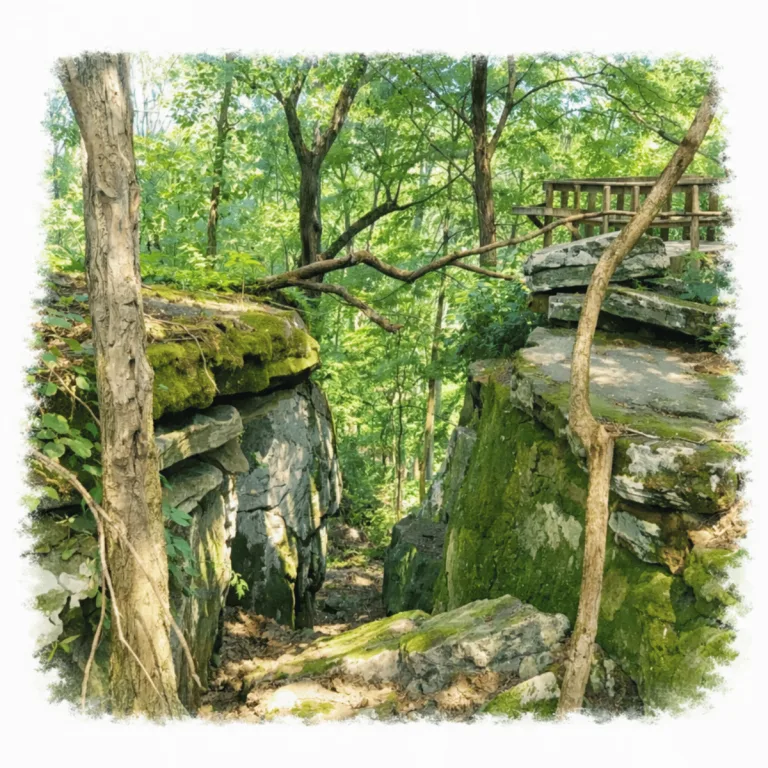
Atop a sandstone bluff above the Ohio River floodplain, Millstone Bluff preserves petroglyphs carved into exposed bedrock, where human and animal figures mark a rare concentration of Mississippian rock art.
| Name | Millstone Bluff |
| Civilization | Mississippian / Woodland |
| Location | Pope County, southern Illinois, USA |
| Elevation | 730 ft (219–223 m) above sea level |
| Years Active | c. AD 1350‑1550 Mississippian; Woodland earlier occupation |
| Primary Resources | Sandstone bluff, local stone for house foundations and carvings |
| Site Type | Hilltop village site with rock art and ancient dwellings |
| Key Highlights | Petroglyph panel; house site outlines; forested bluff views |
| Entry Fee | No fee required |
| Best Time to Visit | Fall, winter, early spring for clearer views and thinner foliage |
| Field Visit | Visited & photographed by Lost Ruins of the Americas |
Unique Features of the Millstone Bluff Ruins
- Petroglyph Panel: Carved symbols and animal tracks etched into sandstone
- House Site Outlines: Shallow soil depressions marking former dwellings
- Stone Box Cemetery: Rectangular slab-lined burials on the bluff top
- Bluff Views: Elevated vantage point over the Shawnee Forest
- Secluded Setting: Remote location with low visitor numbers
Location & Access
- Nearest Town: Glendale, Illinois
- Directions: Drive forest roads in Shawnee National Forest. From Highway 147 turn onto the entrance road to reach the trailhead parking lot
- USDA: Millstone Bluff Archaeological Area
- Trailhead Parking: Small lot with toilets
- Opening Hours: All year sunrise to sunset
- Entry Fees: None
- Facilities: Restrooms are present. No potable water
- Accessibility: Moderate. The path is clearly signed. Trail has uneven surfaces and some incline
- Pro Tip: Visit in cooler seasons. Thin foliage makes petroglyphs more visible

Highlights to Help Understand Your Visit
Before walking the loop, keep these points in mind to better read the site as you move through it:
- A Village Without Walls: Instead of tall stone ruins, the Mississippian houses appear as shallow depressions. Noticing their pattern across the bluff reveals the layout of the entire community.
- Defense in Height: The bluff itself was the fortification. Standing at the rim, imagine the steep slopes as natural walls, giving the village both security and commanding views of the Shawnee forest below.
- Carvings in Shadow: The petroglyphs are faint and often masked by tree shade. Approach slowly and let your eyes adjust — the symbols come alive only when viewed with patience.
- Burials Beside Life: Stone box graves lie on the bluff top close to where people lived. They are subtle and easy to overlook, so be on the lookout for these rectangular outlines that once held community members.
- A Trail as Guide: The modern loop follows the same ridge line where the village once spread. Moving in a circle echoes how residents lived with the bluff as both boundary and anchor.
Key Structures of Millstone Bluff
- Dwelling Depressions: Dozens of shallow depressions mark the locations of Mississippian houses. These semi-subterranean structures were built with wooden frames plastered in clay, many of which show signs of fire and rebuilding. Walking the loop, the outlines give a clear sense of how the village was organized across the bluff top.
- Stone Box Graves: Carved into the bedrock and lined with stone slabs, these distinctive graves held community members in carefully constructed burial spaces. Their placement on the bluff reflects a close relationship between the living settlement and its ancestors.
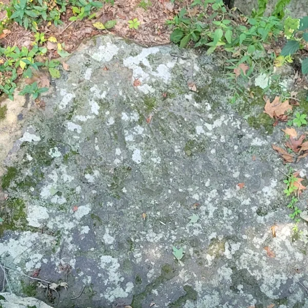
- Petroglyph Wall: Along the bluff rim, a series of carved images depict turkey tracks, crosses, concentric circles, and other symbols. Their meanings remain debated, but they may represent clans, celestial patterns, or spiritual forces tied to the natural world.
- Fortified Bluff Edges: The natural cliffs gave the community a strong defensive position, and traces of built walls at narrow approaches suggest added measures of protection. The steep slopes falling away from the village highlight why this location was chosen.
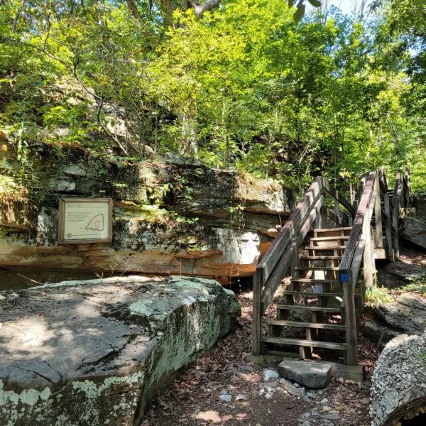
- Loop Trail: The modern interpretive trail leads visitors through the site’s main features, with signage explaining the village remains, petroglyphs, and cemetery. It provides a clear route while preserving the secluded and elevated character of the bluff.
History and Legends
Millstone Bluff preserves an unusually clear record of life in the uplands of southern Illinois. Archaeological investigations show that the bluff was used as early as the Woodland period, when groups came here for hunting, gathering, and small-scale camps. By the Mississippian era, around 1350 to 1550 CE, the bluff supported a permanent village. Dozens of house depressions can still be seen along the loop trail. Excavations reveal that the dwellings were partially sunken into the ground, with walls of poles and branches plastered with clay. Fires destroyed many of these houses at least once, and they were rebuilt, showing that the community endured on this high ridge for generations.
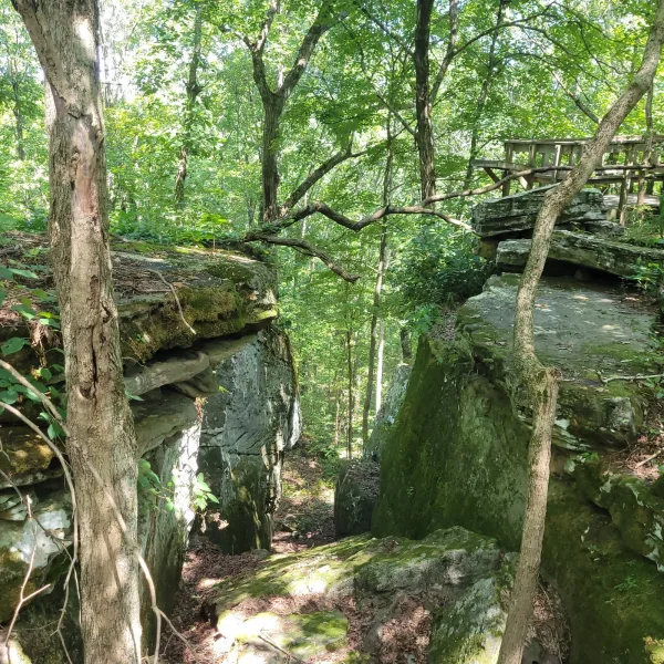
The choice of location was deliberate. The bluff rises above the surrounding forest, its steep slopes providing both defense and commanding views of the Shawnee Hills. From here, residents could see far across the wooded landscape, an advantage for monitoring movement and marking territory. Yet the setting was not only practical. For Mississippian societies, landscapes carried spiritual significance, and a high place above the trees could have been regarded as a sacred point of connection between earth and sky.
Burials at Millstone Bluff reveal more about these beliefs. Archaeologists documented a stone box cemetery, with graves cut into the bedrock and lined with stone slabs. This form of interment is distinctive to the region and reflects complex ritual care for the dead. The cemetery, placed near the living village, tied the community to its ancestors and anchored memory to the bluff itself. Nearby, a panel of petroglyphs adds another dimension to the site’s sacred character. Carved images include turkey tracks, concentric circles, crosses, and other symbols whose meanings are still debated. Some may refer to clan emblems, others to celestial patterns or mythic stories. Local traditions long held that the carvings represent spirits embedded in the rock, their presence felt in the quiet forest that surrounds the bluff.
Experiences Around Millstone Bluff
The ruins are only part of the story. Sandstone bluffs, hardwood forest, and clear rocky creeks shape this rugged corner of the Shawnee Hills.
–
In Metropolis, stop beneath the 15-foot Superman statue, the centerpiece of a downtown that has embraced its comic-book namesake.
–
Farther north, bike the Tunnel Hill State Trail over old railroad trestles and through the historic tunnel that gave the route its name.
Millstone Bluff’s cultural layers also link it to the wider Mississippian world. The period saw the rise of large centers such as Cahokia near present-day St. Louis, Kincaid and Angel Mounds on the Ohio River, but villages like Millstone Bluff formed the backbone of that system. Its inhabitants were farmers who grew maize, beans, and squash in the upland soils, supplemented by hunting deer and gathering wild resources. The remains of houses, graves, and carvings show how these communities adapted Mississippian lifeways to the rugged hills of southern Illinois.
By the 1500s, the village was abandoned, part of the broader shifts that reshaped Mississippian society across the Midwest and Southeast. Climate change, resource stress, and political transformations may all have played a role. What was left behind was not erased. The outlines of houses, the carved symbols, and the silent ridge itself became part of the local memory of the land. To walk the trail today is to move through that layered history, where archaeological evidence, oral tradition, and the solitude of the forest converge.
How to Get There & Where to Go Next
How to Visit Millstone Bluff
– Step-by-step access to the site –
- From St. Louis – Drive southeast on I-64 and I-57 toward Marion, Illinois (about 2.5 hours).
- Highway Segment – Continue south on IL-147 into Pope County (about 1 hour).
- Local Access – Follow signs for Millstone Bluff Archaeological Area; small parking lot at the trailhead.
- Trail Hike – Walk the interpretive loop trail (about 0.75 miles uphill, moderate grade).
Tips: The petroglyphs are easier to see in fall, winter, or early spring when shadows are less dense. Facilities include a small parking lot and restrooms at the trailhead.
Nearby Ruins You Can Visit
Millstone Bluff was part of the wider Mississippian world. These other mound centers show the scale, variety, and reach of that culture across the Midwest and Ohio Valley.

Kincaid Mounds – A major Illinois center on the Ohio River, once home to platform mounds and plazas connecting the region to Cahokia’s influence.

Towosahgy: In Missouri’s bootheel, this fortified Mississippian site with mound building, civic planning, and defended settlement space.

Angel Mounds – A fortified riverside center in Indiana, rich with earthworks and a ceremonial core tied to Mississippian lifeways.

Traveler Tips
- Wear sturdy shoes. Roots and rocks make the trail uneven
- Bring insect repellent, water, and sun protection
- Visit in fall, winter, or early spring when foliage is thinner and visibility improves
- Go early in the day to avoid heat and maximize light
- Stay on marked trail to protect archaeology and flora
Elsewhere in the Americas…
During the same centuries that Millstone Bluff’s community thrived in the uplands of Illinois, other regions of the Americas were also undergoing profound cultural change:

In the Andes, the Inca Empire expanded rapidly, building monumental centers like Chincana Labyrinth and Machu Picchu while extending control across highlands and coasts.


Insider Explorer Advice
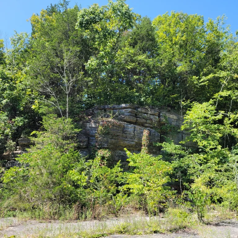
Millstone Bluff sits high above the surrounding forest, almost like a mesa, and the location makes its defensive purpose clear. From the trail, you can look down to the forest floor far below and imagine why a community would choose this vantage point. The signage begins at the trailhead and the path is well marked, making the climb approachable despite the remote setting. The loop trail leads past house outlines, the petroglyph panel, and the stone box cemetery, all set within quiet woodland. Shadows from the canopy often obscure the carvings, so they are easier to see in fall, winter, or early spring when the light is sharper. This is a site best experienced slowly, letting the forest silence and the bluff’s commanding position reveal its history.
Summary: Millstone Bluff is a place of quiet stones and subtle art, an ancient village perched above the woods where history waits in soil and stone.