
Angel Mounds
USA / INDIANA / MISSISSIPPIAN
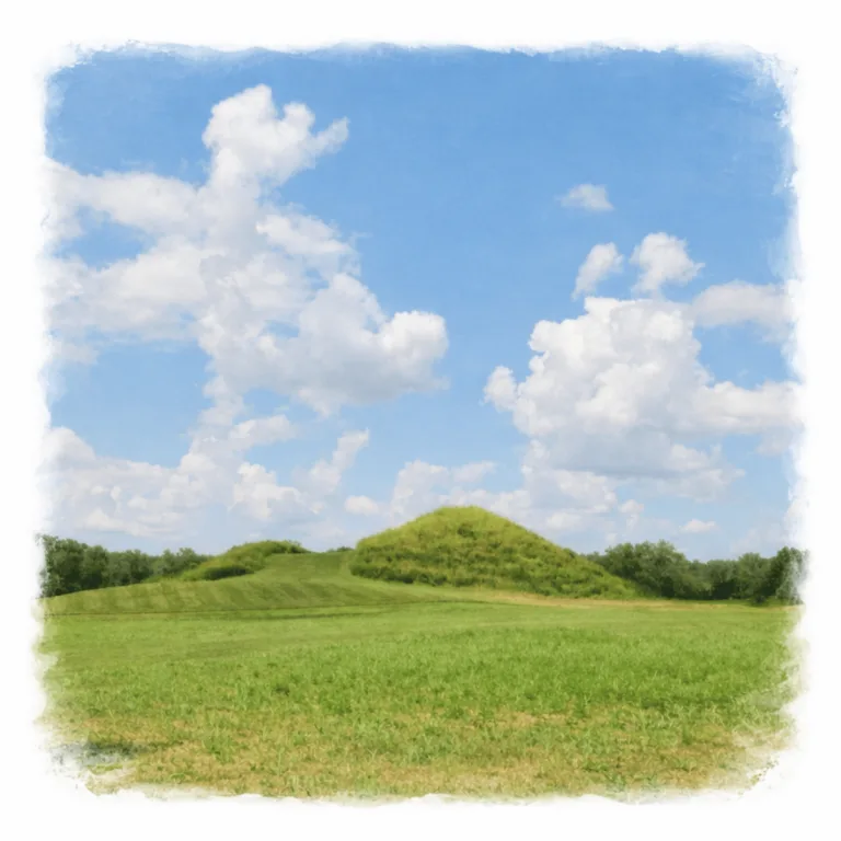
Along the edge of the Ohio River, Angel Mounds reveals a planned mound city, where defensive palisades and carefully spaced platforms structured one of the largest Mississippian settlements in the Midwest.
| Name | Angel Mounds |
| Civilization | Mississippian |
| Location | Evansville, Indiana, USA |
| Years Active | c. 1000 -1450 CE |
| Elevation: | 380 to 400 feet (116–122 meters) |
| Primary Resources | Maize, river transport, animal hides |
| Site Type | Planned town with ceremonial mounds |
| Key Highlights | Central mound, palisade trench, artifact-rich museum |
| INT Airport: | Louisville International Airport (SDF) |
| Entry Fee | $13 adult / $9 youth |
| Best Time to Visit | Spring or fall |
| Field Visit | Visited & photographed by Lost Ruins of the Americas |
Unique Features of Angel Mounds Archaeological Site
- Lunar and Milky Way Alignment: The site’s principal mound arrangement appears to align with major lunar standstills and the seasonal sweep of the Milky Way over the Ohio River valley, reflecting a deep integration of astronomy into civic and ceremonial planning.
- Palisaded Settlement: The core mounds and plazas were once enclosed by a timber and earth wall, creating a protected civic center connected to surrounding residential zones.
- Expansive Earthwork Complex: Multiple platform mounds, borrow pits, and open plazas spread across the river terrace, each linked by sightlines and pathways.
- Ohio River Proximity: Situated on a natural levee beside the river, the site benefited from fertile farmland, river transport, and broad horizon views.
Location & Access
- Nearest City: Evansville, Indiana
- Directions: The site lies southeast of Evansville along the Ohio River. From downtown, take IN-62 East toward Newburgh, then follow brown historic site signs to the entrance and visitor center parking.
- Official Site: Angel Mounds State Historic Site
- Opening Hours: Seasonal; check the official site for current times.
- Entry Fees: $13 adult / $9 youth
- Facilities: Visitor center, museum, restrooms, interpretive trails, open green spaces.
- Accessibility: Mown grass paths connect mounds; some uneven surfaces; shade and seating are limited.
- Pro Tip: Bring a blanket to sit on and enjoy the surrounding nature after exploring the site.
Highlights to Help Understand Your Visit
Approach the site as a designed landscape where movement, mounds, and horizon work together to express community order.
- Plaza as the Anchor: Standing at its center reveals how all pathways and sightlines converge here, making it the focal point of public gatherings.
- Celestial Ties: The layout appears to connect with lunar standstills and the Milky Way’s summer arc, embedding sky cycles into the ground plan.
- Directed Access: The former palisade and gateways controlled entry, guiding visitors and residents along deliberate routes into the core.
- Height as Statement: Platform mounds elevated important buildings, reinforcing authority and offering strategic views over the plaza.
- Landscape Integration: The elevated river terrace combined fertile soils, flood safety, and broad horizons for both agriculture and observation.
- Archaeology as Map: Decades of excavation allow today’s visitor to connect visible contours with their original functions.
Key Structures of the Angel Mounds Ruins
- Mound A (Great Platform): The tallest and most prominent mound, likely supporting an elite or ceremonial building and providing a primary vantage for lunar and Milky Way alignments.
- Mound F: Positioned to mark significant horizon points in lunar cycles, serving both ceremonial and observational functions.
- Mound C: A secondary platform that reinforces observed sightlines from Mound A, integrated into the site’s celestial planning.
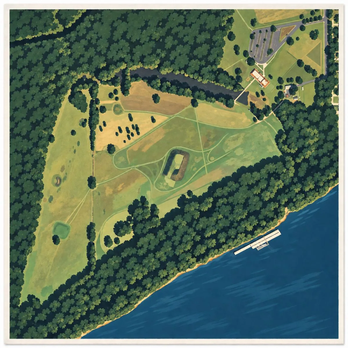
- Central Plaza: A large open space used for gatherings, ceremonies, and processions, preserving astronomical view corridors between mounds.
- Palisade and Gateways: A defensive and symbolic perimeter with controlled entry points, demarcating the sacred and civic core.
- Residential Zones: Areas between mounds containing house platforms and workspaces that supported daily life near the ceremonial center.
History and Legends
Angel Mounds was one of the last great Mississippian towns in the Ohio River valley, occupied from around 1100 to 1450 CE. Built on a natural terrace above the floodplain, it became the political, ceremonial, and economic heart of a wide regional network. The people here were skilled farmers, cultivating maize, beans, and squash in the fertile soils, and were active participants in long-distance trade that connected them to other Mississippian centers across the Midwest and Southeast.
The settlement was laid out around a broad central plaza, encircled by twelve earthen mounds of varying size. At its peak, a timber-and-earth palisade enclosed the core, marking a clear boundary between civic life inside and surrounding residential zones beyond. Elevated platform mounds supported elite residences, council houses, and temples, each one connected by carefully maintained pathways across the open plaza.
Archaeological research has revealed that this was not a randomly placed town. The arrangement of key mounds and open sightlines appears to track the movements of the moon over long cycles and to reflect the arc of the Milky Way in the summer night sky. Such alignments suggest that celestial observation was integrated into the rhythms of governance, ceremony, and agricultural planning. While not every mound follows these patterns, the principal axes reinforce the connection between earth and sky that is a hallmark of Mississippian worldviews.
Life within the palisade would have been both practical and ceremonial. Markets, feasts, and public rituals filled the plaza, while the surrounding fields and forests provided food, game, and raw materials. The Ohio River, just beyond the settlement, served as both a resource and a highway, carrying goods, people, and ideas. Over generations, the town’s leadership coordinated labor to maintain the mounds, renew the palisade, and stage the events that bound the community together.
Archaeological investigations led by the Works Progress Administration in the 1930s uncovered thousands of features, including house foundations, storage pits, hearths, and burials. The scale and detail of these excavations made Angel Mounds one of the most thoroughly documented Mississippian sites in North America. Many artifacts recovered, from pottery vessels to shell beads, reflect a complex and stratified society with far-reaching connections.
By the mid-15th century, Angel Mounds was in decline. Changing climate patterns, shifting trade networks, and social transformations likely contributed to its abandonment. When Europeans first explored the region centuries later, the mounds stood silent, their original purpose and meaning preserved only in the earthworks themselves and in the traditions of descendant Indigenous nations.
Today, the site is preserved as the Angel Mounds State Historic Site, offering both open-air exploration and an interpretive museum. Visitors walk the same pathways that connected mound to mound centuries ago, moving through a landscape shaped by communal labor and sustained by the rhythms of river and field.
Experiences Around Angel Mounds
Angel Mounds sits in a wider Ohio River landscape of open fields, wooded edges, and quiet Midwestern towns.
Evansville adds museums, riverfront walks, and a steady local rhythm. Newburgh brings small-town charm, shops, and views along the Ohio River.
Nearby parks and trails offer space to walk, relax, and take in the natural setting. Together, they make Angel Mounds part of a broader southern Indiana experience.
How to Get There & Where to Go Next
How to Visit Angel Mounds
– Step-by-step access to the site –
- From St. Louis, MO: Drive east on I-64 toward Evansville, about 3 hr 45 min.
- Approach Evansville: Merge onto IN-62 East toward Newburgh, 15 min.
- Final Segment: Follow brown historic site signs to Angel Mounds entrance, 5 min.
- Parking: Free parking at the visitor center adjacent to the museum entrance.
Tips: Check the official site for seasonal hours; plan to combine your visit with the on-site museum for full contex.
Nearby Ruins You Can Visit
Part of the same Mississippian cultural world, these sites share Angel Mounds’ traditions of mound building, civic plazas, and long-distance exchange.

Cahokia Mounds – A sprawling urban center with massive platform mounds and complex social organization.

Millstone Bluff – A bluff-top village site with rock art and the outlines of ancient house circles.

Kincaid Mounds – A multi mound settlement and regional hub at the southern edge of the Mississippian world.

Download Field Guide
Español
English

Traveler Tips
- Stay on the maintained grass lanes between mounds to protect archaeological features.
- Shade is limited; bring sun protection and plenty of water.
- Seating is scarce. Consider bringing a blanket for resting in the open areas.
- The onsite museum is well-curated and recently refurbished. Allow time to explore its exhibits.
- Wear comfortable walking shoes for the open, grassy terrain.
Elsewhere in the Americas…
While Angel Mounds thrived in the Ohio Valley, other centers across the Americas were shaping their own landscapes of power and belief:

In the Andes, the Inca Empire was extending its reach with a roads linking the Sacred Valley across highlands and coast.


.
Insider Explorer Advice
Adjacent to a large public park, Angel Mounds offers a unique blend of history and recreation. After touring the site, you can enjoy nearby walking trails or even a round of disc golf outside the archaeological zone. Within the site, the big mound in the center draws the eye from every angle, and climbing it offers the best panoramic sense of the ancient town’s layout. Bring a blanket to relax on, and plan to linger in the quieter hours, early or late in the day, when the grounds feel most peaceful and the grass paths invite slow exploration.
Summary: Angel Mounds preserves the footprint of a thriving Mississippian town, where earth, river, and community shaped centuries of life along the Ohio.