
Towosahgy
USA / MISSOURI / MISSISSIPPIAN
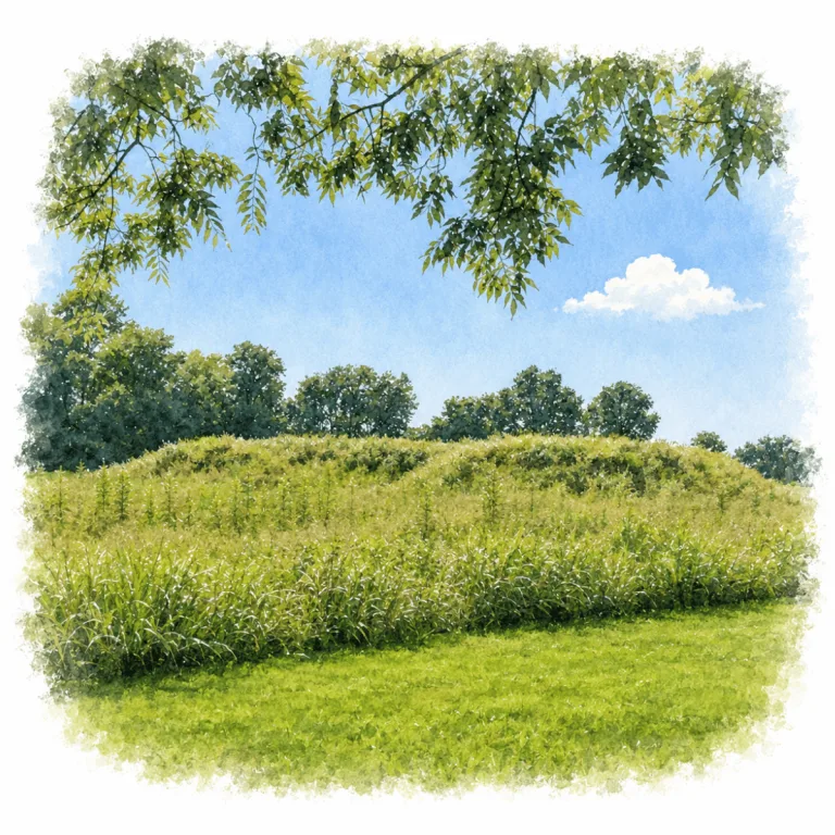
Across a sandy ridge in the Missouri Bootheel, Towosahgy gathers earthen mounds around a central plaza, where a fortified Mississippian village once organized ceremony, defense, and daily life.
| Name | Towosahgy State Historic Site |
| Civilization | Mississippian |
| Location | Mississippi County, Missouri, United States |
| Elevation | About 299 feet (91 m) |
| Years Active | c. 1000 – 1400 CE |
| Primary Resources | Earth, timber, maize, riverine trade goods |
| Site Type | Fortified village and civic-ceremonial center |
| Key Highlights | Temple mound, central plaza, palisade line, borrow pits, interpretive signage |
| INT Airport | Saint Louis International Airport (STL) |
| Entry Fee | Free |
| Best Time to Visit | Spring or fall, early morning |
| Field Visit | Visited & photographed by Lost Ruins of the Americas |
Unique Features of the Towosahgy State Historic Site
- Bootheel Ridge Setting: Mounds rise from an isolated sandy ridge amid rich farmland.
- Fortified Layout: Palisade and moat once enclosed much of the village.
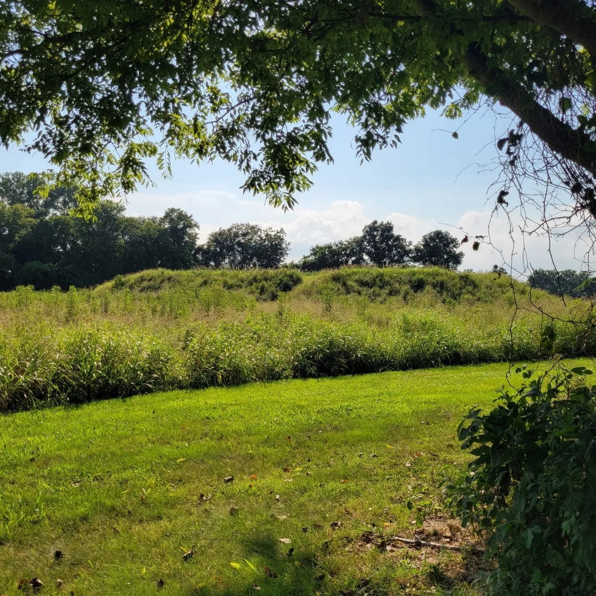
- Temple Mound: The largest surviving mound anchors the north side of the plaza.
- Visible Borrow Pits: Depressions still show where mound fill was taken.
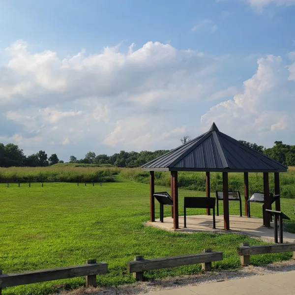
- Interpretive Shelter: Newer signage helps explain the village plan on site.
Location & Access
- Nearest Town: East Prairie, Missouri
- Directions: From East Prairie, drive east toward the site on County Road FF / County Road 502. The historic site sits out among the flat farmland of the Bootheel, a short drive beyond town.
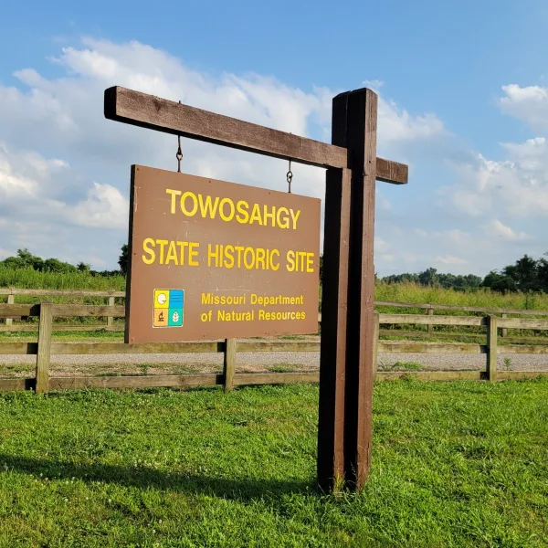
- Missouri State Parks: Towosahgy State Historic Site
- Opening Hours: 6:00 AM to dusk, daily
- Entry Fees: Free
- Facilities: Gravel parking area, interpretive shelter, exhibit panels, vault toilet, walking paths across the mound field
- Accessibility: Partially accessible. A paved path leads from the lot to the interpretive shelter, but the mound paths are mown turf and uneven in places.
- Pro Tip: Bring water and sun protection. Much of the site is open field with limited shade.
Highlights to Help Understand Your Visit
This site reads best as a planned village, not as a loose scatter of mounds.
- Plaza First: The open central space is the key to the whole site. The mounds matter most when seen as edges around a shared civic and ceremonial core.
- Earth as Architecture: Nothing here depends on stone. The scale of the mounds comes from basket-loaded earth, shaped by labor, planning, and repeated rebuilding.
- Defense Was Part of Design: Towosahgy was not only ceremonial. The palisade and moat show that protection and controlled entry were built into the village plan.
- Borrow Pits Tell the Story: The depressions in the ground are part of the architecture. They supplied the earth for mound construction and make the process of building visible.
- The Landscape Matters: Set on a sandy ridge above the lowlands, the site used slightly higher ground in a flood-prone region. Even today, that elevated setting helps explain why a community rose here.
- Silence Helps the Site: With fields stretching in every direction, Towosahgy is easier to read in stillness. The broad openness gives the mounds room to register as planned forms rather than low rises in the grass.
Key Structures at the Towosahgy Archeological Site
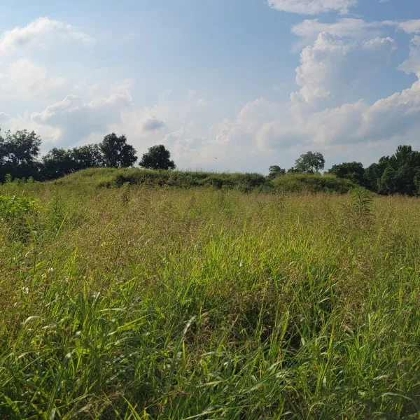
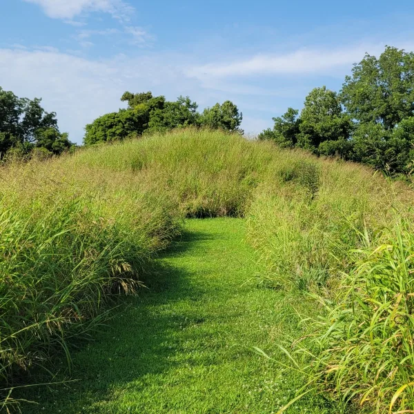
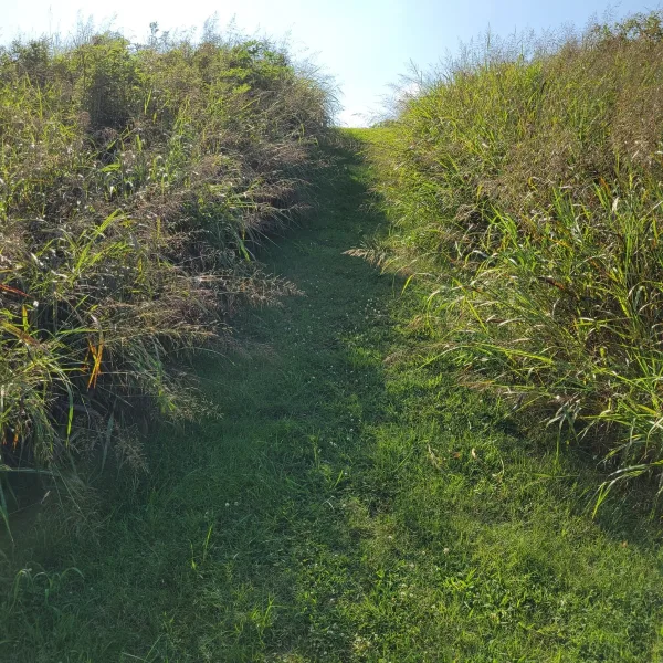
- Temple Mound (Mound 2): At 16 feet high, this flat-topped platform is the largest mound at Towosahgy and the site’s strongest surviving landmark. Excavations revealed an earlier, smaller mound beneath it, followed by two stages of enlargement and a ramp leading up one side. A ceremonial building or elite residence may once have stood at the summit.
- Mound 3: Excavations revealed an early low mound supporting a structure, followed by two later enlargements, each topped by another building. It is the only mound besides Temple Mound where archaeological excavation is identified on the site sign.
- Mound 5: The second-largest mound has a conical form rather than a flat summit. Its rounded profile stands apart from Towosahgy’s platform mounds and shows that the settlement included more than one type of earthwork.
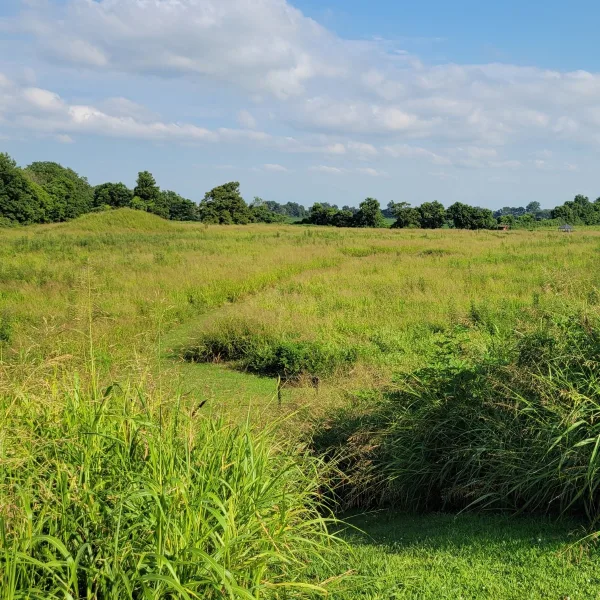
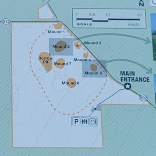
- Central Plaza: Six of the site’s seven mounds were arranged around this broad open space. The plaza gave Towosahgy its central plan and likely served as the setting for ceremonies, public gatherings, and movement between the surrounding mound-top buildings.
- Secondary Mounds: Towosahgy includes both flat-topped platform mounds and rounded or conical mounds. Some may have supported important buildings or elite residences, while the seventh mound stood north of Temple Mound, extending the settlement beyond the main plaza group.
- Borrow Pit: The large depression beside the mound group marks where builders removed earth for construction. It helps reveal the enormous labor behind the site, with soil dug, carried, and added in repeated stages as the mounds grew.
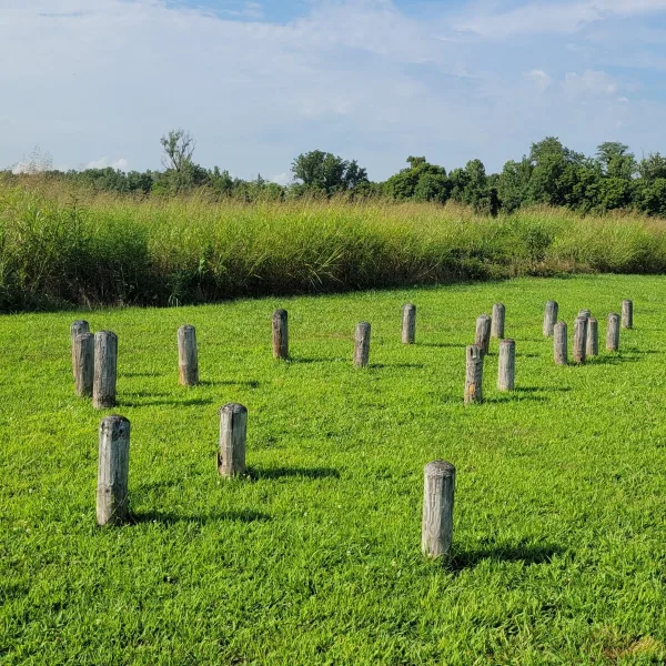
- Palisade and Moat: Towosahgy was enclosed by a series of five timber fortifications rebuilt over several centuries. The final and most elaborate defense combined a broad moat, an earthen embankment, and likely another palisade standing above it.
History and Legends
Towosahgy occupies Pinhook Ridge, a strip of higher ground within a landscape once shaped by river channels, swamps, oxbow lakes, and seasonal water. Between roughly 400 and 700 CE, Woodland communities established a village in the southern part of the site. The ridge offered stable ground above the surrounding floodplain, while nearby wetlands and waterways supplied food, raw materials, and routes through the region.
Several centuries later, by about 1000 CE, Mississippian people transformed the ridge into a fortified civic and ceremonial center. Seven earthen mounds stood around a central plaza, while hundreds of houses spread across and beyond the enclosed settlement. The relationship between the two occupations remains uncertain, but the later town marked a substantial change in scale and organization. Public space, mound platforms, houses, and defensive works now formed a planned center where daily life, ceremony, and authority were gathered into the same landscape.
Towosahgy was protected by a series of timber walls rebuilt over several centuries. Archaeologists have identified five separate fortification lines, some strengthened with projecting bastions. The final system was the most imposing. A moat roughly 20 feet wide surrounded an earthen embankment that may have supported another palisade above it. These defenses gave the town the appearance of a guarded center, although excavations have found no clear evidence that a battle was ever fought here.
Experiences Around Towosahgy
The ruins are only part of the story. Flat farmland and drainage canals stretch across the Missouri Bootheel, with remnants of the swamp forest that once covered the region.
–
In New Madrid, tour the Hunter-Dawson State Historic Site, a 15-room mansion completed just before the Civil War and still filled with much of the family’s original furniture.
–
Walk the boardwalk at Big Oak Tree State Park beneath towering oaks and hickories in one of the Bootheel’s last remnants of bottomland forest.
Life inside the walls reached far beyond the Bootheel. Chert for tools arrived from the Ozarks, southern Illinois, and Tennessee, while quartz, fluorite, mica, lead crystals, and marine shell traveled from much greater distances. Some of these materials likely belonged to people of higher status. Their presence shows that Towosahgy was part of a broad Mississippian world tied together by exchange, ceremony, and political relationships.
The town was abandoned around 1400 CE, and no surviving tradition clearly explains why. Its modern name came centuries later, after the site entered the Missouri state park system. Archaeologist Carl Chapman drew the word from Osage and Quapaw language, and it has often been translated as “Old Town,” though the meaning is more complicated than that simple phrase suggests. The name does not identify the original mound builders, but it captures the sense that this place was already ancient when later peoples encountered it.
Archaeologists began investigating the site in 1891, when it was known as Beckwith’s Fort. Farming soon reduced the height of most of the mounds, leaving only parts of the original town visible above the fields. Even so, the surviving earthworks still hold the plan together. The plaza remains open, the mounds rise gently around it, and the old defensive line can still be traced across the ground. Towosahgy no longer appears as the fortified center it once was, but the order of the town has not entirely disappeared.
How to Get There & Where to Go Next
How to Visit Towosahgy
Step-by-step access to the site
- St. Louis, Missouri: Follow I-55 south toward Sikeston, roughly 2½ hours.
- Take Exit 58: Turn east onto Route 80 and continue through East Prairie.
- Make the final turn: Follow Route 77 south for about 8 miles, then turn west onto gravel County Road 502.
- Arrive at the site: Continue 1 mile to the entrance and parking area.
Tip: Visit in the late afternoon, when low-angle light makes the plaza edges and low mound profiles easier to read.
Nearby Ruins You Can Visit
Across the lower Mississippi and Ohio valleys, these sites reveal how Mississippian communities shaped towns around earthen monuments, plazas, and carefully chosen landscapes.

Millstone Bluff – A secluded blufftop settlement where house remains, carved sandstone symbols, and earlier stone enclosures survive along an interpretive forest trail.
Wickliffe Mounds – A Mississippian village near the meeting of the Ohio and Mississippi rivers, preserving mounds, excavated remains, and evidence of life between 1100 and 1350 CE.

Kincaid Mounds – A major Middle Mississippian city where multiple earthen mounds mark a large political and ceremonial center in the lower Ohio Valley.
Download Quick Guide
Español
English
Traveler Tips
- Start at the interpretive shelter: Review the site map and exhibit panels before following the paths into the mound complex.
- Prepare for full sun: Most of the mounds and borrow pits lie across an exposed field with little shade.
- Wear practical footwear: The main walking routes are mown natural-turf paths rather than paved trails.
- Bring drinking water: The open setting can become hot during warmer months, especially around midday.
Elsewhere in the Americas…
While Towosahgy flourished, communities across the Americas were developing walled capitals, regional trade centers, and carefully planned cities.



In Peruvian Andes, the of Kuélap rose along a mountain ridge, enclosed by massive walls and crowded with circular buildings.
Insider Explorer Advice
Towosahgy rewards an unhurried visit. The grounds are quiet, lightly visited, and easy to explore at a measured pace, with picnic tables and a simple restroom making it practical to stay well beyond a quick walk through the mounds. Study the site map first, circle the central plaza, and approach Temple Mound after tracing the smaller earthworks. With time to pause between each structure, the layout of the fortified Mississippian town becomes far easier to read, making Towosahgy a peaceful place to spend much of the day.
Summary: Towosahgy preserves the readable footprint of a fortified Mississippian town, where low mounds and an open plaza still reveal a carefully ordered community.