
Toolesboro Mounds
USA / ILLINOIS / HOPEWELL
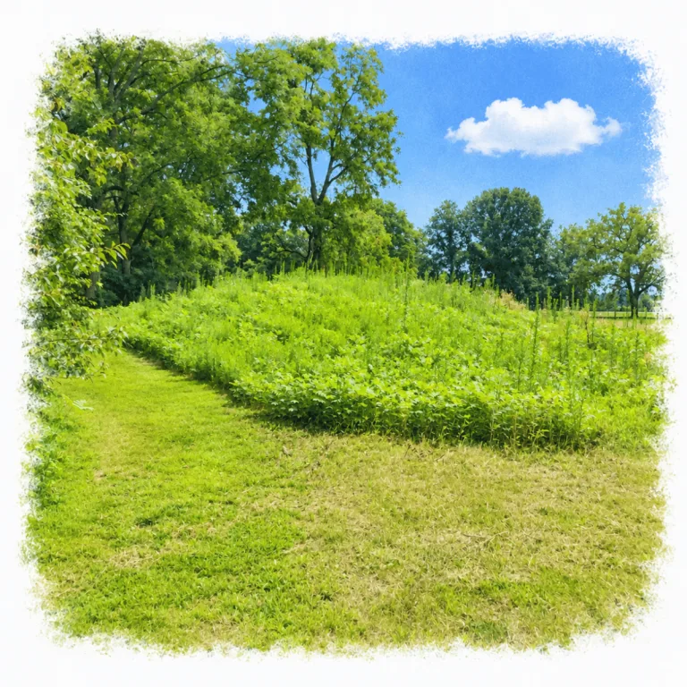
On a wooded bluff above the Iowa River floodplain, Toolesboro Mounds preserves seven Hopewell earthworks where burial ceremony, layered construction, and distant exchange came together more than 2,000 years ago.
| Name | Toolesboro Mounds |
| Civilization | Havana Hopewell tradition, Middle Woodland |
| Location | Toolesboro, Louisa County, Iowa, United States |
| Elevation | Approximately 680 feet (207 meters) |
| Years Active | c. 200 BCE to 300 CE |
| Primary Resources | Fish, game, wild plants, cultivated crops, local chert, and freshwater pearls |
| Site Type | Burial mound and ceremonial complex |
| Key Highlights | Seven conical mounds, Mound 2, community museum, prairie demonstration plot |
| INT Airport | Quad Cities International Airport (MLI) |
| Entry Fee | Free |
| Best Time to Visit | Memorial Day through Labor Day during museum hours |
| Field Visit | Visited & photographed by Lost Ruins of the Americas |
Unique Features of Toolesboro Mounds Archaeological Site
- Seven-Mound Preserve: Two mounds stand in the open; five continue into the woodlot.
- Broad Low Earthworks: Large footprints make the mounds subtler than their scale suggests.
- Continental Exchange Goods: Copper, mica, shell, pearls, and obsidian reached Toolesboro.
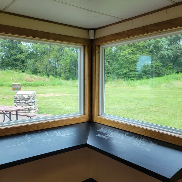
- On-Site Museum: Exhibits connect the mound field with burials, exchange, and preservation.
Location & Access
- Nearest Town: Wapello, Iowa, approximately 8 miles west of the site.
- Directions: From Wapello, follow County Road 99 east toward Toolesboro, then turn north onto Toolesboro Avenue and continue to the signed entrance.
- Official Site Authority: State Historical Society of Iowa, Toolesboro Mounds National Historic Landmark.
- Opening Hours: The grounds are generally open from sunrise to sunset. The museum operates on limited seasonal hours.
- Entry Fees: Free admission.
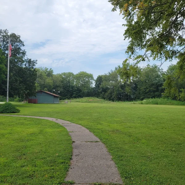
- Facilities: Small museum, interpretive exhibits, seasonal restrooms, outdoor panels, picnic tables, parking, and a prairie demonstration plot.
- Accessibility: The visible mounds are reached across short grass surfaces. Uneven ground and limited access to the wooded area may create mobility challenges.
- Pro Tip: Plan the visit around museum hours. The indoor interpretation is essential to understanding the low, weathered earthworks outside.
Highlights to Help Understand Your Visit
Toolesboro is best read as a ceremonial cemetery whose low earthworks held carefully prepared burials and far-reaching exchange goods.
- Read the Low Profiles: The mounds spread broadly across the terrace, making their scale clearer from a short distance.
- Look for Deliberate Burial: Prepared chambers and limited interments point to formal treatment rather than ordinary community graves.
- Follow the Exchange Network: Copper, mica, marine shell, pearls, and obsidian reached Toolesboro from distant regions.
- Recognize the Remnant: The seven protected mounds preserve only part of a landscape altered by farming, erosion, construction, and early excavation.
Key Structures of Toolesboro Mounds
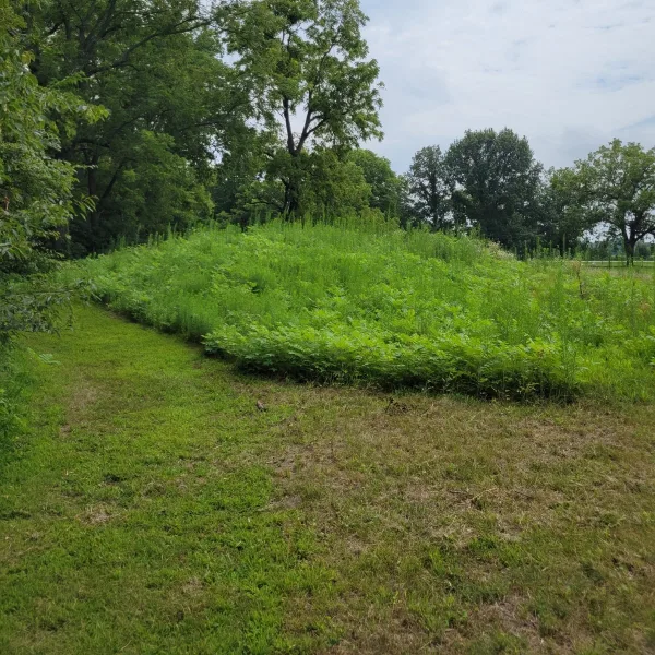
- Mound 2: The largest surviving earthwork at Toolesboro spans about 100 feet and rises roughly 8 feet, forming a broad, low mound that anchors the open grounds and gives the clearest sense of the cemetery’s original scale.
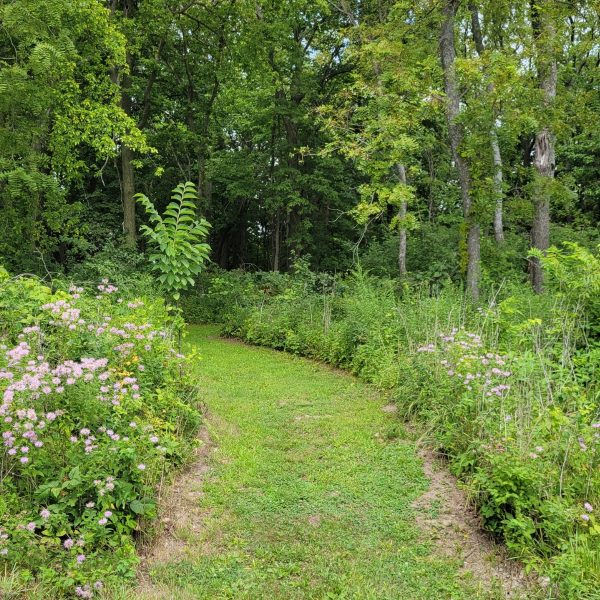
- Second Visible Mound: A smaller conical earthwork forms the second mound readily visible within the open visitor grounds.
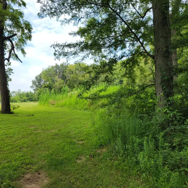
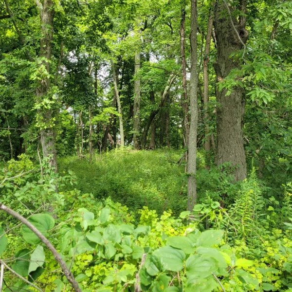
- Woodlot Mounds: Five additional surviving mounds continue into the adjoining woodlot beyond the maintained open area.
- Subfloor Burial Chambers: Excavated mounds contained prepared pits or crypts beneath their floors, several covered with logs and used for multiple burials.
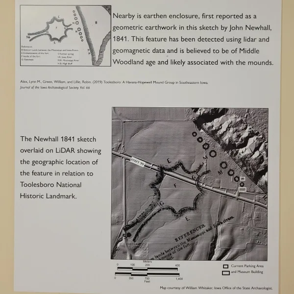
- Former Geometric Enclosure: An 1841 map recorded a five- to six-acre, roughly octagonal earthwork with causeways near the mounds, although plowing erased it and its cultural affiliation remains unresolved.
History and Legends
Around 150 BCE, Middle Woodland communities began raising burial mounds on the narrow bluff between the Iowa and Mississippi river valleys. The position gave them access to two major waterways, broad floodplains, wooded slopes, and routes reaching deep into the center of the continent. These people belonged to the Havana tradition and participated in the wider Hopewell network, a system of shared mortuary practices and exchange among distinct Native communities. Toolesboro stood near the western edge of that network, but its builders took part fully in the movement of materials, objects, and ceremonial ideas along the rivers.
At least twenty mounds once occupied the Toolesboro vicinity. The principal group stood northwest of the later town, while another cluster extended south near the Parsons farm. Most were conical earthworks between roughly thirty and eighty feet across, though one recorded mound reached about 140 feet in diameter and eleven feet high. The builders cleared and prepared the ground, cut shallow chambers into the clay, arranged burials inside, and covered some tombs with oak logs before carrying up the surrounding soil. Several mounds held more than one person, including adults and children, and some remains were gathered and reburied after decomposition elsewhere.
Objects placed beside the dead show how widely Toolesboro was connected. Excavators found hammered copper gouges, celts, and pins made from metal probably obtained near Lake Superior, along with Appalachian mica, shell beads, freshwater pearls, pottery, chipped stone tools, and platform pipes. One bird-shaped pipe had pearl eyes and copper inlay. In one tomb, bent copper pins were driven into the hard clay around the burials, apparently fastening a covering over them. These materials reached Toolesboro through long chains of travel and exchange, but the final burial ceremonies happened here, on the bluff above the two river valleys.
Experiences Around Toolesboro Mounds
The ruins are only part of the story. Broad floodplains, wetlands, and wooded riverbanks spread around the mouth of the Iowa River where it reaches the Mississippi.
–
Port Louisa National Wildlife Refuge opens into river backwaters and wetlands used by migrating waterfowl, shorebirds, and bald eagles.
–
In Muscatine, the National Pearl Button Museum tells how freshwater mussels from the Mississippi supported an industry that once produced more than a billion mother-of-pearl buttons a year.
The main period of mound construction continued for perhaps two or three centuries, ending around CE 200. No associated village has been securely located. Homes may once have stood on the floodplain below, where changes in the Iowa River could have erased or buried their traces. Centuries later, Oneota communities occupied other nearby sites, including McKinney and Poison Ivy, showing that the same river junction remained important long after Toolesboro’s Hopewell ceremonies ended. An embanked enclosure remembered by settlers as the “old fort” was once separated from the mound complex or assigned to this later occupation, but lidar and geophysical surveys have relocated its remains and strengthened the case that it belonged with the Middle Woodland mounds.
Excavation began early and caused lasting damage. William Toole opened a mound by the early 1840s, and local residents dug into others before members of the Davenport Academy of Natural Sciences arrived in 1875. Academy crews returned in 1886, cutting through mounds and removing burials and objects with methods that left many relationships unrecorded. Farming, construction, erosion, and repeated digging destroyed or flattened additional earthworks. Nineteenth-century reports describe separate mound groups that were later confused with one another, and modern researchers have had to reconstruct the site from old maps, museum collections, letters, and traces still visible in the ground.
The George H. Mosier family donated the principal mound property to Iowa in 1963. Toolesboro became a National Historic Landmark in 1966, an educational center followed in 1969, and the protected tract was dedicated as a state preserve in 1981. Nine mounds or mound remnants have been identified in the principal group, although only part of the original complex survives clearly above ground. Archaeologists now favor lidar, remote sensing, and other nonintrusive methods over reopening the burial chambers. The preserved mounds are treated as graves, and their protection has become the final stage in the history of a place first built for the dead more than two thousand years ago.
How to Get There & Where to Go Next
How to Visit Toolesboro Mounds
Step-by-step access to the site
- Arrival Airport: Fly into Quad Cities International Airport in Moline, Illinois.
- Drive South: Follow I-280 and US-61 toward Muscatine and Wapello, allowing approximately 1 to 1.25 hours.
- Continue from Wapello: Take County Road 99 east for approximately 8 miles toward Toolesboro.
- Final Approach: Turn north onto Toolesboro Avenue and continue to the signed entrance at 6568 Toolesboro Avenue.
- Rural Drive: The final route passes through small Iowa towns and broad stretches of active farmland before reaching the site.
- Begin Indoors: Visit the museum first when it is open, then walk the outdoor mound area with the archaeological context fresh in mind.
Tip: Confirm seasonal museum hours before beginning the drive. The site loses much of its interpretive depth when the museum is closed.
Nearby Ruins You Can Visit
The mound-building traditions of the Mississippi Valley developed across different communities, landscapes, and centuries. These sites extend the story beyond Toolesboro.

Albany Mounds: A major Illinois Hopewell complex where dozens of surviving burial mounds line a prairie walking route near the Mississippi River.

Dickson Mounds: An Illinois River Valley museum and archaeological complex interpreting 12,000 years of Native history.

Malchow Mounds: A six-acre Iowa preserve containing about sixty conical and linear Middle Woodland mounds
Traveler Tips
- What to Bring: Water, insect repellent, sunscreen, and shoes suitable for grass and uneven ground.
- Best Time to Visit: Memorial Day through Labor Day, when the museum keeps its most regular seasonal hours.
- Museum Hours: Confirm the schedule before traveling, since the museum is the strongest interpretive part of the site.
- Visit Length: Allow 45 to 60 minutes for the exhibits, outdoor panels, and visible mounds.
- Ground Conditions: Expect grass, uneven surfaces, and softer ground after rain.
Elsewhere in the Americas…
During Toolesboro’s active period, major ceremonial traditions were also developing across Mesoamerica and the Andes.

On Peru’s southern coast, communities shaped ceremonial landscapes across the desert plains, including the vast geoglyphs known as the Nazca Lines.

In central Mexico, Teotihuacan was expanding into a planned urban center organized around monumental avenues, pyramids, and residential compounds.

In southern Colombia, communities at San Agustín developed burial mounds, stone tombs, and a distinctive tradition of monumental carved figures.
Insider Explorer Advice
Plan the visit around the museum’s opening hours. The small community museum is thoughtfully arranged, with clear displays explaining the mound construction, burial practices, recovered objects, and Toolesboro’s place within the wider Hopewell world. The person caring for it was exceptionally kind and welcoming, and their enthusiasm for the site and the archaeology of the surrounding area added a strong local understanding to the exhibits.
That perspective carries into the landscape beyond the museum. The drive through small Iowa towns and fertile farmland makes clear why communities were drawn to this river country for thousands of years. Toolesboro is best understood not as an isolated mound group, but as part of a broader landscape shaped by food, water, settlement, travel, and ceremony.
Summary: Toolesboro preserves a quiet but carefully constructed Hopewell burial landscape, where fertile river country, distant exchange, and community interpretation give seven modest earthworks lasting depth.