
Kabah
MEXICO / YUCATÁN / MAYA
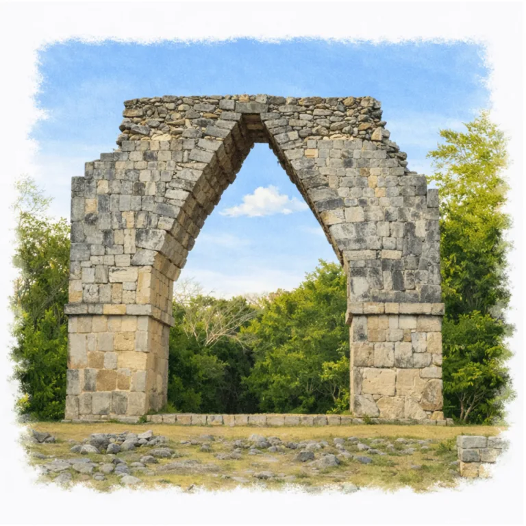
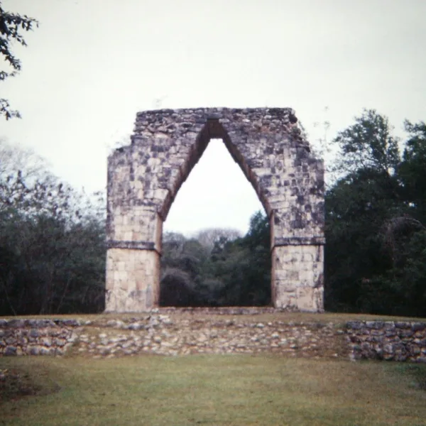
Along a forested rise in the Puuc hills of Yucatán, Kabah organizes its ceremonial approach around the Codz Poop arch, where a vaulted stone gateway marks the transition between connected site groups.
| Name | Kabah |
| Civilization | Maya |
| Location | Puuc Route, Yucatán, Santa Elena Municipality, Yucatán, Mexico |
| Elevation | 100 meters (328 feet) above sea level |
| Years Active | c. 600 – 1000 CE |
| Primary Resources | Limestone, lime plaster, rainwater stored in chultunes, agricultural goods |
| Site Type | Puuc ceremonial and civic center |
| Key Highlights | Codz Pop, Palace, Kabah Arch, sacbé, rainwater chultunes |
| INT Airport: | Mérida International Airport (MID) |
| Unesco | Part of the Uxmal regional inscription |
| Entry Fee | 85 MXN for nationals and residents; 155 MXN for foreign visitors |
| Best Time to Visit | Morning or late afternoon, November to March, dry season |
| Field Visit | Visited and documented by Lost Ruins of the Americas |
Unique Features of the Kabah Archeological Site
- Palace of the Masks: A 90-foot-long façade covered in over 250 Chac deity masks.
- Triumphal Arch: A rare free-standing ceremonial arch leading toward Uxmal’s sacbé.
- Unrestored Sector: Remote and lightly excavated areas for those seeking solitude and raw structure.
- Long Sacbé: Ancient road connecting Kabah directly with Uxmal, a unique inter-site linkage.
Location & Access
- Nearest Town: Santa Elena, Yucatán
- Directions: From Mérida, take Federal Highway 261 south toward Uxmal and Santa Elena. Continue past Uxmal and follow the highway toward Kabah, approximately 101 kilometers from Mérida. Travel time is about 1 hour 40 minutes by car.
- Official Website: INAH Zona Arqueológica de Kabah
- Opening Hours: Monday to Sunday, 8:00 AM to 5:00 PM, with last entry at 4:00 PM.
- Entry Fee: 85 MXN for Mexican visitors and foreign residents; 155 MXN for foreign visitors. Sunday admission is free for Mexican nationals and foreign residents with proof of residency.
- Facilities: Limited services; occasional vendors near entrance
- Accessibility: Moderate trails with steps and uneven terrain
- Pro Tip: Do not leave after viewing the Codz Pop. Cross the highway carefully to reach the Kabah Arch and the beginning of the raised sacbé that once connected the city with Uxmal.
Highlights to Help Understand Your Visit
To see Kabah clearly is to read its symbols. The site unfolds through patterns, alignments, and spatial decisions meant to guide both ritual and authority.
- Rain as political language: The overwhelming presence of Chac motifs reflects more than belief, it asserts control over seasonal power in an unpredictable land.
- Segmented movement: Unlike centralized cities, Kabah divides its spaces with distance and elevation, guiding foot traffic across thresholds both physical and symbolic.
- Architecture as persuasion: Decorative stonework wasn’t just for show, it marked elite buildings, suggesting rank and access through aesthetic complexity.
- Invisible connections: The sacbé to Uxmal wasn’t just a road. it was a spine of ritual exchange. Even today, Kabah feels oriented outward rather than inward.
- Power through repetition: Repeated motifs, faces, latticework, angles, create rhythm in the architecture, reinforcing status through scale and pattern.
Key Structures of the Kabah Ruins
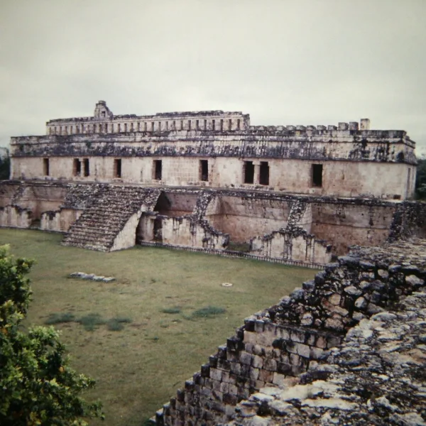
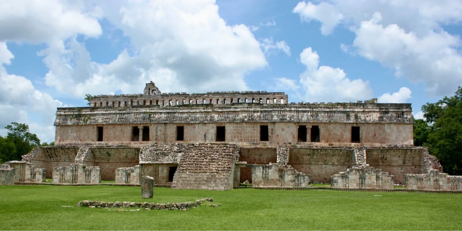
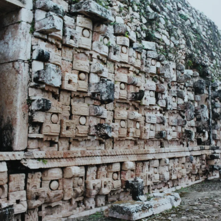
- Palace of the Masks: This long rectangular façade is covered in over 250 carved masks of the rain god Chac. Each mosaic face was built from individually cut stones fitted together with precision. A signature of Puuc craftsmanship and religious symbolism.
- Arch of Kabah: A freestanding ceremonial arch that once marked the entrance to the sacbé connecting Kabah and Uxmal. Its unusual placement and form suggest it served more as a ritual threshold than a defensive feature.
- Codz Poop (Palace of the Mats): Named for its mat-patterned stone latticework, this elite residential building displays one of the most intricate examples of Puuc mosaic geometry in the region, blending aesthetics with status display.
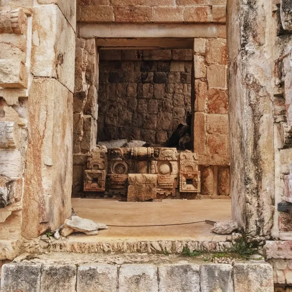
- Northeast Group: A remote, lightly excavated cluster of mounded structures and collapsed vaults. This area preserves the raw density of Kabah’s unretouched layout, offering a glimpse of what the city looked like before modern restoration efforts.
- Temple Platforms: Scattered platforms throughout the site, some with remnants of stairways or upper shrines, may have served as ceremonial stages, residential foundations, or administrative spaces within the city’s fragmented layout.
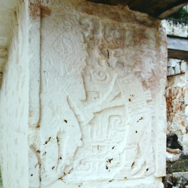
- Small Altars and Stelae Bases: Though many stelae are no longer standing, several carved bases and altar blocks survive across the site, hinting at once-active ritual zones and public offerings now lost to time.
History and Legends
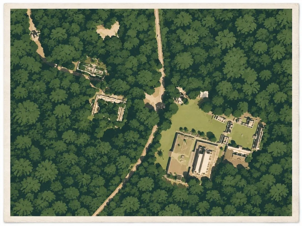
Kabah was inhabited by about 400 BCE, centuries before the stone buildings that now define the site. The settlement grew among the low limestone hills of the Puuc, a region with few permanent sources of surface water, where communities depended heavily on captured rainfall. Monumental construction became visible around 400 CE in what is now called the Central Group. Builders raised broad platforms topped by smaller temples, creating an early ceremonial core that predates the elaborate Puuc façades of Kabah’s later centuries.
Between roughly 750 and 900 CE, Kabah expanded into one of the principal Maya centers of the Puuc. Large architectural groups spread across the higher ground, combining plazas, vaulted rooms, terraces, temples, and long palace ranges. The carefully fitted limestone veneers and mosaic façades associated with Puuc architecture became increasingly prominent, while older architectural traditions remained embedded within the city. Kabah was not simply a ceremonial cluster. Its monumental buildings belonged to a much larger settlement whose inhabitants lived and worked around the great plazas and elevated compounds.
At Kabah’s height, an immense raised road tied the city directly to Uxmal. The sacbé ran about 18 kilometers across the Puuc countryside and was roughly five to six meters wide, reaching Kabah through the freestanding monumental arch that still marks its approach. The road was active during the period when both cities flourished, approximately 700 to 950 CE. Its exact political meaning is uncertain, but its construction required organized labor on a regional scale and made the relationship between Kabah and Uxmal physical. People, goods, officials, and ceremonial processions could move along a built route connecting two of the Puuc’s most powerful centers.
Experiences Around Kabah
The ruins are only part of the story. Kabah sits among the low limestone hills of southern Yucatán, surrounded by dry forest, small Maya towns, and orchard country.
In Ticul, step into a pottery workshop to see red-clay vessels and planters shaped and fired, then browse the town’s shops for locally made shoes.
Farther south, Oxkutzcab’s Mercado 20 de Noviembre fills with citrus, tropical fruit, and vegetables from the surrounding farms, alongside breakfast stalls serving salbutes and relleno negro.
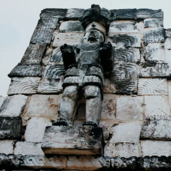
The ninth-century Codz Pop concentrated Kabah’s stonework into one of the most elaborate façades in the Maya world. Thousands of individually carved limestone pieces covered its exterior with repeated supernatural faces. These masks were traditionally identified as Chaac, the rain deity whose imagery appears widely throughout the Puuc. Conservation of the façade documented about 5,400 carved stones forming 161 masks and produced a different reading, identifying the faces as Witz, the personified sacred mountain. Whichever interpretation ultimately proves strongest, the repetition was deliberate and overwhelming in scale. A visitor approaching the building would have faced an entire wall transformed into sacred imagery rather than a few isolated carvings around doors or corners.
Around 950 CE, Kabah’s governing dynasty appears to have left the city, although occupation continued among other inhabitants after the political center had declined. By about 1300, people were still returning to perform ceremonies among buildings that had already begun to collapse. Even the name endured. Kabah appears in the colonial Maya Chilam Balam of Chumayel and is commonly translated as “Powerful Hand,” preserving a pre-Hispanic name for a city whose rulers and monumental building programs had disappeared centuries earlier.
How to Get There & Where to Go Next
How to Visit Kabah
– Step-by-step access to the site –
- Start in Cancún: Take the Tren Maya to Uxmal Station (approx. 4–5 hours).
- From Uxmal: Hire a taxi or shuttle to Kabah (approx. 20 minutes).
- Walk-in access: Short trail from parking area to main structures (5 minutes).
- Optional tour: Join a Puuc Route day trip from Mérida for multiple site access..
Tip: Arrive early to beat midday heat and Uxmal spillover crowds. There are no shade structures inside.
Nearby Ruins You Can Visit
The Puuc Route links Kabah to other ceremonial sites through ancient roads, shared iconography, and regional alliances shaped by both ritual and rivalry.

Xlapak – A quiet ceremonial compound surrounded by jungle, with beautifully preserved Puuc friezes in miniature scale.

Uxmal – A dominant Puuc capital of towering pyramids, palace quadrangles, and precise cosmological alignments.

Labná – Intricate archways, columned halls, and fine Puuc latticework carved deep in the forest.
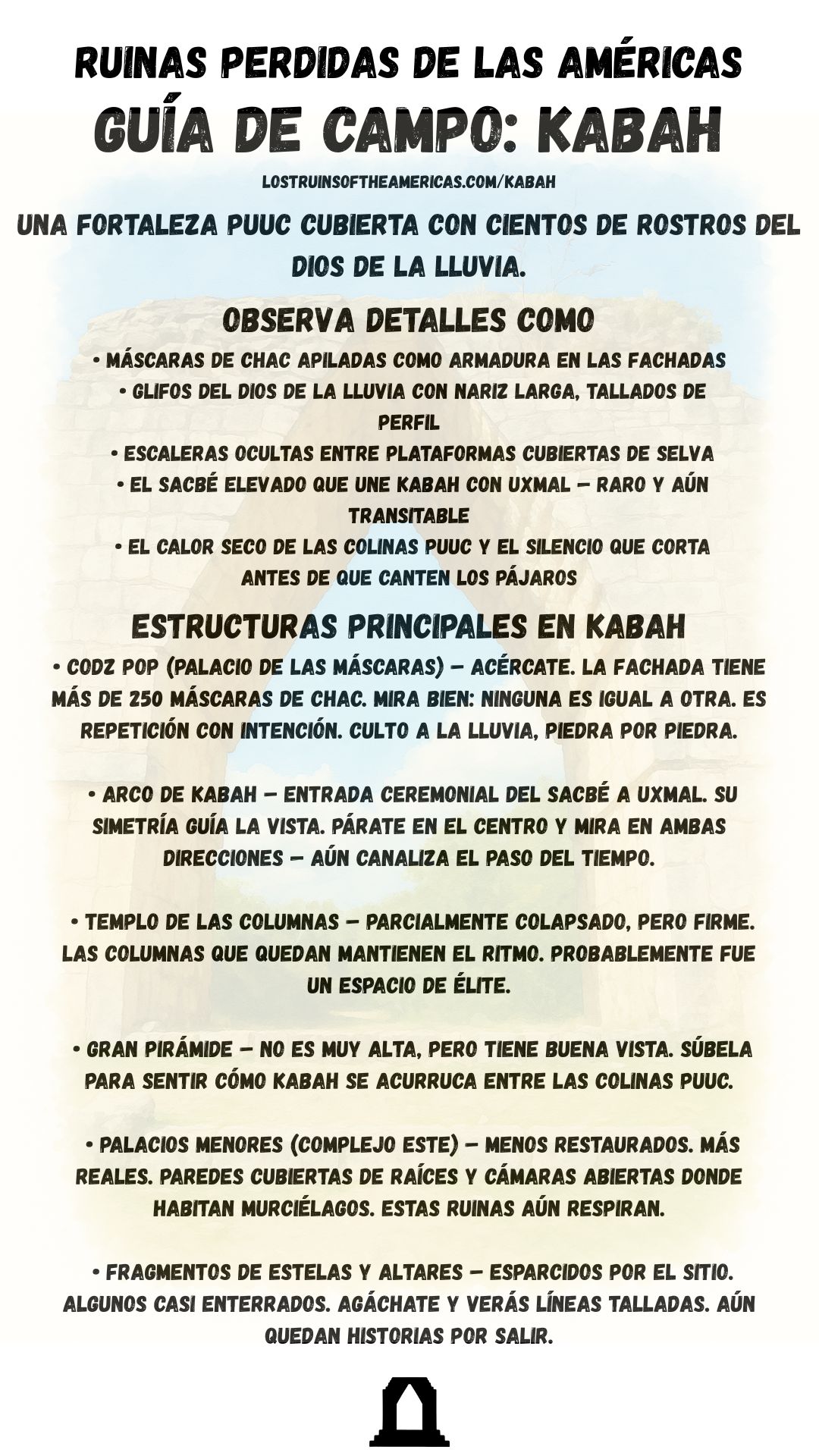
Download Quick Guide
Español
English
Traveler Tips
- Ask about a Puuc Route combo ticket at your first stop. Multi-site access is sometimes available but not always advertised
- Morning visits are best for both light and solitude.
- Bring water, sun protection, and good shoes, no facilities inside the grounds.
- Beware of slippery stones after rain, and sharp edges along the Palace of the Masks.
- If driving, pair with Uxmal and Xlapak for a full-day loop.
Elsewhere in the Americas…
While Kabah flourished as a refined Puuc-style Maya center in the Yucatán, other cultures across the Americas were shaping monumental landscapes of their own:


Along Peru’s south coast, the Nazca created vast geoglyphs and ritual landscapes across the desert.
On Peru’s north coast, the Moche built ceremonial centers like Huaca de la Luna, known for vivid murals and ritual architecture.
Insider Explorer Advice
Kabah was part of a full-day Puuc Route loop from Mérida that included Sayil, Labná, Xlapak, and Uxmal. ravelers without a rental car should arrange a guided circuit or private driver, since transport between the sites is limited. Kabah is often one of the quieter stops, especially outside the main Uxmal day-trip window. Begin at the Codz Pop, where rows of Chaac masks form a dense limestone mosaic across the façade, then cross carefully to the monumental arch and sacbé. The exposed ground, strong sunlight, and distance from the larger tour routes give Kabah a calm, remote character that rewards an unhurried visit.