
Cantona
MEXICO / PUEBLA / CANTONA
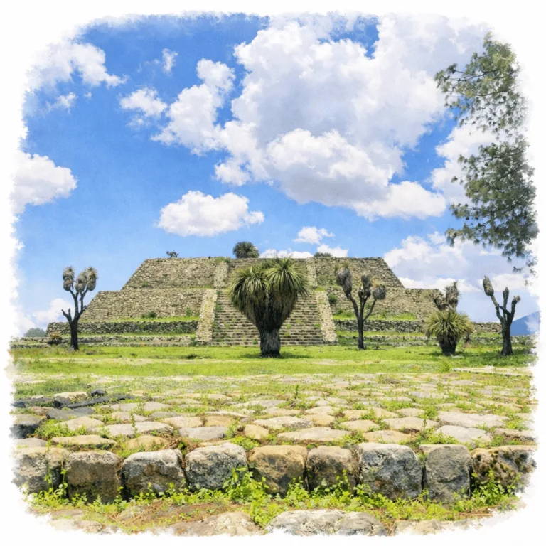
Across a lava-strewn valley in Puebla, Cantona organizes a vast network of stone-walled compounds, where thousands of interconnected patios form one of the most densely built cities in Mesoamerica.
| Name | Cantona |
| Civilization | Cantona culture; ethnic identity remains unknown |
| Location | Tepeyahualco, Puebla, Mexico |
| Elevation | 2,450 – 2,600 m (8,000 – 8,500 ft) |
| Years Active | c. 600 BCE–1050 CE; earlier settlement from c. 1000 BCE |
| Primary Resources | Oyameles-Zaragoza obsidian, volcanic stone, maize, stored water |
| Site Type | Urban center with defensive architecture |
| Key Highlights | Acropolis, 27 ballcourts, walled streets, obsidian workshops |
| INT Airport: | Puebla International Airport (PBC) |
| Entry Fee | 105 MXN for Mexican visitors and residents; 210 MXN for foreign visitors |
| Best Time to Visit | Dry season; clear mornings for views |
| Field Visit | Visited & photographed by Lost Ruins of the Americas |
Unique Features of the Cantona Archaeological Site
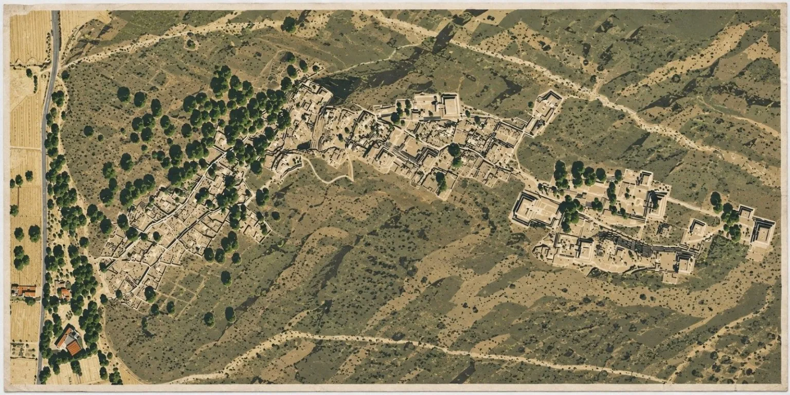
- Architectural Highlights: Over 500 cobblestone streets and more than 3,000 residential structures, including tiered patios
- Notable Artifacts: Stone carvings, obsidian tools, and carved ballgame markers
- Natural Surroundings: Set in a high-altitude valley between extinct volcanoes, offering sweeping panoramic views
- Comparative Notes: Unlike most Mesoamerican sites, Cantona had a grid layout and a vast network of raised causeways. It is often compared to Teotihuacan in scale, but with a more defensive and austere character.
Location & Access
- Nearest Town: Tepeyahualco de Hidalgo, Puebla.
- Directions: Puebla or Xalapa, take the Amozoc-Perote toll road and exit at the Cantona toll plaza, then follow the secondary road approximately 4 kilometers to the archaeological zone. Travel time is about 1 hour 15 minutes from either city.
- Official Website: INAH Zona Arqueológica de Cantona.
- Opening Hours: 9:00 AM to 6:00 PM, with last entry at 4:00 PM.
- Entry Fees: 105 MXN for Mexican visitors and residents; 210 MXN for foreign visitors. Admission includes the site museum.
- Facilities: Small museum, bathrooms, snack stand near entrance
- Accessibility: Moderate, with long stone-paved routes, uneven volcanic ground, and a gradual climb toward the Acropolis.
- Pro Tip: Visit the site museum before starting the walking circuit. Cantona’s walled streets, patios, and ballcourt complexes are much easier to read once the city plan is clear.
Highlights to Help Understand Your Visit
These clues will help decode Cantona’s unusual layout and the mindset behind its massive design:
- Gridded for Control: The city’s rigid street grid, unique in Mesoamerica, suggests a society organized around planning, separation, and oversight.
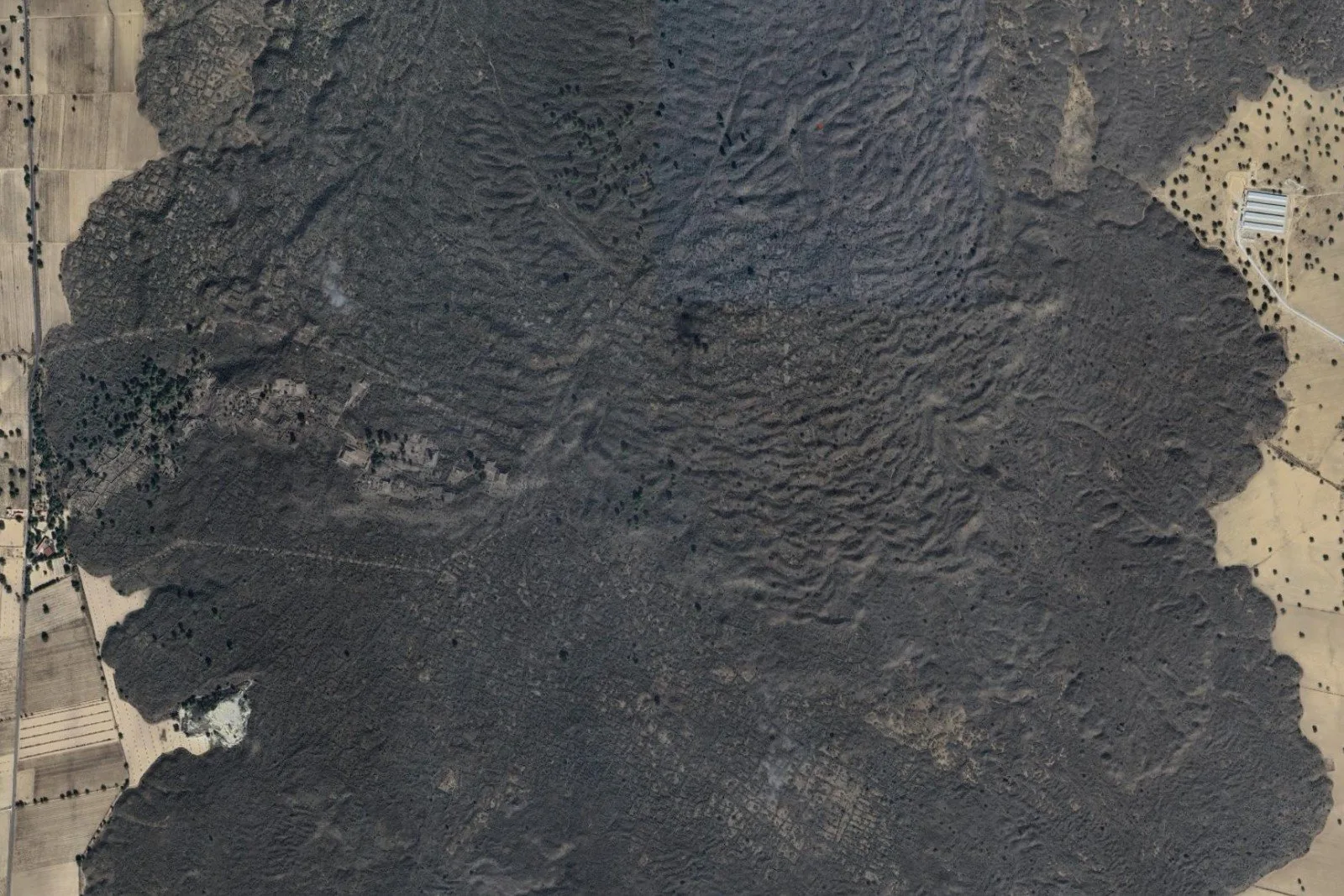
- Built on Lava Flow: Cantona’s foundations rest atop hardened volcanic rock. This influenced its structure, layout, and access from the surrounding valleys.
- Massive, Not Monumental: Instead of grand pyramids, the site emphasizes walled patios and discreet temples. These are subtle signs of elite authority.
- A City of Avenues: Processional roads connect neighborhoods and ball courts, guiding movement through layers of ceremonial and residential space.
- Ball Courts in Abundance: With more ball courts than any other site in the Americas, Cantona reveals a culture where ritual play and power were deeply entwined.
- No Central Core: The absence of a main plaza points to decentralized leadership. This was a city governed through structure, not spectacle.
Key Structures of the Cantona Ruins
- Main Causeways (Calzadas 1 and 2): Broad stone avenues that run the length of the city, connecting residential areas to ceremonial plazas. These were likely used for both civic processions and daily traffic through the site.
- Residential Units: Walled patio compounds scattered throughout the western sector, each featuring altars, entryways, and domestic structures—believed to be elite or clan-based dwellings.
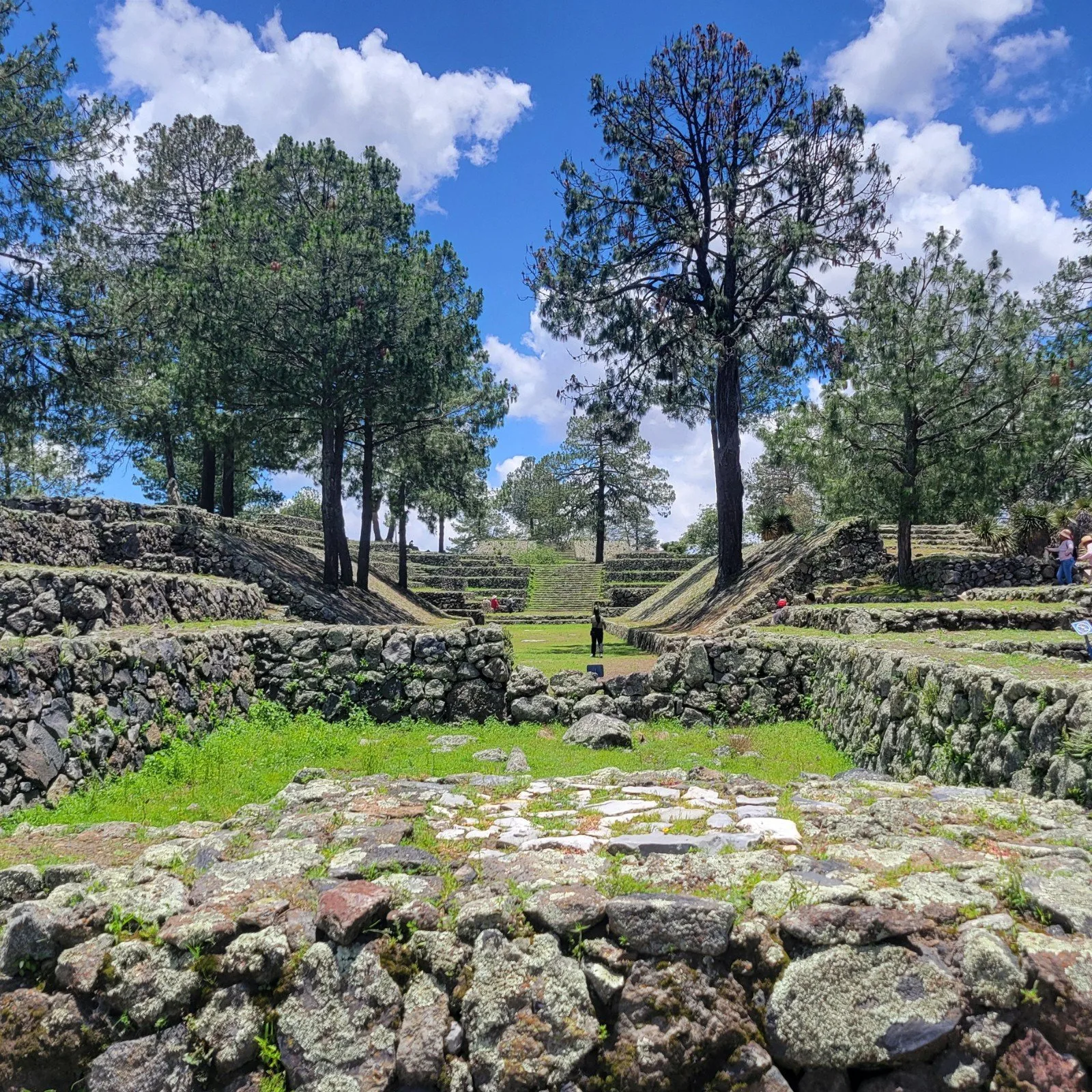
- Ballcourt Complexes (Juego de Pelota 5, 6, and 7): Among Cantona’s two dozen known ballcourts, these three are the most prominent. Their grouping suggests organized ritual tournaments tied to regional identity and calendrical cycles.
- Acropolis Access and Summit: Elevated ceremonial sector accessed by stairways and platforms. Served as the central political-religious hub, likely reserved for high-ranking elites and priests.
- Plaza Poniente and Plaza Oriente: Twin civic spaces that bookend the core of the site. These open plazas hosted public gatherings, markets, and large-scale rituals.
- Temple of Fertility (Plaza de la Fertilización de la Tierra): A ritual area possibly tied to agricultural cycles and rain ceremonies. Architectural alignment suggests seasonal observance.
- El Palacio (Unidad 10): One of the best-preserved elite structures, with thick walls and multiple chambers. May have housed ruling families or ceremonial stewards.
- South Sunken Plaza (Plaza Hundida del Sur): A lowered ceremonial space adjacent to residential and palace units, offering a semi-private setting for elite rites.
- Pyramid of the Lookout (Pirámide del Mirador): An easternmost high platform believed to serve both ritual and surveillance purposes. It commands views across the entire site.
- Concourse of the Concubines (Concubinas): A cluster of rooms and structures whose purpose remains unclear, but may have housed attendants, scribes, or high-status women..
History and Legends
Cantona took shape among the dry lava fields of the Cuenca de Oriental. Human occupation in the region reaches back to around 1000 BCE, but the city’s first clear phase of expansion began around 600 BCE, when two earlier villages spread across the malpaís. As the settlement grew, builders reshaped the volcanic ground with terraces, enclosed residences, defensive walls, and stone-paved routes.
Obsidian gave Cantona its strongest economic advantage. Workshops across the city turned stone from the nearby Oyameles-Zaragoza deposits into blades, tools, and other objects traded along the corridor between the Central Highlands and Gulf Coast. This exchange helped sustain a large population in a dry basin where farming and reliable water remained constant challenges.
The city entered its first long period of growth between the final centuries BCE and about 550 CE. By the fifth century, Cantona covered more than 1,000 hectares and may have held around 65,000 people. Walled household compounds filled the lower terraces, while plazas, pyramids, and ballcourts climbed toward the Acropolis. The extraordinary number of courts, eventually reaching at least twenty-seven, shows how deeply the ballgame was woven into the city’s ceremonial and political life.
Between about 550 and 600 CE, parts of Cantona’s civic and religious center were deliberately damaged. Facades were torn apart, symbols of authority were broken, and several ceremonial spaces fell out of use. Archaeologists interpret this destruction as evidence of internal upheaval, but the city did not disappear. Obsidian production continued, and after 600 CE the city entered another major period of population growth.
Cantona reached its greatest size between about 600 and 900 CE, during the unsettled centuries that followed the decline of Teotihuacan. Nearly 90,000 people may have occupied more than 1,400 hectares, making Cantona one of the largest cities in the Central Highlands. Its fortified position, controlled entrances, and dense internal street system reflect a political order shaped by regional competition as well as trade. Fertility offerings recovered from the Central Plaza show that agricultural renewal remained part of public ceremony within this increasingly guarded city.
After 900 CE, Cantona’s population declined rapidly. Paleoclimate records show prolonged dry conditions across the basin, and water stress likely contributed to the city’s abandonment between about 900 and 1050 CE. Other political or social pressures may also have played a role, but they remain less clearly documented.
No securely identified ancient name or founding legend survives from Cantona. The proposal that the city was called Caltonac, translated as “House of the Sun,” appeared in a 1903 publication but is not supported by an ancient inscription or historical document. The name Cantona has been recorded since at least 1790.
Experiences Around Cantona
The ruins are only part of the story. Cantona sits in the high, dry Cuenca de Oriental, where volcanic cones, maguey, grassland, and distant mountains shape the landscape.
Laguna de Alchichica adds a deep volcanic crater lake with pale microbialite formations and stark open shores.
Around Tepeyahualco, old pulque haciendas, maguey fields, and regional cooking bring a more rural side of Puebla into the same day.
How to Get There & Where to Go Next
How to Visit Cantona
Step-by-step access to the site
- Puebla City – Drive northeast on Highway 140D (1.5 hrs).
- Take local road to Cantona – Continue to INAH-signed entrance road to the site (15 min).
- Arrive at main entrance – Free parking and small visitor center.
- Enter on foot – Walk through gate and begin exploring (5 min)
Tip: Little shade and no food. Bring water and visit early to avoid midday heat.
Nearby Ruins You Can Visit
Cantona sits at the edge of a region rich with ceremonial centers, military outposts, and painted temples. Each offers a different lens on power in the Puebla-Tlaxcala Valley.

Yohualichan – A post-Tajín ceremonial site where Totonac traditions endured through mountain mist and sacred waterworks.

El Cuajilote – A forested hilltop site with stepped mounds and Totonac-era stonework still hidden in the jungle.

Xochitécatl – Spiral pyramids and fertility symbolism define this elevated site, paired nearby with Cacaxtla’s vivid murals above the Tlaxcala plain.
Download Field Guide
Español
English
Traveler Tips
- What to Bring: Water, snacks, hat, sunblock, the site is exposed and remote
- Best Time to Visit: Early morning for cooler weather and open skies
- Nearby Attractions: The Tepeyahualco town plaza, and regional obsidian workshops (informal, local)
- Safety Notes: Watch your step, the stone paths can be rough and the layout is large enough to get turned around if you’re not paying attention
Elsewhere in the Americas…
While Cantona rose in the highlands of Mexico, powerful cultures across the Americas were shaping regional power and identity:

Nazca etched geoglyphs across the desert and mastered water engineering in one of South America’s driest regions.

The Moche center of Huaca de la Luna developed ceremonial platforms and painted walls that depict rituals, deities, and scenes of elite power.

Ancestral Puebloans at Mesa Verde raised stone villages and gathered in Great Kivas on the Colorado Plateau.
Insider Explorer Advice
The journey to Cantona by public transport starts at CAPU bus station in Puebla, then transfers at Oriental and Tepeyahualco, two small towns where locals are generally helpful and proud of their proximity to the ruins. A taxi to the site from Tepeyahualco might be needed, as colectivo transport from Tepeyahualco can be inconsistent. The site’s vast layout, limited shade, and remote setting require preparation. Those who make the effort are rewarded with one of the most expansive and well-preserved ancient cities in Mexico, still largely off the typical tourist radar.
Summary: Cantona was a vast and complex city with a defensive layout and an obsidian economy. It is one of Mexico’s best-kept archaeological secrets.