
Chacchobén
MEXICO / QUINTANA ROO / MAYA
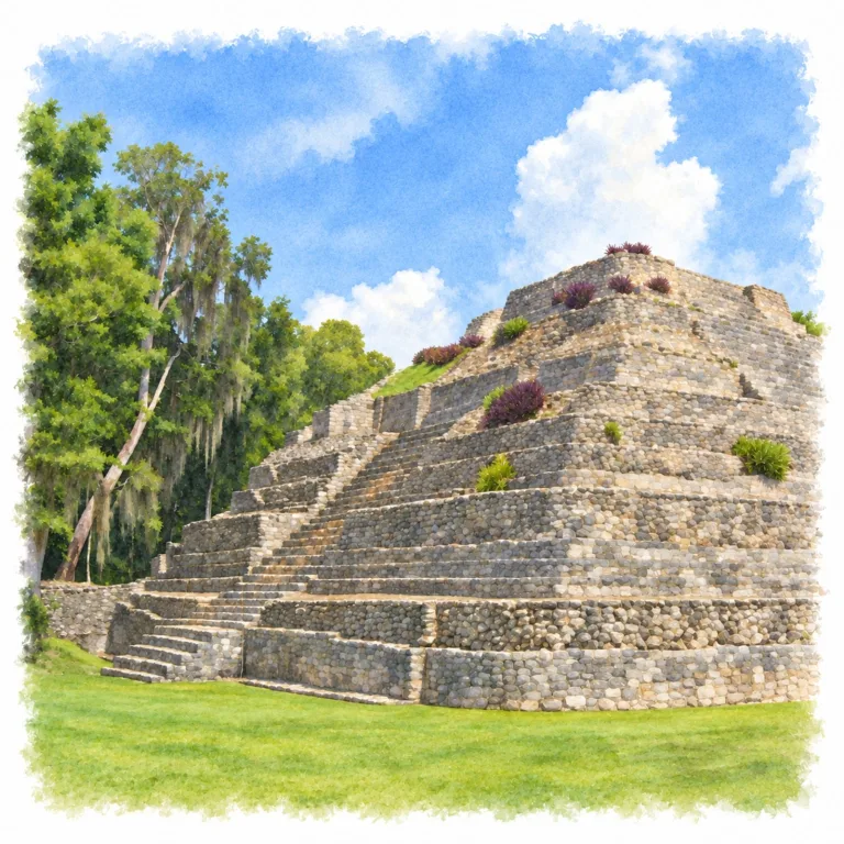
Among the forests and freshwater lakes of southern Quintana Roo, Chacchobén raises a Maya ceremonial center above the lowlands, where a broad Acropolis carries temples overlooking the surrounding plazas.
| Name | Chacchobén |
| Civilization | Maya |
| Location | Bacalar municipality, Quintana Roo, Mexico |
| Elevation | Lowland setting |
| Years Active | c. 300 BCE onward; major growth c. 250–750 CE; later reuse c. 1200–1450 CE |
| Primary Resources | Freshwater lakes, forest resources, agricultural land |
| Site Type | Settlement and ceremonial center; later pilgrimage site |
| Key Highlights | Gran Basamento, Temple 1, Building 24, Las Vías |
| INT Airport | Tulum International Airport (TQO); Chetumal (CTM) is closer |
| Entry Fee | MX$85 Mexican visitors and residents; MX$155 foreign visitors; local charges may be additional |
| Best Time to Visit | At opening; cooler, drier months from November to April |
| Field Visit | Visited and documented by Lost Ruins of the Americas |
Unique Features of the Chacchobén Ruins
- Raised Acropolis: A broad platform gathers several temples above the surrounding plazas.
- Lakes region: Permanent freshwater helped support the earliest Maya settlement.
- Southern styles: Petén architecture mixes with Río Bec and Chenes influences.
- Las Vías: Parallel rows of low platforms reveal the settlement beyond its pyramids.
- Later pilgrimage: Maya worshippers returned to the temples after the city declined.
Location & Access
- Nearest Town: Lázaro Cárdenas; Bacalar is a convenient visitor base.
- Directions: From Bacalar, follow Highway 307 north, then Highway 293 west to the signed entrance; about 40–50 minutes.
- Official Website: INAH Zona Arqueológica de Chacchobén.
- Opening Hours: Daily, 9:00 AM–3:00 PM; last entry 2:30 PM. Confirm closing time before travel.
- Entry Fees: MX$85 Mexican visitors and residents; MX$155 foreign visitors. Separate local access or parking charges may apply.
- Facilities: Visitor services, toilets, parking, signed paths, and entrance shops.
- Accessibility: Forest paths include uneven surfaces; reaching the Acropolis involves stairs.
- Pro Tip: Allow time for the paths between groups, not only the main pyramids.
Highlights to Help Understand Your Visit
Chacchobén makes more sense as a spread-out settlement with a raised ceremonial core than as a handful of separate pyramids.
- Read the change in level: The Gran Basamento lifts the temples above the plazas, separating the upper ceremonial space from the ground around it.
- Look past the tallest buildings: Low platforms at Las Vías help reveal where people lived around the monumental center.
- Picture the finished surfaces: The exposed masonry once carried stucco, which gave the temples a different appearance from the stone visible today.
- Follow the whole layout: Building 24, the plazas, and the Acropolis belong to different parts of the same settlement; the connecting walks help establish its scale.
Key Structures of Chacchobén
- Gran Basamento / Acropolis: The large raised platform supports the principal temple group, with stairways connecting its upper level to the plazas below.
- Temple 1: A west-facing pyramid with six stepped tiers and a broad central staircase; successive building phases extend from the Early Classic into later reuse.
- Temple II / Las Vasijas: A smaller stepped temple on the Gran Basamento, with a rectangular sanctuary and a low altar.
- Building 24: A separate pyramid marked on the official visitor plan, helping define another monumental group away from the Acropolis.
- Templo Adosado: A later temple added over the stairway of Temple 1, linking renewed worship to an older monument.
- Las Vías: Three parallel rows of low masonry platforms, interpreted as a residential group associated with the settlement’s leading households.
History and Legends
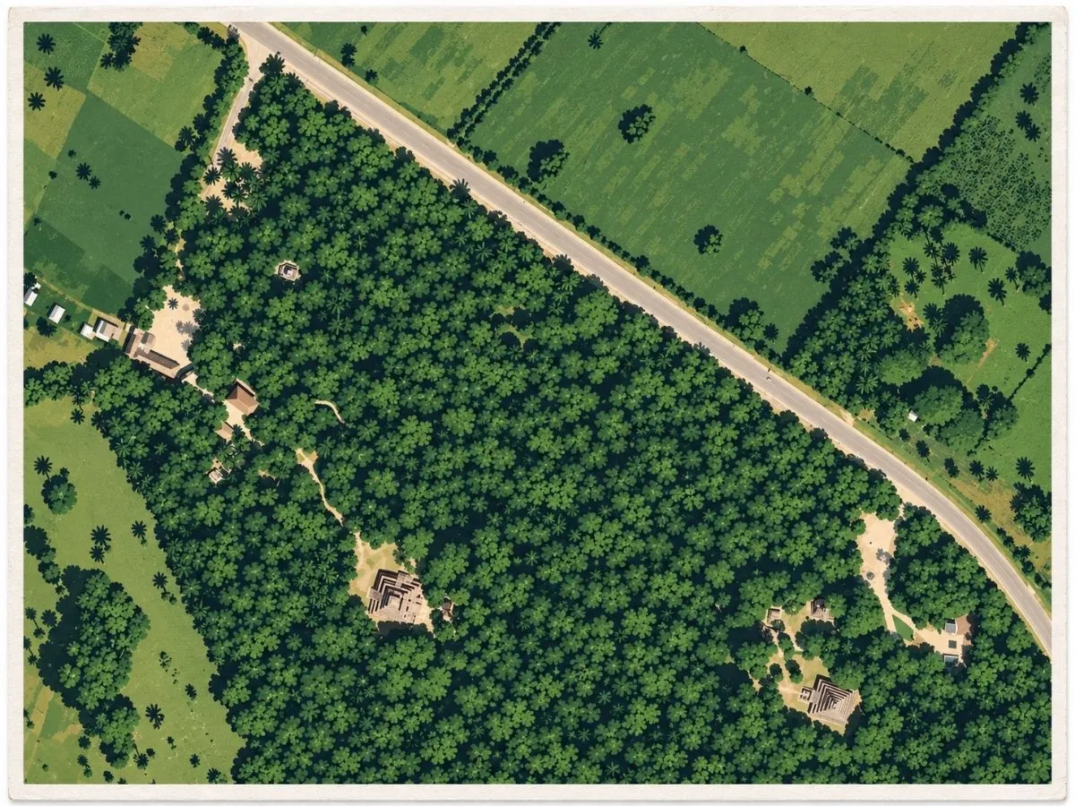
Permanent water helped make the lake country of southern Quintana Roo a favorable place for the community that became Chacchoben. By about 250 to 300 CE, the settlement had developed a recognizable urban plan covering roughly 70 hectares, with temples, residences, plazas, and civic buildings spread through the forest. The name used today is much later. Chacchoben comes from the nearby modern ejido and is usually translated as “Place of the Red Corn.” The name by which the ancient inhabitants knew their city has not survived.
The greatest building effort came during the Early Classic period. Builders raised the Gran Basamento, an enormous elevated platform more than 100 meters across, then placed additional platforms and two pyramidal temples on its summit. Other monumental groups developed nearby, including Las Vías and Group II, where the tallest surviving structure rises above the surrounding trees. These buildings did not remain unchanged. Building 1 on the Gran Basamento was enlarged through three major stages extending from the Early Classic into the much later Postclassic occupation, allowing successive communities to build directly onto the ceremonial center created by their predecessors.
Chacchoben’s architecture places it firmly within the networks of the southern Maya lowlands. Early buildings used forms associated with the Petén tradition, including recessed wall panels, rounded or inset corners, sloping apron-like moldings, and stairways flanked by architectural masses that sometimes carried modeled stucco decoration. Other parts of the city show Río Bec and Chenes influences. The closest architectural comparisons lie toward Guatemala and northern Belize. Chacchoben’s two known inscribed stelae are too eroded to identify rulers or political relationships, so its place within the wider Maya political landscape remains uncertain.
Major construction slowed around 700 CE, and the monumental center eventually lost much of the population and activity that had sustained it for centuries. Chacchoben followed a broader transformation occurring across south-central Quintana Roo, where old political centers changed dramatically during the final centuries of the Classic period. The decline was not necessarily a single abandonment event, and there is no secure evidence tying it to one war, drought, or political collapse. What is clear at Chacchoben is that the great temples ceased to function on their earlier scale while the buildings remained standing above the lake district.
Beginning around 1200 CE, people returned to Chacchoben and gave the old ceremonial center a new life. The Gran Basamento and its temples again became places of worship and pilgrimage even though the city around them was no longer the Classic-period settlement it had once been. Large numbers of portrait incense burners were broken or deposited on the summit and around the principal temples during this Late Postclassic use, while Building 1 received its final architectural changes. This renewed activity continued until roughly 1450, centuries after Chacchoben’s first monumental age had ended. The last major chapter of the site was therefore not the construction of another city, but repeated return to the old temples by Maya communities who still considered the ancient ceremonial ground worth visiting and using.
Experiences Around Chacchoben
The ruins are only part of the story. Low tropical forest and small farming communities spread across this inland corner of southern Quintana Roo.
–
On the road through Pedro Santos, stop for sweet locally grown pineapple sold from roadside stands, a crop closely associated with the village.
–
Farther south, paddle or swim in Bacalar’s Lagoon of Seven Colors, where changing depths turn the freshwater from pale turquoise to deep blue.
How to Get There & Where to Go Next
How to Visit Chacchobén
From Tulum International Airport:
- Airport departure: Take a rental car or arrange a driver for the round trip.
- South on Highway 307: Follow the airport access road to 307 and drive toward Felipe Carrillo Puerto and Limones.
- Turn inland: At the Highway 293 junction, turn west toward the signed archaeological zone.
- Final approach: Follow signs to the entrance; allow about 2–2.5 hours from the airport.
Tip: From Mahahual/Costa Maya, the direct road journey takes roughly an hour.
Nearby Ruins You Can Visit
These Maya centers connect southern Quintana Roo’s inland cities with the Caribbean coast, from monumental stucco masks to vast pyramids and seaside temples.

Becán – A moat surrounds the monumental core of this Río Bec city, where tall pyramids and enclosed plazas give the ceremonial center a sharply defined boundary.
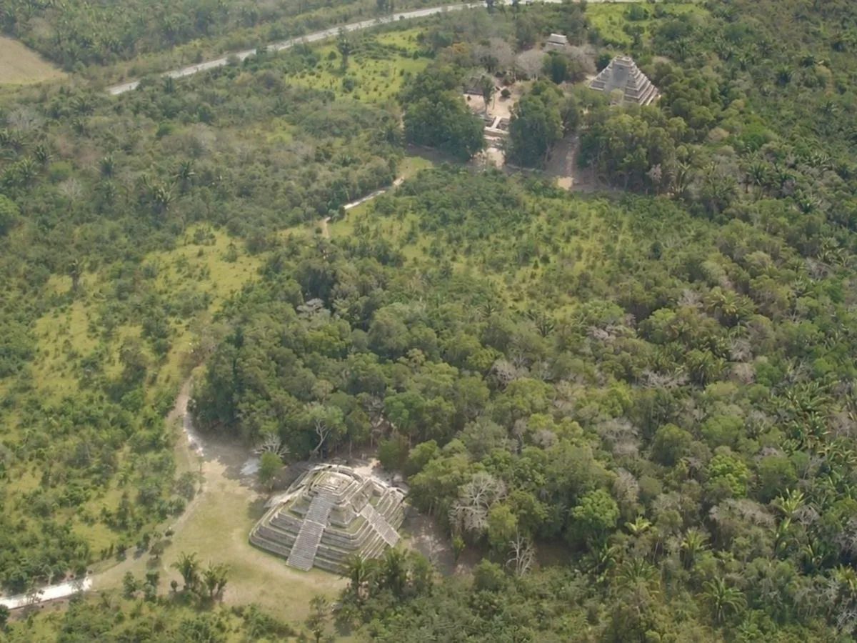
Kohunlich – Huge stucco masks flank a temple staircase, while palm-shaded plazas, palace courtyards, and residential groups reveal a city extending well beyond its famous facade.

Traveler Tips
- Forest heat: Tree cover helps, but humid air builds quickly. Carry water for the whole circuit.
- Acropolis steps: Wear shoes with grip for the raised platform; follow barriers around the temple stairways.
- Group arrivals: Costa Maya excursions can change the feel of the site; an early independent visit offers more flexibility.
Elsewhere in the Americas
While Chacchobén’s Classic temples took shape, South American societies were building coastal ceremonial centers and expanding cities across the highlands.

Near Lake Titicaca, Tiwanaku grew into the ceremonial capital of the civilization of the same name, where sunken courts, carved stone figures, and carefully fitted masonry shaped its public center.
Insider Explorer Advice
Chacchobén can feel much larger once the visit moves beyond the first pyramid. Coming inland from Costa Maya, the forest paths and separate building groups give the day a stronger sense of exploration than a quick excursion stop suggests. The Acropolis and larger temples provide the obvious highlights, but the approach matters too, with structures appearing between the trees as the route crosses the settlement. Leaving time for those walks makes the city’s spread easier to grasp and keeps the visit from becoming a hurried circuit of its tallest buildings.
Summary: Chacchobén preserves a raised Maya ceremonial center, forest-linked building groups, and temples reused for pilgrimage in southern Quintana Roo.