
Yohualichan
MEXICO / PUEBLA / TOTONAC
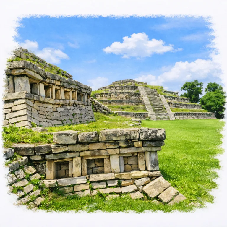
On a high ridge in the Sierra Norte de Puebla, Yohualichan rises beside the village around it, where niche-cut Totonac pyramids remain woven into the surrounding community.
| Name | Yohualichan |
| Civilization | Totonac |
| Location | Sierra Norte de Puebla, Cuetzalan del Progreso Municipality, Puebla, Mexico |
| Elevation | 600 m (1,969 ft) above sea level. |
| Years Active | 200 to 1200 CE |
| Primary Resources | Limestone, agricultural goods, forest products, regional trade goods |
| Site Type | Ceremonial center and regional settlement |
| Key Highlights | Niche-covered pyramids, Edificio de las Grecas, central plaza, ballcourt |
| INT Airport | Puebla International Airport (PBC) |
| Entry Fee | 80 MXN national or resident; 145 MXN foreign visitor |
| Best Time to Visit | December to March, early morning |
| Field Visit | Visited & photographed by Lost Ruins of the Americas |
Unique Features of the Yohualichan Archaeological Site
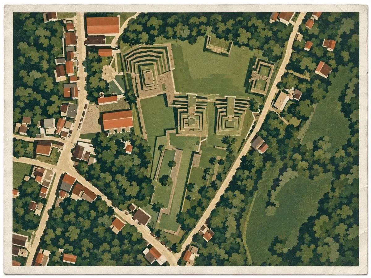
- Community-embedded layout: Unlike isolated ruins, Yohualichan unfolds within the daily rhythms of a modern town, merging past and present.
- Sunken ceremonial plazas: Architectural depressions used for ritual gatherings and performance ceremonies.
- Step pyramids with sloped corners: Characteristic Totonac design echoed centuries later at nearby El Tajín.
- Circular path orientation: Visitors walk in a loop through the structures, exiting at the opposite end of the town square.
Location & Access
- Nearest Town: Yohualichan adjacent to site, Cuetzalan del Progreso, approximately 10 to 12 kilometers from the archaeological site.
- Directions: Take a short colectivo from Cuetzalan to Yohualichan (approx. 15 minutes). The ruins are located within the town named for the site, directly behind the main church.
- Official Website: INAH Zona Arqueológica de Yohualichan
- Opening Hours: 9:00 AM to 6:00 PM, with last access at 5:15 PM.
- Entry Fees: 80 MXN; 145 MXN for foreign visitors.
- Facilities: Basic restrooms; small shops and snack vendors in town square
- Accessibility: Easy to moderate, flat paths, some uneven stone surfaces
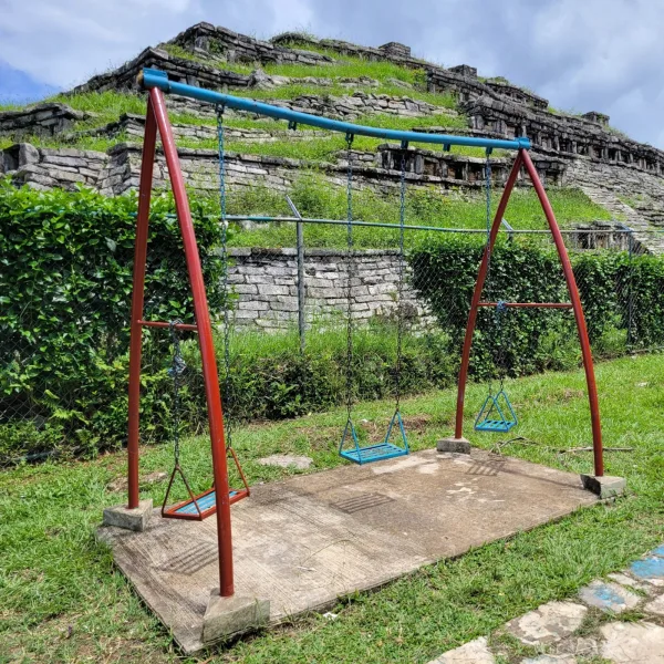
- Pro Tip: Visit in the afternoon for peaceful walks and children playing in the central plaza, a rare lived-in ruin setting.
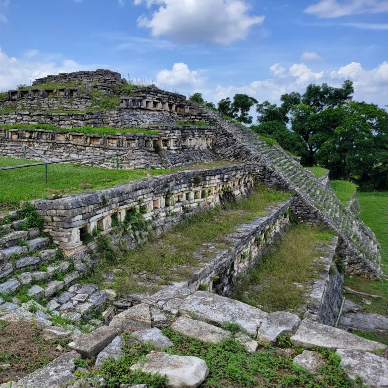
Key Structures of the Yohualichan Ruins
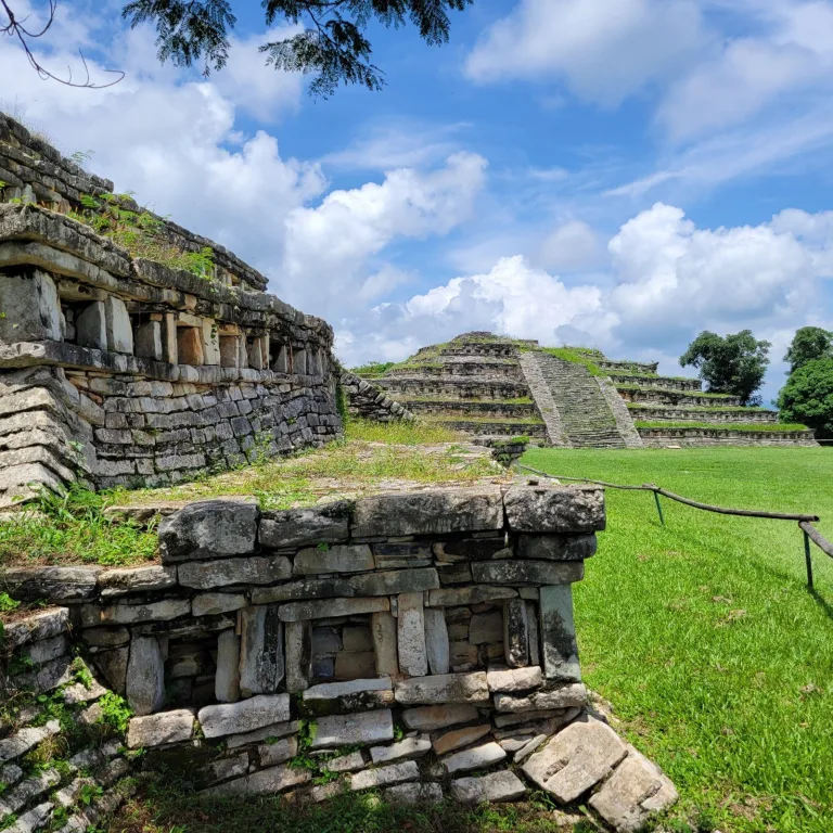
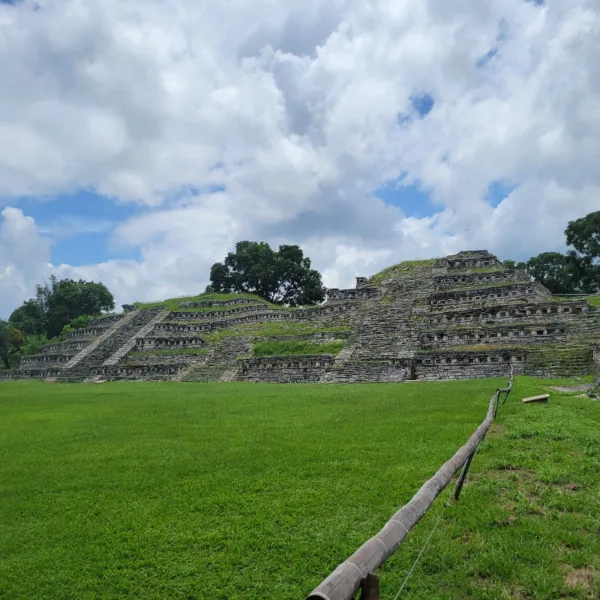
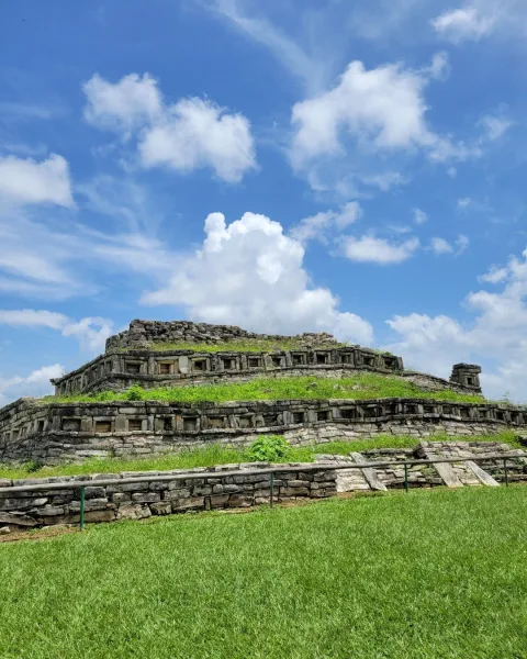
- Main Pyramid: Central stepped temple with rounded corners and niches, believed to host religious ceremonies and seasonal rituals tied to the solar calendar.
- Sunken Plaza: Below-grade ceremonial courtyard likely used for public performances, dances, or ritual gatherings associated with Totonac ceremonial cycles.
- Residential Platforms: Elevated stone foundations where elites or ritual specialists may have lived. These are often placed to face the plaza or pyramid directly.
- Ballcourt Remains: Partial outline of a traditional Mesoamerican ballcourt, oriented along the northern edge of the site and now partially reclaimed by vegetation.
- Perimeter Wall: Low retaining wall that defines the ceremonial zone’s boundary, subtly separating sacred space from the rest of the surrounding village.
- Stela Base and Altar Fragments: Scattered stone elements suggest the presence of upright stelae or altars, now eroded, possibly used for ritual offerings or ancestral veneration.
- Entry Causeway: The original ceremonial approach from the town may have included a defined entry path leading through a gateway or framed space into the main plaza.

History and Legends
Around 200 CE, Totonac builders established a ceremonial center high in the Sierra Norte de Puebla, on steep ground overlooking the routes between the mountains and the Gulf lowlands. Yohualichan was not built beside a major river. Instead, water moved largely beneath the surface. More than seventeen springs have been identified around the archaeological zone, while rainwater working through the limestone created caves, sinkholes, underground galleries, and subterranean streams. The builders adapted their city to this broken terrain, raising plazas on natural shelves and connecting different levels with stairways and stone platforms.
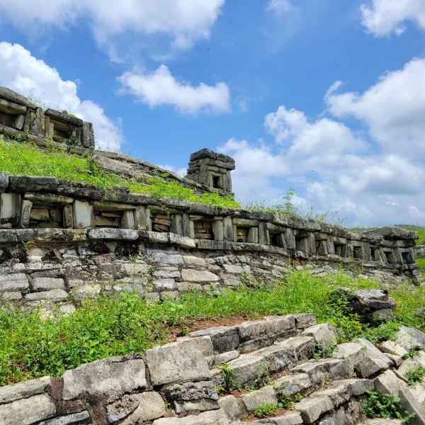
As Yohualichan grew, its ceremonial center spread across these terraces. The Edificio de las Grecas preserves bands of geometric stonework, while the Edificio del Ameyalli closes the western side of the principal plaza. A spring emerges within the Ameyalli complex, and stairways connect the building both with the plaza above and with lower ground to the west. Nearby, pyramidal buildings carry the rows of recessed niches that make Yohualichan immediately recognizable. The city also possessed a ballcourt nearly 100 meters long, one of the largest known in Mesoamerica, squeezed into a settlement where level ground itself was limited.
Those niches create Yohualichan’s strongest architectural connection with El Tajín, across the mountains in Veracruz. The two centers also shared elements of the hacha, yugo, and palma sculptural tradition, but Yohualichan was not simply a smaller copy or proven dependency of El Tajín. More than a hundred archaeological sites have been recorded across the country between the Sierra and the coast, showing that the two cities belonged to a populated corridor of smaller communities and travel routes. Yohualichan’s higher position gave it productive agricultural land and closer access to obsidian sources, while routes descending toward Veracruz opened connections with Gulf Coast goods. Trade, kinship, political relationships, and shared ceremonial traditions could all have carried architectural ideas through this network.
Experiences Around Yohualichan
The ruins are only part of the story. Misty ridges, coffee plots, and dense subtropical forest shape this part of Puebla’s Sierra Norte.
–
If your visit falls on Sunday, browse Cuetzalan’s weekly market for local coffee, chiles, vanilla, woven textiles, and produce brought in from surrounding Nahua communities.
–
Nearby Cascada Las Brisas adds a forest walk, with trails descending through thick vegetation to a broad pool beneath the falls.
The underground landscape may also have influenced how the people of Yohualichan understood their city. Recent research has proposed a connection between the repeated architectural niches and the abundance of caves throughout the Cuetzalan region, though that interpretation is not certain. What is clear is that caves nearby were used ceremonially. An offering recovered from Huayateno Cave included hundreds of greenstone beads, a large Gulf Coast shell, pottery, and masks made in a Teotihuacan-related style. Centuries later, Nahua pochteca, or long-distance traders, called the old center Yohualichan, “House of the Night,” a name later tradition associated with the many caves around it.
The principal Totonac occupation lasted until about 800 CE. Around 900, groups associated in the historical reconstruction with the Toltec sphere appear to have entered the region, probably displacing at least part of the earlier population. Another conquest followed around 1200, attributed in later accounts to groups described as Chichimec, and the old ceremonial center continued to lose political importance through the final centuries before the Spanish arrival. Nahua-speaking communities and traders later occupied the same Sierra and gave the ruins the name used today. By then the great ballcourt, spring-fed Ameyalli complex, and niche-covered temples belonged to an older Totonac city, but Yohualichan remained part of an inhabited mountain landscape shaped by successive peoples long after its first political order had ended.
How to Get There & Where to Go Next
How to Visit Yohualichan’
– Step-by-step access to the site –
- Puebla to Cuetzalan: Take a regional bus (4.5–5.5 hours).
- Arrive in Cuetzalan: Get off near the town center or main terminal.
- Colectivo to Yohualichan: Shared van ride from near plaza (15 minutes).
- Walk to entrance: Path begins behind the town church (2–3 minutes).
Tip: Morning departures avoid fog and winding road delays. Return vans run until early evening.
Nearby Ruins You Can Visit
These sites share ceremonial layouts, architectural patterns, and cultural ties that echo Yohualichan’s Totonac legacy. This includes everything from niche pyramids to plaza-centered civic life.


El Cuajilote – A forested hilltop site with stepped mounds and Totonac-era stonework still hidden in the underbrush.

Cantona – A sprawling highland city of obsidian trade and ritual plazas, built with volcanic stone and unmatched urban planning.
Traveler Tips
- The entrance is behind the town church. Signage is subtle, so ask a vendor if unsure.
- There is little shade. Bring a hat or umbrella for comfort during sunny visits.
- Small snack vendors and paleteros are often in the town square, perfect post-visit.
- There is no museum on site, but interpretive signs near key structures help orient your walk.
- The full circuit can be done in 30–45 minutes at a relaxed pace.
Elsewhere in the Americas…
As Yohualichan flourished in the Totonac world, other cultures across the Americas were also building, expanding, or entering their final great phases.

In Peru the Sicán culture built monumental temples at Batán Grande and forged elaborate gold funerary masks.


At Millstone Bluff in Illinois, Woodland peoples were building stone enclosures on a defensible blufftop above the river valleys.
Insider Explorer Advice
Arriving via colectivo from Cuetzalan makes Yohualichan feel like a shared secret. It is a quick, winding ride that deposits you into a plaza framed by a church and ancient stonework. Children play near the pyramids. Locals sell helado and smile with quiet pride that you made the effort. Follow the looped path through the ruins, and on the far side, reemerge into the square. Before catching your ride back, sit in the shade with ice cream in hand and take in a view where town and temple meet. Here, memory still walks beside everyday life.
Summary: Yohualichan isn’t remote, it’s rooted. A place where stone and story remain part of the same town square.