
Becán
MEXICO / CAMPECHE / MAYA
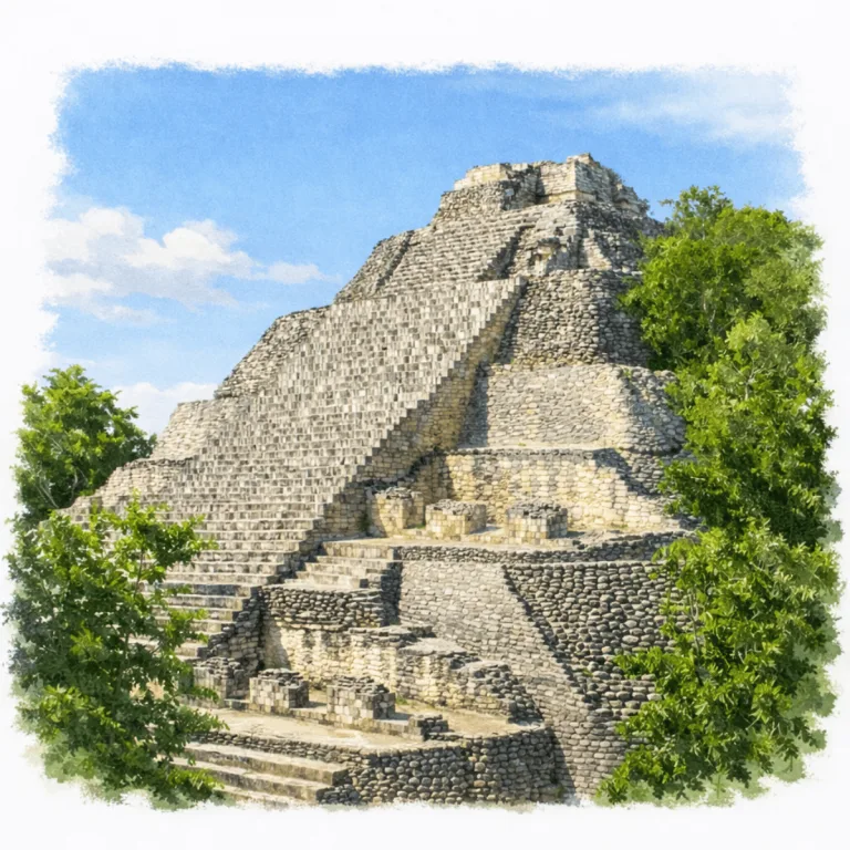
Encircled by a deep man-made ditch in the central Yucatán lowlands, Becán organizes a fortified urban core, where walls, causeways, and gateways controlled access to one of the Maya world’s most defensive city layouts.
| Name | Becán |
| Civilization | Maya |
| Location | Calakmul Municipality, Campeche, Mexico |
| Elevation | 290 meters (951 feet) |
| Years Active | c. 600 BCE–1200 CE |
| Primary Resources | Limestone, defensive earthworks, stucco masonry |
| Site Type | Fortified ceremonial and civic center |
| Key Highlights | Encircling moat, steep Rio Bec towers, causeways |
| INT Airport | Chetumal International Airport (CTM) |
| UNESCO | Calakmul Biosphere Reserve |
| Entry Fee | 85 MXNs; 155 MXN for foreign visitors. |
| Best Time to Visit | Morning or late afternoon |
| Field Visit | Visited and independently documented by Lost Ruins of the Americas |
Unique Features of the Becán Archaeological Site
- Regional Position Becán sits at the center of the Río Bec zone and links nearby forest cities in southern Campeche.
- Range of Monument Types Pyramids, palace style complexes, a ballcourt, and residential groups all sit within a short walking circuit.
- Vaulted Tunnel A preserved corbel vaulted passage connects parts of the site and shows classic Maya stone roofing up close.
- Ballcourt Layout The ballcourt sits between major plazas and reflects the ceremonial rhythm of the civic core.
- Elevated Viewpoints Upper platforms offer clear views over the tree line and the outline of the ancient city.
Location & Access
- Nearest Town: Xpujil, Campeche.
- Directions: From Xpujil, follow Federal Highway 186 west to the signed Becán turnoff at kilometer 145, then continue 450 meters to the entrance.
- Official Website: INAH Zona Arqueológica de Becán.
- Opening Hours: Monday through Sunday, 8:00 AM to 5:00 PM. Last entry is at 4:45 PM.
- Entry Fees: 85 MXN for Mexican visitors and foreign residents; 155 MXN for foreign visitors. Sundays are free for Mexican citizens.
- Facilities: Parking, restrooms, information module, and small shop.
- Accessibility: Moderate, with uneven ground and steep stairways on the principal structures.
- Pro Tip: Watch closely for the kilometer 145 turnoff. The entrance road is only 450 meters long, making the highway sign easy to pass.
Highlights to Help Understand Your Visit
Key patterns at Becán help explain how the site was organized and how its architecture signaled power and movement.
- Moat as Spatial Boundary The surrounding ditch defines the limits of the civic core, creating a clear separation between the interior plazas and the outer landscape.
- Río Bec Tower Symbolism The tall, steep towers were never meant for climbing. They function as visual statements that marked authority and status within the region.
- Controlled Access Points Raised crossings and narrow entry routes show how movement into the city was directed through specific paths rather than open approaches.
- Plaza Arrangement The plazas are arranged in a compact sequence, with administrative and residential buildings framing the central activity areas.
- Construction Layers Many buildings include added rooms, sealed chambers, and rebuilt façades, showing long-term modification as the city’s role shifted over time.
Key Structures of the Becán Ruins
- Structure IX: Iconic twin-tower temple at the heart of the city, with steep, decorative façades that showcase the Río Bec style. The towers are largely symbolic, meant to impress rather than serve as functional temples.
- Structure IV: The largest pyramid in Becán, with broad stairways leading to a commanding view over the central plazas and the encircling moat. Its size and position suggest both religious and political importance.
- Defensive Moat: A dry ditch up to 15 meters wide and 4 meters deep that completely encircles the site. This feature makes Becán one of the only truly fortified cities in the Maya world.
- Causeways (Sacbeob): Elevated stone roads that once linked Becán with other Río Bec centers, including Chicanná and Xpuhil. These sacbeob reinforced the city’s role as a regional hub.
- Ballcourt (Juego de Pelota): Positioned between plazas, the ballcourt reflects the importance of ritual games in Maya society and ties Becán to broader Mesoamerican traditions.
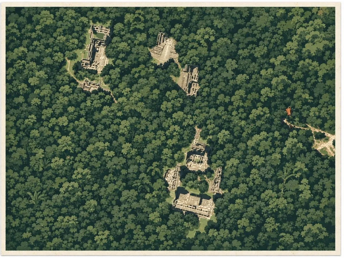
- Plaza Central and Plaza Oeste: Open courtyards framed by temples and residences, used for gatherings, ceremonies, and elite activities. Their layout highlights the balance between civic and ritual functions.
- Interior Residential Plazas: Groups of buildings within the protected core, thought to have housed administrative elites and served as spaces for governance. Their placement inside the moat shows the defensive priority given to ruling families.
- Vaulted Tunnel (Túnel Abovedado): A passageway near Structure VIII, illustrating Maya corbel arch construction. It offered controlled access between plazas and added to the fortified nature of the site.
History and Legends
Becán is one of the oldest and most strategically designed Maya sites in the Rio Bec region. Its origins trace back to around 550 BCE, but it rose to prominence during the Early Classic period. What sets Becán apart is its moat. Carved into the limestone and reinforced with raised earthworks, it once encircled the ceremonial and residential core of the city. This defensive feature is unique among lowland Maya sites, suggesting a time of conflict, power consolidation, or regional instability.
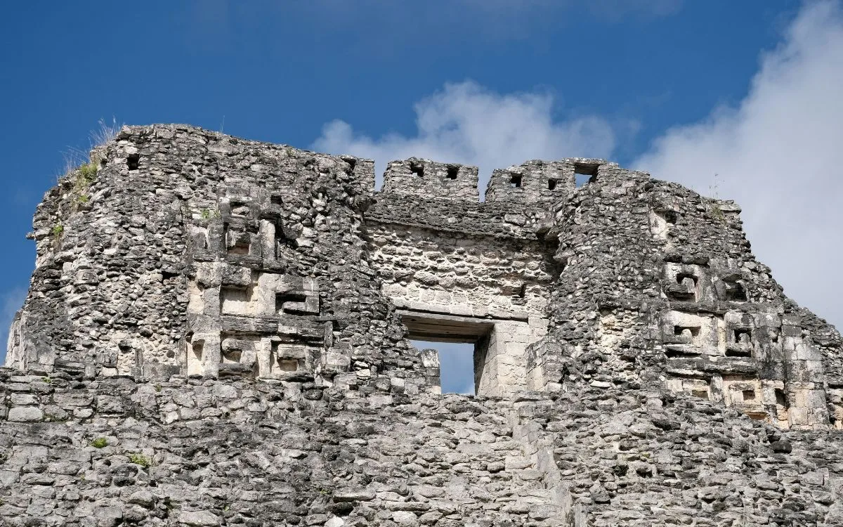
The name Becán means “ravine or canyon formed by water” in Yucatec Maya, likely a reference to the moat itself. Early explorers were struck by the city’s unusual defensive layout and tight geometric planning. Rio Bec architecture dominates the skyline. Twin towered facades, false stairways, and decorative stonework project authority and sacred design, even though many of the towers could not be climbed.
Becán’s layout reflects careful planning. Plazas and pyramids are symmetrically arranged within the moat, and causeways link it to nearby sites such as Chicanná and Xpuhil. These roadways may have facilitated ritual travel or trade. While less monumental than Calakmul to the south, Becán reveals a different Maya priority. Security, aesthetics, and internal order shaped the city’s form and function.
Abandoned sometime after 1200 CE, Becán’s moat eventually filled with silt and vegetation. But its outlines remain clearly visible, a reminder of a fortified city in the Maya forest that once looked both inward and outward with purpose.
How to Get There & Where to Go Next
How to Visit Becán
Step-by-step access to the site
- Tren Maya to Xpujil Station Board the southbound train toward Xpujil. Travel time varies between 5 and 6 hours depending on departure point.
- Station to Xpujil Town Take a local taxi along Highway 186 for 10 to 15 minutes into town.
- Town to Becán Hire a taxi or flag a colectivo east along Highway 186. The ride to the entrance takes 10 minutes.
- Road Access Option Drivers can take Highway 186 directly from Escárcega or Chetumal. Expect 1.5 to 2.5 hours depending on direction.
- Return Trip Taxis and colectivos run frequently along Highway 186 back toward Xpujil.
Tips: Check local schedules for Tren Maya service, and bring cash for taxis and the site entry fee.
Nearby Ruins You Can Visit
Becán sits within a corridor of major Maya cities where ceremonial towers, carved facades, and powerful capitals shaped the region. These nearby sites reveal the broader story that surrounded Becán.

Chicanná – Famous for its sculpted serpent mouth entrance and precise architectural layout in the Río Bec region.

Calakmul – A vast Maya Capital with monumental pyramids and royal tombs hidden deep in the Calakmul Biosphere Reserve

Xpuhil – Three slender towers on a shared platform create one of the most distinctive silhouettes in the region.
Traveler Tips
- Easy to access by taxi or colectivo from Xpujil. Drop-off is directly at the entrance.
- Restrooms and shaded seating available near the ticket booth.
- Early mornings offer shade and good light for photography, especially near the moat.
- Bring snacks and take a break near the main plaza. It’s a peaceful and uncrowded spot.
- Combine with nearby ruins like Chicanná, Balamkú, and Hormiguero for a full day of exploration.
Elsewhere in the Americas…
During the same centuries that Becán thrived as a fortified Maya city in the Río Bec region, other cultures across the Americas were reaching new heights of power and influence:


Huaca de la Luna on the north coast continued Moche style ceremonies even as local power shifted.

In the U.S. Southwest Ancestral Puebloans built kivas at Lowry Pueblo.
Insider Explorer Advice
Becán is one of the best-kept secrets along the Calakmul corridor. The architecture may seem familiar at first, but the moat changes everything. Walk the perimeter trail and take time to view the site from outside the walls. The towers and plazas feel different when approached with the original defenses in mind. If you’re already in Xpujil, visiting Becán by colectivo makes for a low-cost, high-reward afternoon.
Summary: Becán is a rare blend of geometry and defense. A fortified Maya city carved into the earth and crowned with towers that still command attention.