
El Tlatoani
MEXICO / MORELOS / NAHUA
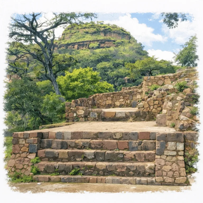
Perched above Tlayacapan, El Tlatoani crowns a steep mesa with terraced stone platforms, where its elevated position dominates the surrounding valleys in a deliberately defensive setting.
| Name | El Tlatoani Ruins |
| Civilization | Nahua (possibly Xochimilca or Tlahuica) |
| Location | Tlayacapan, Morelos, Mexico |
| Elevation | 1,700 meters ( 5,600 feet) |
| Years Active | 600–1150 AD |
| Primary Resources | Maize, water management, obsidian trade |
| Site Type | Hilltop ceremonial complex with agricultural terraces |
| Key Highlights | Panoramic views, stone terraces, remote setting |
| Entry Fee | 100 MXN (~$5 USD) |
| Best Time to Visit | Dry season; early morning for the hike |
| Field Visit | Visited & photographed by Lost Ruins of the Americas |
Unique Features of the El Tlatoani Archaeological Site
- Architectural Highlights: Hilltop platform, foundations of ceremonial structures
- Notable Artifacts: Stone wall remnants, stepped trail sections, hillside terraces
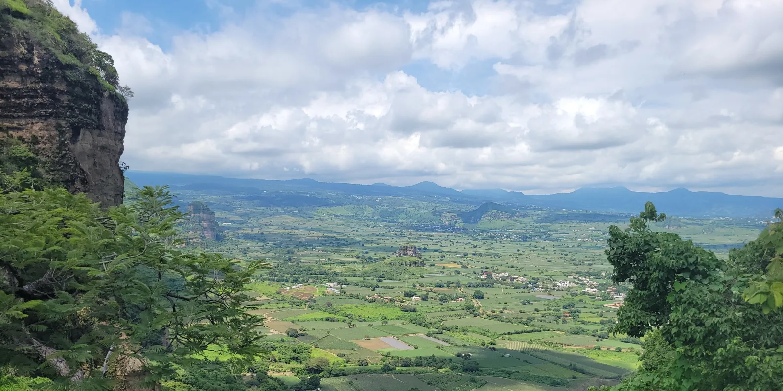
- Natural Surroundings: Sweeping views of volcanic ridges and the Morelos valley
- Comparative Notes: More remote than El Tepozteco, offering solitude and expansive scenery
Location & Access
- Nearest Town: Tlayacapan, Morelos. El Tlatoani rises above the western side of town.
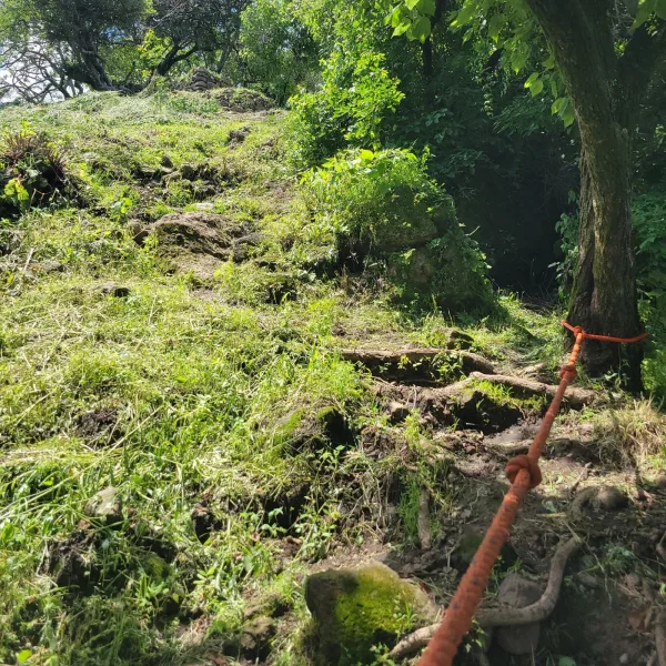
- Directions: From central Tlayacapan, take a mototaxi to the base of Cerro El Tlatoani, about 20 minutes away. The steep hike to the summit takes roughly 90 minutes.
- Official Site: Tlayacapan, Zona Arqueológica El Tlatoani.
- Opening Hours: Friday to Sunday, 10:00 AM to 5:00 PM. Access is managed locally and may change on holidays or during bad weather.
- Entry Fees: 100 MXN per person, collected by the agrarian community that maintains the trail and entrance.
- Facilities: Small parking area, ecological restrooms, and a viewpoint at the trailhead. No visitor facilities at the summit.
- Accessibility: Difficult. The route follows steep, rocky terrain without constructed steps and is not suitable for wheelchairs or visitors with limited mobility.
- Pro Tip: Start early, carry water, and wear shoes with strong traction. The exposed rock and steep descent become harder in midday heat or rain.
Highlights to Help Understand Your Visit
El Tlatoani unfolds in layers, from defense to cultivation to ceremony. Here’s what to notice on the way up:
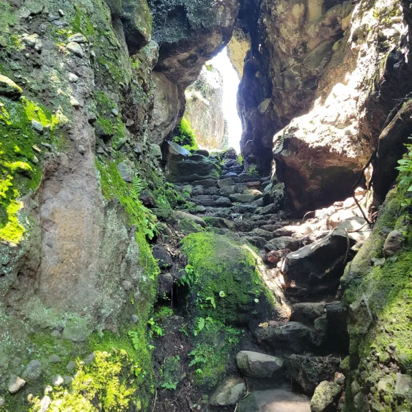
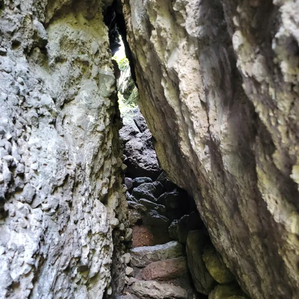
- The Crack as a Marker: The narrow cleft in the rock serves as a controlled entry point, marking the transition from open terrain to cultivated land.
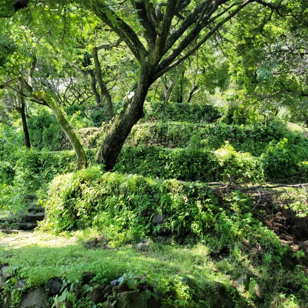
- Farming on the Mountain: Just beyond, stone terraces step up the slope. Built for agriculture, they may also align with seasonal or ritual cycles.
- The Summit as Sanctuary: Above the terraces lies a flat ceremonial zone, likely used for offerings, gatherings, and sky-based observance.
- Movement Was Designed: The path upward is shaped by stone. It provides access and also separates functional zones to guide experience.
- Layers of Use, Layers of Meaning: This wasn’t one kind of site. It evolved from practical to sacred. Every level carries purpose.
Key Structures of the El Tlatoani Ruins
- Hilltop Ceremonial Platform: The summit platform anchors the upper zone of El Tlatoani, creating a leveled ritual space above the Tlayacapan valley. Its position gives the site its commanding presence, with broad views across the surrounding hills, town, and agricultural lowlands.
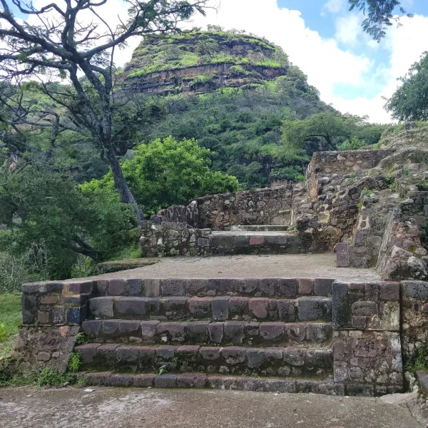
- Summit Terrace System: The upper slopes are shaped by stone terraces that reduce the steepness of the hill and create usable space near the ceremonial core. These terraces show how builders adapted a difficult summit into a planned architectural landscape.
- Agricultural Terraces: Lower terrace lines follow the hillside contours below the main ruins. They likely supported farming, soil retention, and slope management, tying daily subsistence to the same mountain that held the ceremonial precinct.
- Stone Staircase Segments: Surviving stair sections and stepped paths guide movement between the lower slopes, terrace levels, and upper platform. The climb helps reveal how access to the summit was controlled through narrow, rising approaches.
- Rock Passage and Natural Fissure: A narrow stone corridor near the ascent uses the bedrock itself as part of the route. This passage gives the site a strong threshold quality, separating the climb from the summit zone above.
- Rock Carving Outcrops: Boulders and exposed stone surfaces hold faint carvings and geometric marks. Their placement suggests symbolic use, possibly tied to ritual movement, landscape observation, or sacred geography.
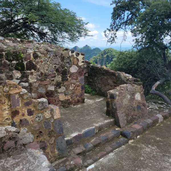
- Perimeter Wall Traces: Low stone alignments near the summit may have helped define the ceremonial area and guide circulation. Even where fragmentary, they show that the hilltop was organized rather than casually occupied.
- Lookout Points: Natural overlooks around the upper terraces frame views toward Tlayacapan and the surrounding valleys. These sightlines likely mattered for surveillance, procession, and the symbolic power of the hill itself.
- Unexcavated Mound and Platform Remains: Scattered stone foundations and low mound-like traces suggest additional building phases still not fully exposed. El Tlatoani feels partly revealed, with much of its original plan still held in the hilltop terrain.
How to Get There & Where to Go Next
How to Visit El Tlatoani
Step-by-step access to the site
- CDMX to Oaxtepec: Bus or drive via Tepoztlán (2–2.5 hrs)
- Oaxtepec to Tlayacapan: Colectivo from terminal (20–30 min)
- Find trailhead: North edge of town, marked with signs
- Hike to summit: Steep trail with terraces and rock pass (1 hr)
Tips: Trail is signed and monitored — local staff may check that all visitors exit before dusk. Bring water and start early.
Nearby Ruins You Can Visit
El Tlatoani crowns a sacred ridge. These nearby sites echo its Nahua origins, mountaintop views, and highland spiritual legacy.

Tepozteco – A cliffside temple dedicated to Tepoztecatl, god of pulque, fertility, and mountain storms.

Xochicalco – Fortress-like ceremonial city with a carved observatory and traces of Toltec influence.

Chalcatzingo – A valley-side Olmec site with massive bas-reliefs, ritual plazas, and enduring mystery.
History and Legends
El Tlatoani rises sharply above Tlayacapan, with Popocatépetl dominating the eastern horizon. People were using the hill centuries before the settlement visible today took shape. Ceramics from the upper slopes reach back into the Late Preclassic, roughly 500–150 BC, showing that the summit and its approaches were already part of the local landscape. From the upper hill, the changing position of the sun against Popocatépetl can be followed through the year, and that relationship has been interpreted as part of an agricultural calendar tied to the farming cycle around Tlayacapan.
By the Classic period, activity on the summit had become architectural. A temple was established near the top of El Tlatoani around AD 400–600, giving the hill a permanent ceremonial focus centuries before its largest residential expansion. Later ritual activity continued around the building, which has been associated with Tláloc and Xólotl. The temple stood high above the cultivated land below, reached only after climbing the steep upper slopes.
The largest transformation came between AD 900 and 1200, when the Tlayacapan tlaca, the people of Tlayacapan, occupied the summit and upper hill most intensively. Builders cut usable ground into the slope and held it in place with stone retaining walls, creating terraces for houses and larger structures where there was little naturally level land. The archaeological zone on the summit covers about 1.4 hectares, concentrating homes, work areas, burials, and ceremonial buildings into a compact series of platforms climbing toward the top.
Experiences Around El Tlatoani
The ruins are only part of the story. Steep green ridges rise around Tlayacapan, enclosing old neighborhoods and cultivated fields below the mountains.
Walk between the town’s historic barrio chapels, including Santa Ana, Santiago, El Rosario, and La Exaltación, each tied to one of Tlayacapan’s traditional neighborhoods.
At the Museo Ex Convento de San Juan Bautista, see surviving wall paintings and the enormous rainwater-collection system built into the 16th-century convent complex.
The people living on those terraces were connected to communities well beyond Tlayacapan. Pottery recovered at El Tlatoani has close parallels with Tula and the southern Basin of Mexico, placing the settlement within the exchange networks of central Mexico during the Early Postclassic. Ceramic styles and objects moved across those routes while daily life continued on the hill itself, among retaining walls, houses, work spaces, and the older ceremonial architecture near the summit.
At its height, El Tlatoani was a crowded hilltop community built on ground that demanded constant adjustment. Houses stood on narrow terraces held against the mountainside, people climbed between levels to work and gather, and goods arriving through wider central Mexican networks reached a settlement overlooking Tlayacapan and the fields below. The summit that had first drawn activity centuries earlier had become, by the Early Postclassic, a permanent and highly organized place to live.
Traveler Tips
- What to Bring: Water, snacks, hiking shoes, sun protection
- Best Time to Visit: Early morning during the dry season
- Nearby Attractions: Tepozteco, colonial chapels of Tlayacapan
- Safety Notes: Trail is demanding and unmarked; GPS guidance is recommended
Elsewhere in the Americas…
While El Tlatoani overlooked the hills of central Mexico, powerful cultures across the Americas were shaping vast empires and sacred landscapes:


In the Andes of Peru, Kuélap rose as a fortified center with massive stone walls and circular dwellings.

In the Southwest U.S., Ancestral Puebloans built early communities and ceremonial spaces at Mesa Verde.
Insider Explorer Advice
El Tlatoani’s hilltop ruins offer a rewarding but strenuous hike ideal for self-reliant travelers. Though maintained, the trail features steep grades, a small tunnel, and ambiguous forks, with little formal signage. There is an attendant that makes sure everyone has left. Visitors should begin early in the day, carry sufficient water, and use offline navigation tools. The summit rewards with striking views, stone terraces, and a sense of total solitude, making it one of the more immersive archaeological hikes in central Mexico.
Summary: El Tlatoani’s remote ruins offer a glimpse into Nahua ceremonial life, a quiet, high-altitude site where geography, history, and endurance meet.