
Sand Canyon Trail
USA / COLORADO / ANCESTRAL PUEBLOAN
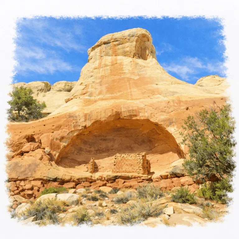
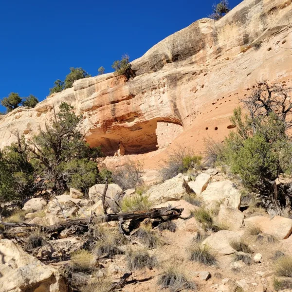
Along a canyon corridor in Canyons of the Ancients, Sand Canyon Trail passes a dense line of cliff dwellings and pueblos, where masonry structures cluster along the canyon walls and floor.
| Name | Sand Canyon Trail |
| Civilization | Ancestral Puebloans |
| Location | Near Cortez, Montezuma County, Colorado, within Canyons of the Ancients National Monument |
| Elevation | 5,450 ft (1,660 m) and rises to about 5,900 ft (1,800 m), providing roughly 1,390 ft of elevation gain over the 6.5-mile trail |
| Years Active | c. 900 – 1300 CE (Pueblo II – Pueblo III period) |
| Primary Resources | Sandstone, timber, dryland agriculture, canyon springs |
| Site Type | Canyon and mesa trail with multiple pueblo and cliff dwelling sites |
| Key Highlights | Castle Rock Pueblo, Saddlehorn Pueblo, Sand Canyon Pueblo, canyon to mesa views |
| Entry Fee | No specific trailhead fee, standard public lands regulations apply |
| Best Time to Visit | Spring and fall, early morning or late afternoon |
| Field Visit | Visited & photographed by Lost Ruins of the Americas |
Unique Features of the Sand Canyon Trail
- Canyon Route with Pueblo Sites The trail follows a natural corridor lined with small masonry dwellings and towers that mark long term settlement in the canyon.
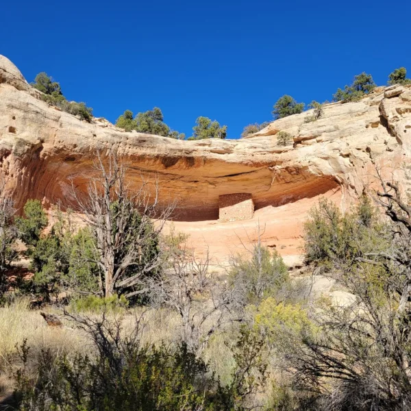
- Edge and Alcove Construction Builders positioned walls along ledges and shallow alcoves that take advantage of shade, shelter, and stable bedrock.
- Views Across Side Canyons High points offer wide views into branching canyons where additional structures are visible to careful observers.
- Integrated Trail System The route connects with other trails in Canyons of the Ancients National Monument, allowing visitors to experience a broader network of sites.
Location & Access
- Nearest Town: Cortez, Colorado
- Trailhead: Southern Sand Canyon Trailhead on County Road G in McElmo Canyon, about twelve miles west of Cortez.
- Directions: From Cortez, drive south on US 491, then turn west onto County Road G and follow signs to the Sand Canyon Trailhead parking area.
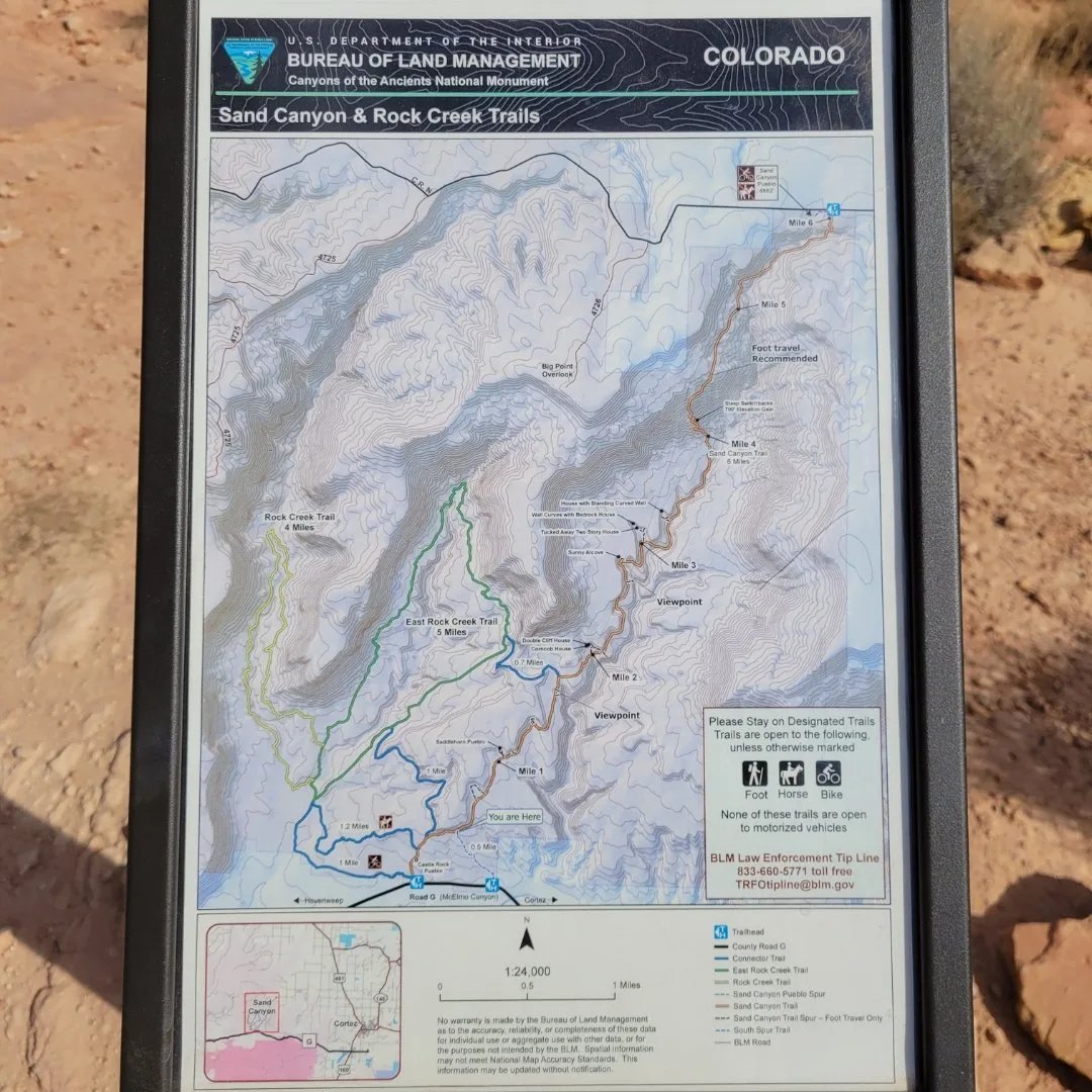
- Managing Agency: Bureau of Land Management, Sand Canyon & Rock Creek Trails
- Opening Hours: Day use only, generally accessible year round, with conditions varying by season.
- Entry Fees: Free
- Facilities: Gravel parking area with no water, food, or restrooms, so bring all supplies.
- Accessibility: Moderate canyon walking on uneven rock, transitioning to a steep climb toward the mesa top if you continue past the main pueblos.
- Pro Tip: Use the posted maps in the canyon section to plan your turnaround point before committing to the upper mesa climb.

Highlights to Help Understand Your Visit
These points help frame what you will see along the trail and how to read the remains in the canyon landscape:
- Architecture in Motion Many structures appear along ridgelines or tucked into alcoves. This placement reveals how residents balanced shelter, visibility, and movement through the canyon.
- Stonework with Purpose Walls often show careful shaping at corners and entry points. These changes signal shifts in activity or status within a cluster of rooms.
- Towers as Signals Look for tower forms near edges or rises. Their positions help explain how communities monitored travel routes and stayed connected with neighboring sites.
- Cliffside Adaptation Some structures incorporate natural rock shelves. This blending of masonry and cliff line shows a practical approach to defense and stability.
- Trail as Lifeline The route itself follows paths used for farming, water access, and intercommunity travel. The relationship between trail and settlement is part of the story.
Key Structures of Sand Canyon Trail
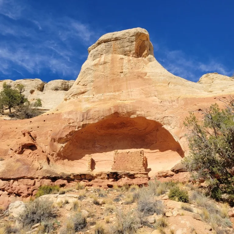
- Castle Rock Pueblo: A large late-period village wrapped around a dramatic sandstone tower near the southern approach, with room blocks, kivas, and defensive sight lines across the canyon.
- Saddlehorn Pueblo: A pueblo tucked beneath a distinctive rock feature that resembles a saddle horn, with masonry rooms and a kiva built into a protected alcove above the canyon floor.
- Sand Canyon Pueblo: A major settlement near the mesa rim that once contained hundreds of rooms and numerous kivas, representing a significant population center looking out over the canyon system.
- Alcove Dwellings: Smaller habitation clusters built into rock niches along the canyon walls, likely used for family groups, storage, and sheltered living spaces away from the canyon bottom.
- Kiva Foundations: Circular or subcircular depressions and low walls at several sites, marking former ceremonial and communal spaces where social and ritual life were centered.
- Agricultural Terraces and Check Dams: Subtle stone alignments and terraced areas that hint at ancient water control and farming strategies in a dry landscape.
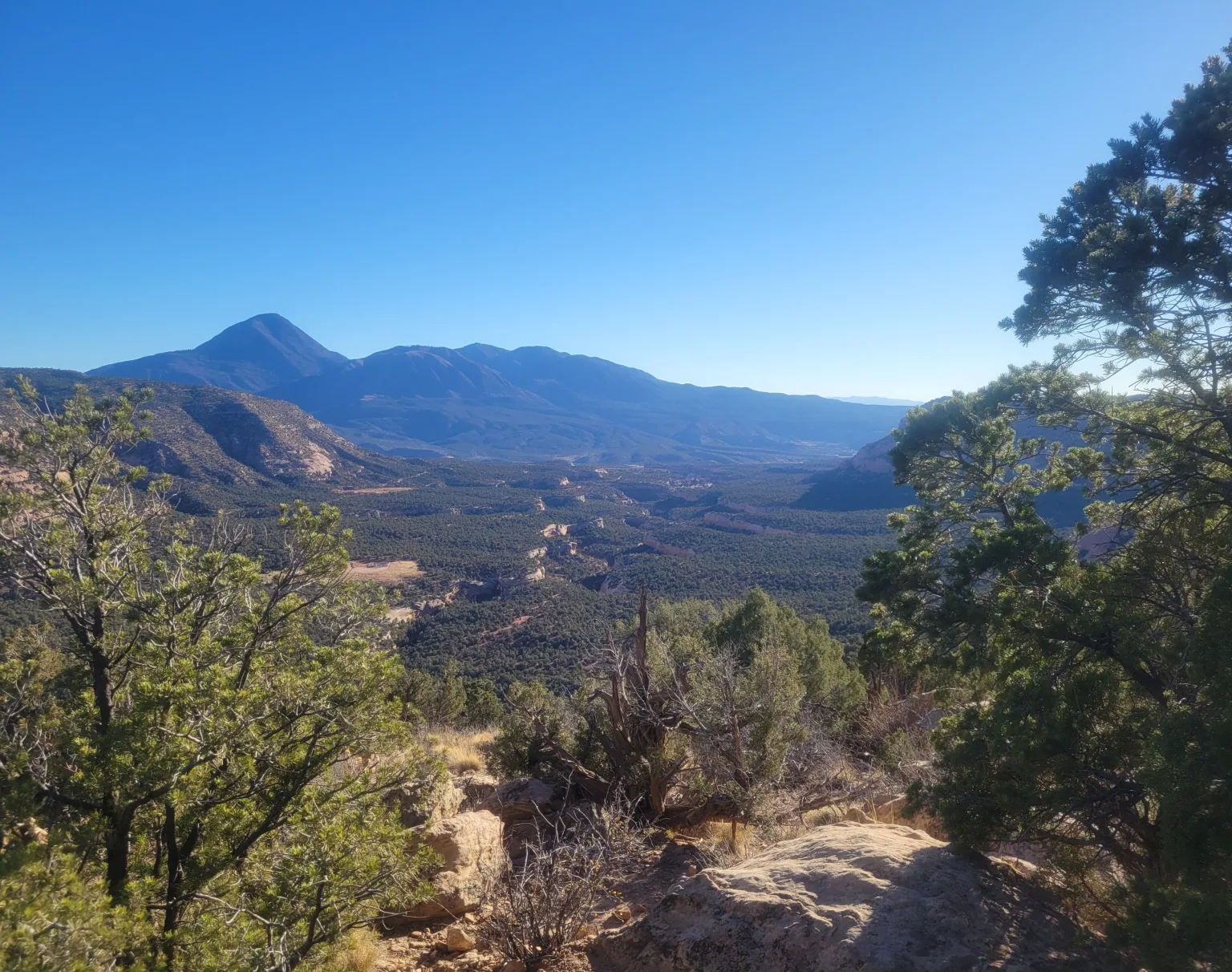
- Mesa Rim Vantage Points: Overlooks near Sand Canyon Pueblo that provide commanding views into adjacent drainages, underscoring the strategic placement of settlements in this region.

History and Legends
Sand Canyon lies within the wider cultural landscape of the Ancestral Puebloans of the Four Corners region. Long before masonry appeared along the canyon walls, early farmers and mobile families moved through this terrain, using seasonal water sources in an environment shaped by both scarcity and opportunity. Small pit house communities gradually formed along ridges and benches as agriculture expanded and regional connections strengthened.
By about 900 CE, the Mesa Verde and Canyons of the Ancients area saw the rise of more formal villages. Families built clusters of masonry rooms, created kivas for ceremony and community life, and farmed the slopes and pockets of deep soil nearby. Shaped sandstone blocks set with mud mortar formed durable walls that still cling to alcoves and ledges today.
During the late Pueblo II and Pueblo III periods, settlements became more concentrated and often more strategic. Village locations show a preference for visibility, access to farmland, and natural defensibility. Sites such as Castle Rock Pueblo and Sand Canyon Pueblo formed part of a wider network that was visually linked along canyon rims. Towers, plazas, and kivas served both ceremonial and practical functions, anchoring daily life in a landscape filled with meaning.
Castle Rock Pueblo illustrates this relationship between topography and architecture. Rooms curve around a tall sandstone pillar that provided shelter, shade, and symbolic focus. Further up the canyon, places like Saddlehorn Pueblo take advantage of broad alcoves where masonry fills natural curves to create protected living space. These choices reflect a careful reading of light, water runoff, and seasonal weather.
Experiences Around Sand Canyon Trail
The ruins are only part of the story. Pinyon-juniper mesas and sandstone canyons spread west of Cortez, with irrigated fields running through McElmo Canyon.
–
In Cortez, follow the downtown mural walk through public art shaped by local history, landscapes, and Four Corners culture.
–
The restored McElmo Creek Flume east of town preserves the last surviving section of the 104 wooden flumes that once carried irrigation water across the Montezuma Valley.
Sand Canyon Pueblo near the mesa rim represents a larger and more outward facing community. Excavations in the region reveal roomblocks arranged around plazas, kivas of different sizes, and alignments that may have carried ritual significance. Pottery and tool styles show strong links with neighboring areas, which indicates that these villages were part of a broader web of travel, exchange, and shared tradition.
By the late 1200s, the Mesa Verde region saw widespread depopulation. Shifts in rainfall, resource pressures, and social change contributed to a movement of people toward new homelands in the south and east. Over time these migrations shaped the communities that are today recognized as Pueblo peoples of the Southwest.
For many Pueblo people, the places along Sand Canyon remain part of an active ancestral landscape. Low walls, scattered sherds, and kiva depressions are viewed not as remnants, but as markers of continued presence. Visitors are encouraged to walk with care and to recognize the canyon as a corridor of memory where homes, ceremonies, and daily life once filled the spaces now quiet.
Today, Canyons of the Ancients National Monument protects thousands of sites across this region, including those along Sand Canyon. Trail markers and interpretive signs offer enough guidance to understand what is visible while allowing space for reflection. As the trail climbs from canyon bottom to mesa top, it follows a path shaped by the rise, movement, and resilience of the communities who once lived here.
How to Get There & Where to Go Next
How to Visit Sand Canyon Trail
Step-by-step access to the site
- Drive from Las Vegas Take US 95 and US 160 toward Durango then continue to Cortez. Plan for about 7 hours 45 minutes.
- Continue to McElmo Canyon From Cortez take County Road G toward the canyon. This takes about 20 minutes.
- Reach the Sand Canyon Trailhead The trailhead sits near the mouth of the canyon with clear signage. Allow 5 minutes from parking.
- Begin the hike The first visible pueblo sites appear within 15 to 25 minutes of hiking.
- Plan your turnaround Full trail length is long. Choose a reasonable segment based on time and fitness.
Tips: Summer heat builds quickly. Carry water and start early. Road G can be dark at night, so plan return timing carefully.
Nearby Ruins You Can Visit
In the sandstone canyons of the Four Corners, these nearby ancestral sites reveal the shared traditions and regional connections of the ancient Pueblo world.

Yucca House: An unexcavated village where kivas and room blocks survive as subtle mounds across the Montezuma Valley.

Hovenweep: Tower clusters and canyon overlooks reveal the defensive strategies shared across this borderland region.

Sand Canyon Pueblo: Low walls, kiva depressions, and a surrounding wall still trace this community above the canyon.

Traveler Tips
- Bring plenty of water. The trail has no reliable water sources and heats up quickly.
- Start early in the day. Morning light improves visibility and avoids peak heat.
- Wear proper footwear. Expect loose rock, sand, and uneven terrain.
- Plan your distance. The trail is long, so pick a turnaround point.
- Respect protected sites. Stay on trail and do not touch or climb structures.
- Check weather conditions. Rain can make sections muddy and harder to navigate.
Elsewhere in the Americas…
As Sand Canyon Trail winds through the cliff dwellings of the Mesa Verde region, other cultures across the Americas were shaping their own ceremonial and political landscapes:


On the Puuc Route, Uxmal continued to influence northern Yucatán through its grand palaces and ceremonial foundations.

In the Andes, the Chachapoya center of Kuélap developed massive stone walls and circular structures across a fortified mountaintop.
Insider Explorer Advice
The lower canyon offers the clearest sense of place, with signed pueblos and posted maps that guide the experience. Many visitors treat this section as a dedicated out and back walk, since the route stays moderate and the ruins appear at steady intervals.
For those who continue to the mesa, the climb is steeper but the view is worth the effort. The rim opens into wide scenery where additional sites can be found with binoculars. A simple plan, steady pace, and extra water make the full route comfortable.
Summary: Sand Canyon Trail offers a rare blend of accessible hiking, signed ancestral pueblos, and sweeping mesa views. In one route it links canyon floor to high rim, giving modern travelers a clear sense of how communities once lived, moved, and watched over this red-rock landscape.