
Caracol
BELIZE / CAYO / MAYA
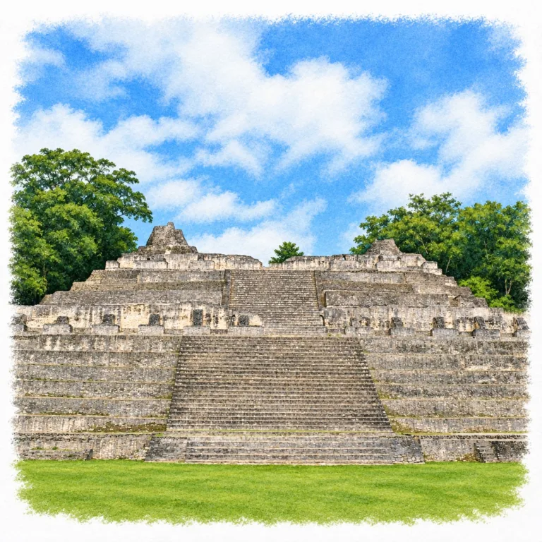
Deep in the Chiquibul forest, Caracol spreads across a vast Maya city of terraced hills and raised roads, where the temples and palaces of Caana rise above the canopy.
| Name | Caracol |
| Civilization | Maya |
| Location | Vaca Plateau, Cayo District, Belize |
| Elevation | Approximately 500 meters (1,640 feet) |
| Years Active | First millennium BCE to c. 950 CE |
| Primary Resources | Limestone, maize, timber, collected rainwater |
| Site Type | Dynastic capital and extensive agricultural city |
| Key Highlights | Caana, Temple of the Wooden Lintel, reservoirs, causeways |
| INT Airport: | Philip S. W. Goldson International Airport (BZE) |
| Entry Fee | BZ$25 non-resident; BZ$15 resident adult |
| Best Time to Visit | Dry season, roughly December to April; morning |
| Field Visit | Visited and documented by Lost Ruins of the Americas |
Unique Features of the Caracol Ruins
- Caana: A raised palace and temple complex towering 43.5 meters above its plaza.
- Terraced City: Agricultural fields extended between residential groups across the surrounding hills.
- Causeway Network: Raised roads connected the center with outlying plazas and neighborhoods.
- Household Reservoirs: Dispersed water storage sustained a city without a permanent local river.
- Tikal Rivalry: Carved records preserve Caracol’s victory over Tikal in 562 CE.
Location & Access
- Nearest Town: San Ignacio, the main visitor base in western Belize.
- Directions: Travel through Mountain Pine Ridge to the Chiquibul forest, allowing about 1.5 to 2 hours from San Ignacio before sightseeing stops.
- Site Authority: Institute of Archaeology, NICH.
- Opening Hours: From 8:00 AM daily; NICH lists last tours at 2:00 PM and departure by 3:00 PM. Confirm current cutoffs before travel.
- Entry Fees: BZ$25 (US$12.50) non-resident adult; BZ$15 (US$7.50) resident adult.
- Facilities: Visitor center, monument displays, restrooms, picnic area, trails, and parking.
- Accessibility: Uneven forest paths and substantial stair climbs; the main temple terraces are unsuitable for wheelchair access.
- Pro Tip: Confirm road conditions and any checkpoint instructions with the guide or NICH before leaving San Ignacio.
Highlights to Help Understand Your Visit
Caracol becomes easier to understand when the plazas are read alongside the land that supported them.
- Public Space and Restricted Space: Broad plazas lead toward narrower stairs and elevated courts. That change in access separates places for large gatherings from the residences and temples above.
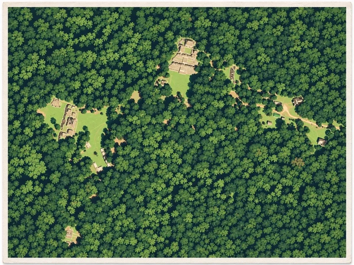
- A Working Landscape: The forest covers former houses and agricultural terraces as well as temples. The ancient city extended through cultivated ground far beyond the cleared visitor circuit.
- Water Between Buildings: Reservoir depressions belong to the urban plan. Stored rainfall supplied both monumental precincts and households across a plateau without a permanent river through its center.
- Roads Beyond the Plazas: Raised causeways carried movement out toward other architectural groups. Their branching routes help explain how a dispersed settlement functioned as one city.
- Color Over Stone: Surviving and replicated stucco details recall buildings once finished in plaster and paint. The exposed limestone is only part of their original appearance.
Key Structures of Caracol
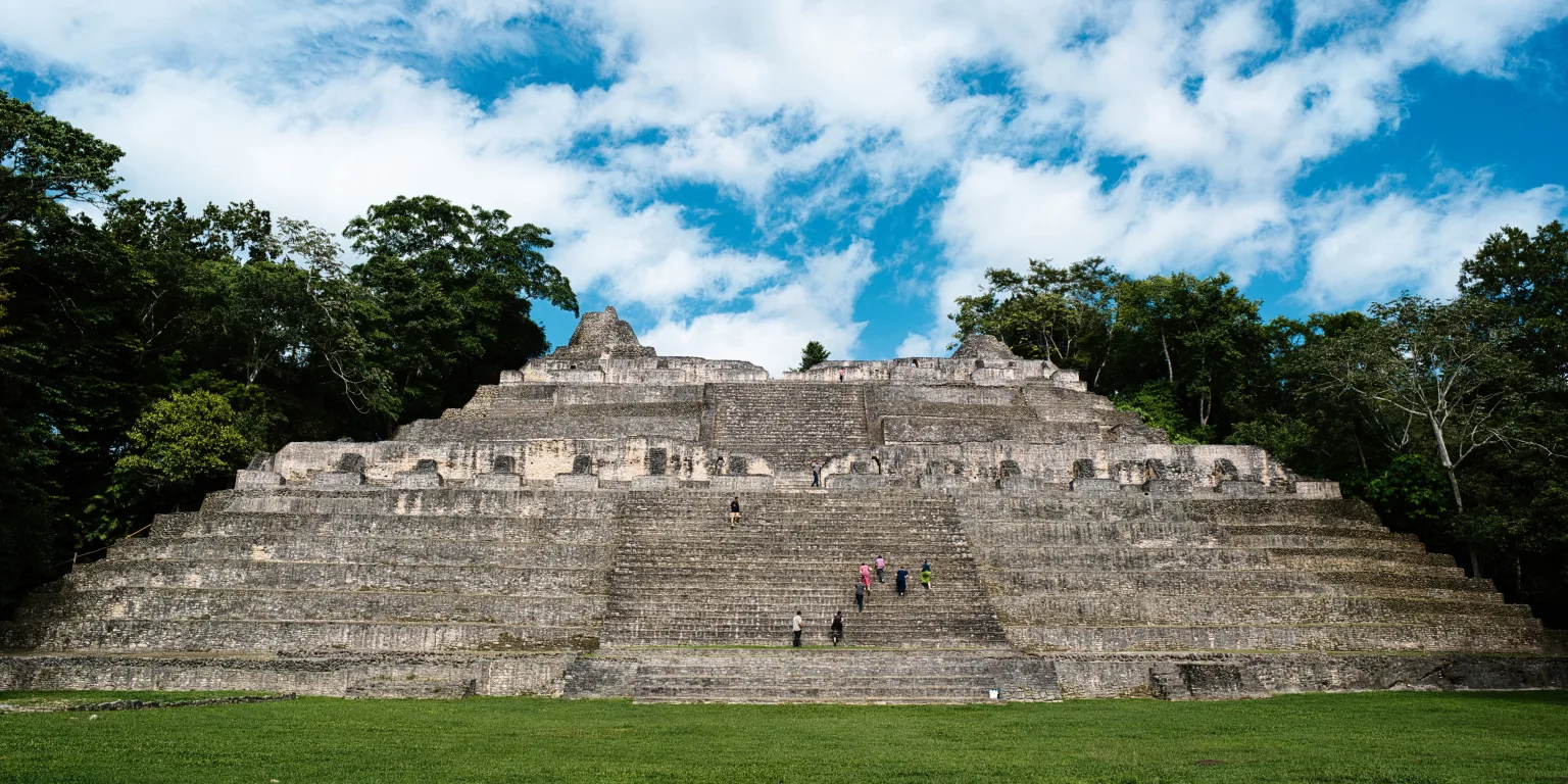
- Caana: The largest complex rises about 43.5 meters above the B Group plaza. Palace compounds and three summit temples, Structures B18, B19, and B20, share the elevated platform.
- Structure B19: The northern temple on Caana contains successive construction phases and elite burials, including a painted tomb dated to 634 CE. Its position anchors the summit court.
- Temple of the Wooden Lintel, Structure A6: The central temple on the A Group’s eastern platform takes its name from a surviving timber doorway lintel. Earlier versions contained carefully placed jadeite and shell offerings.
- Structure A2: This approximately 25-meter pyramid stands opposite the eastern platform in the A Group. It forms the western component of the ceremonial arrangement known as an E Group.
- Structure B5: Across the plaza from Caana, this temple preserves a program of large stucco masks. Replicas protect the original decoration while showing its sculptural detail to visitors.
- South Acropolis: A raised complex beside the main reservoir combines formal courts with residential areas. Structures D16, D17, and D18 occupy the platform along the main plaza’s southern side.
- Ballcourt and Altar 21: A carved marker recovered from a central ballcourt preserves the account of the 562 CE victory over Tikal, linking public architecture with royal political history.
- Main Reservoir: The large basin near the South Acropolis formed part of a much wider storage system. Smaller reservoirs were distributed among residential groups throughout the city.
History and Legends
Without a permanent river, the Maya inhabitants of Caracol depended on rainfall collected across the Vaca Plateau. Settlement began during the first millennium BCE, with limestone hills supplying building stone and ground for cultivation. Residents developed reservoirs and gradually terraced the slopes to retain agricultural soil. By the Late Preclassic period, monumental construction included early versions of the Temple of the Wooden Lintel. Builders sealed jadeite and shell offerings beneath its architecture, establishing a ceremonial center that successive generations would enlarge.
Caracol’s royal dynasty traced its beginning to Te K’ab Chaak, who took power in 331 CE. A tomb in the Northeast Acropolis, identified by its excavators as his burial, held jadeite ornaments, a mosaic mask, carved bone, pottery, and shells brought from the Pacific. Nearby burials from around the same period included objects and practices associated with Teotihuacan in central Mexico. These connections reached Caracol before the famous Teotihuacan-linked arrival recorded at Tikal in 378. The early court already belonged to a world of long-distance exchange and contact, with foreign materials entering the burial places of its ruling families.
The balance of power changed sharply in 562 CE, when Caracol defeated Tikal. The event survives in the inscription on Altar 21, a stone marker recovered from a ballcourt. During the following century, K’an II continued an aggressive regional policy, and Caracol conquered Naranjo in 631. These victories coincided with substantial growth at home. New construction, expanding residential groups, and an increasingly extensive causeway system drew formerly separate parts of the landscape into the city. By about 650, the wider urban population is estimated to have exceeded 100,000 people, spread across houses, fields, reservoirs, and neighborhood centers far beyond the royal plazas.
Supporting that population required work across the whole plateau. Farmers built stone retaining walls to hold soil on slopes, while households maintained nearby water storage. Raised causeways connected the center with outlying plazas where exchange and public activities could take place. Excavated residential groups contain tombs, ritual offerings, and imported goods, showing that access to valued objects and formal burial extended beyond the largest palaces. Caracol’s prosperity depended on this broad network of households and cultivated land as well as on the military achievements carved into royal monuments.
Above the central plazas, Caana brought the ruling household, temples, and ancestral burials together on one immense platform. Its form changed through repeated rebuilding. A woman’s painted tomb beneath Structure B19 was closed in 634 CE, and later builders raised the summit plaza, burying parts of earlier architecture within the enlarged complex. Naranjo broke away from Caracol’s control in 680, but the city continued to build and its rulers continued to record military captures into the ninth century. The surviving palaces therefore belong to a long sequence of adaptation, including major work after the era of Caracol’s greatest regional expansion.
Royal monument-making continued until at least 883 CE, the last recorded date on a Caracol altar. Around the end of the ninth century, buildings in the center burned and rooms were left with vessels and other belongings on their floors. Warfare, disruption of exchange, and growing social strain appear to have contributed to the breakdown, although the final events cannot be reduced to one cause. Some households and ceremonial activity continued after the central palaces ceased functioning, with use of parts of the site lasting into the tenth century. The city emptied unevenly: the royal courts fell out of use before the last residents left the surrounding settlement.
Experiences Around Caracol
The ruins are only part of the story. Broadleaf forest around Caracol gives way to the pine ridges, granite outcrops, and streams of Mountain Pine Ridge on the journey toward San Ignacio.
–
At Rio On Pools, river water runs over granite ledges into a series of natural swimming pools, a useful return-route stop when water levels allow.
–
In San Antonio village, visits arranged with the Women’s Co-op combine pottery demonstrations with corn grinding and tortilla making, led by local Maya women sharing their craft and food traditions.
How to Get There & Where to Go Next
How to Visit Caracol
From Philip S. W. Goldson International Airport (BZE):
- BZE to San Ignacio: Take a prearranged shuttle or private transfer west, approximately 2 hours.
- San Ignacio to Caracol: Join a guided day trip or arrange a driver through Mountain Pine Ridge, roughly 2 hours each way.
Tip: Arrange return transport from San Ignacio; Caracol is a full-day outing.
Nearby Ruins You Can Visit
Xunantunich and Cahal Pech suit separate outings from San Ignacio. Tikal extends the journey across the border into Guatemala.

Xunantunich – Above the Mopan River, El Castillo rises over a hilltop Maya center, with monumental stucco friezes and broad views across western Belize.

Traveler Tips
- Caana stairs: Shoes with grip help on the steep limestone steps, especially after rain.
- Unrestored buildings: Many structures remain beneath vegetation; a guide helps make sense of the wider city.
- Heat: Carry water and sun protection for the open plazas and the climb up Caana.
- Swimming stop: Pack a swimsuit and towel if the return trip includes a stop at the pools.
Elsewhere in the Americas
During Caracol’s sixth- and seventh-century expansion, South American societies were building coastal temples and powerful highland capitals.

On Peru’s north coast, the Moche used Huaca de la Luna for ceremonies beneath painted reliefs, repeatedly rebuilding its adobe platforms beside the desert slopes of Cerro Blanco.

Near Lake Titicaca, Tiwanaku anchored the civilization of the same name, with monumental stone courts and carved figures expressing the authority of a growing southern Andean capital.
Insider Explorer Advice
Caracol works well as a shared day out from San Ignacio, with the same small group staying together through the forest drive, the ruins, and the return journey. A guide is particularly useful here because so much of the city remains beneath the jungle; a low mound can otherwise be easy to dismiss as part of the hillside. Leaving enough time for Caana gives the visit a clear high point, with the climb revealing the scale of the central complex above the surrounding canopy. A swim on the way back changes the pace after the heat and walking, provided it has been arranged without shortening the time at the ruins.
Summary: Caracol spreads far beyond Caana, across a forested landscape once worked into a city of homes, fields, reservoirs, and raised roads.