
Nazca Lines
PERU / NAZCA / NAZCA
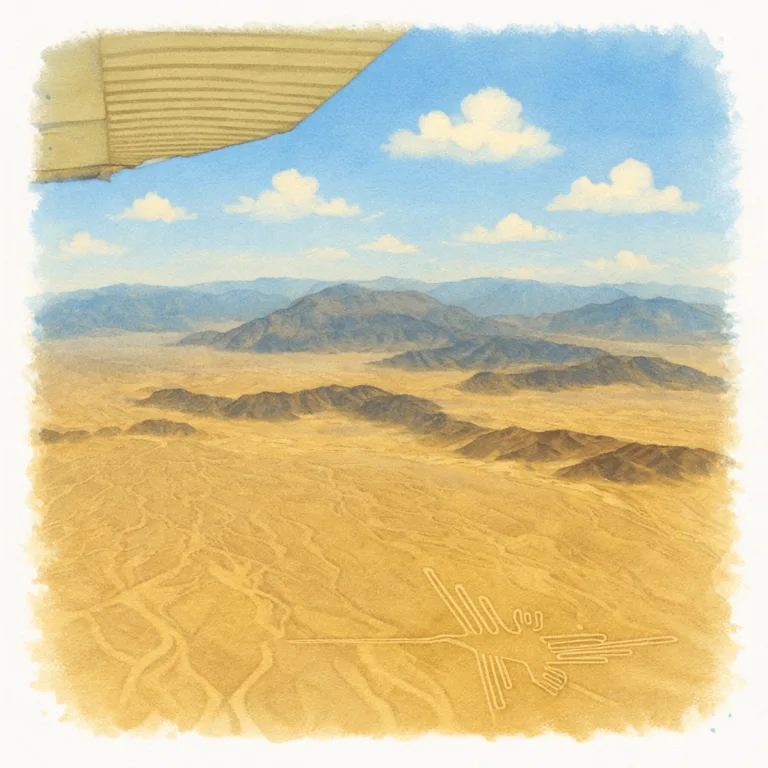
Across a vast desert plain in southern Peru, the Nazca Lines stretch into giant ground drawings, where long straight lines and geometric figures extend across the landscape in a continuous surface design.
| Name | Nazca Lines |
| Civilization | Nazca |
| Location | Nasca Desert, Peru |
| Years Active | c. 100 BCE – 800 CE |
| Primary Resources | Geoglyphic surface engineering |
| Site Type | Desert geoglyph complex |
| Key Highlights | Monkey, Hummingbird, Astronaut, Trapezoids |
| UNESCO | Lines and Geoglyphs of Nasca and Palpa |
| Entry Fee | Varies (flight tours ~$60–100 USD) |
| Best Time to Visit | April to October (dry season) |
Unique Features of the Nazca Lines
- Scale: Geoglyphs span over 450 square kilometers, some figures over 100 meters long
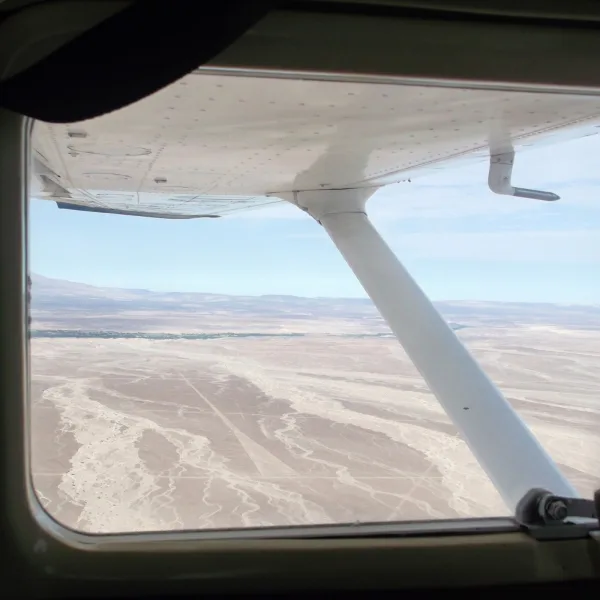
- Viewability: Designed to be seen from above, aircraft tours provide the full visual impact
- Symbolism: Representations of animals, plants, humans, and geometric designs tied to cosmology and ritual
- Construction Method: Created by scraping away dark surface stones to reveal lighter soil beneath
- Preservation: Arid desert climate and windless plains have kept the lines remarkably intact
Location & Access
- Nearest Town: Nazca, Peru
- Directions: 6-hour bus or private transfer from Lima; regional flights also available to nearby cities
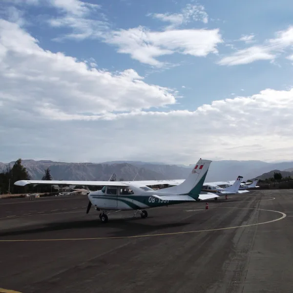
- Airport Tours: Departures from Nazca city airstrip; standard flights last 30–45 minutes
- Fees: Flight tours range from $60–100 USD depending on provider
- Facilities: On-site observation tower, small museum, airport terminal with restrooms
- Accessibility: Requires boarding small aircraft; alternative ground tower view available
- Tips: Book morning flights for best light and calm air; bring motion sickness meds if sensitive

Highlights to Help Understand Your Visit
These insights will help you see beyond the surface, not just lines in the sand, but a sacred landscape shaped by vision, ritual, and time.
- Built to Be Seen from Above: The scale and proportion only make sense from the air, meaning the builders understood viewpoints that no one at ground level could fully experience.
- Symbols with Power: Many geoglyphs represent animals tied to fertility, water, or spiritual realms, not just decoration, but sacred communication etched into the earth.
- Paths, Not Pictures: Some lines form long straight routes, walked ceremonially, suggesting movement itself was part of the message, not just the image.
- Placed in a Harsh, Silent World: The extreme dryness preserved the lines, but it also made survival difficult. This was a place of pilgrimage, not daily life.
- Not a Lonely Site: While the lines sprawl across desert plains, nearby ceremonial centers like Cahuachi hint at gatherings, rituals, and shared beliefs that gave these lines meaning.
Key Structures of the Nazca Lines
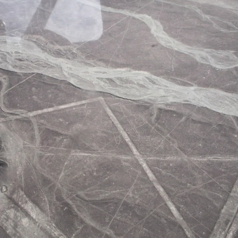
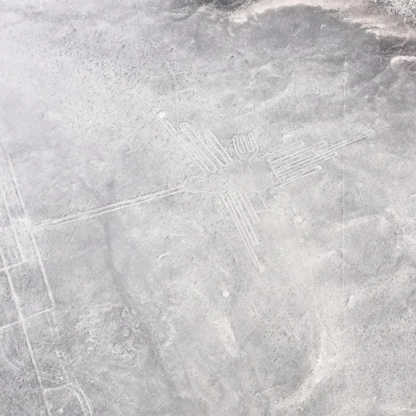
- Hummingbird: A precise, iconic figure with straight lines and symmetry, one of the most photographed geoglyphs.
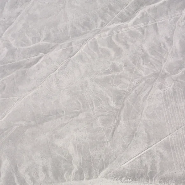
- Monkey: Features a coiled spiral tail and stylized limbs, possibly linked to Amazonian iconography or fertility symbols.
- Spider: A narrow, elongated design believed to symbolize water or rainfall, positioned near ritual pathways.
- Condor: A wide-winged geoglyph associated with Andean cosmology and sky deities, visible only from the air.
- Astronaut: A humanoid figure carved on a hillside, often debated, possibly a deity or sky-watcher symbol.
- Straight Lines and Trapezoids: Hundreds of geometric forms crisscross the desert, some stretching over 10 kilometers, believed to guide ceremonial walking or align with water sources..
How to Visit Nazca Lines
Step-by-step access to the site
- Depart Lima – Take a bus to Nazca (8–9 hrs)
- Reach town center – Buses arrive walkable to hotels
- Head to airfield – Short taxi ride (5–10 min)
- Take flight – 30–40 min loop over geoglyphs
- Optional: view tower – Roadside platform (20 min by taxi)
Tips: Flights run daily; mornings have less turbulence and clearer skies.
Nearby Ruins You Can Visit
The Nazca Desert holds more than geoglyphs, nearby ruins reveal how the builders of the lines lived, worshipped, and governed.
- Los Paredones – An Inca administrative hub with coastal stonework and ceremonial flair — built long after the lines but overlooking their legacy.
- Cahuachi – A sprawling ceremonial center of adobe temples — the heart of Nazca ritual life during the height of line creation.
- Pachacamac – A massive pilgrimage site near Lima where coastal and highland cultures converged — echoing the spiritual purpose of the lines.
History and Legends of the Nazca Lines
The Nazca Lines are one of the most enigmatic archaeological phenomena in the Americas. Created by the Nazca culture between roughly 100 BCE and 800 CE, these vast desert etchings stretch across the Pampa Colorada, a flat, arid plateau between the Andes and the Pacific.
Unlike most ancient sites, Nazca’s ruins are subtractive, not built with stone or wood, but made by removing surface rock to reveal lighter sediment below. The result is a sprawling map of shapes only fully visible from the sky: birds, beasts, spirals, and geometric corridors that seem to stretch endlessly across the earth. The largest figures span the length of football fields. Hundreds of smaller lines and trapezoids crisscross the plain, suggesting ritual pathways or celestial alignments.
The Nazca were not the first to work the desert, earlier societies such as the Paracas had already begun using the coastal landscape for symbolic and ritual expression, laying the cultural groundwork that the Nazca would later expand and transform.
Following Nazca’s decline, the region came under the influence of the Wari Empire, whose highland capital at Huari expanded into coastal zones through a vast network of roads and settlements. While the Wari did not continue the geoglyph tradition, their presence marked a shift toward centralized political control in the region. Centuries later, the Inca established the nearby site of Los Paredones, using the Nazca Valley as part of their administrative system along the southern coast.
Experiences Around Nazca Lines
The lines are only part of the story. Arid coastal plains stretch around Nazca, with irrigated valleys cutting green corridors through the desert.
–
Cerro Blanco rises east of the city, a massive sand dune where trekking and sandboarding open views across the surrounding desert.
–
Farther toward the coast, San Fernando National Reserve brings guanacos, sea lions, Humboldt penguins, and Andean condors together where desert cliffs meet the Pacific.
The purpose of the lines remains debated. Some scholars link them to water worship, an essential theme in desert life. Others see them as astronomical markers, forming a massive calendrical system. Still others suggest they were walked during ritual pilgrimages, each figure holding symbolic meaning for fertility, agriculture, or cosmology. No consensus has been reached, but most agree the lines were sacred expressions meant for divine, not human, eyes.
Rediscovered by modern pilots in the 1920s and studied extensively in the decades since, the lines continue to reveal new secrets. The use of drone surveys and satellite imaging has uncovered previously unknown figures, some of which date earlier than previously believed. Despite weathering thousands of years, the lines remain vulnerable, threatened by development, foot traffic, and environmental shifts. Peru’s government, along with international archaeologists, has worked to preserve their integrity while allowing controlled access.
To witness the Nazca Lines is to confront the abstract genius of a culture that measured meaning in miles, not meters, that shaped silence into signal, and turned desert into message.
Traveler Tips
- Flights are in small aircraft: Expect tight quarters and sharp banking turns
- Best visibility is mid-morning: Haze increases by afternoon
- Motion sickness pills: Recommended for sensitive travelers
- Allow extra time for flight schedules: Weather delays are common
- Free-standing observation tower: For a limited ground view
Elsewhere in the Americas…
While the Nazca people etched messages into the desert, civilizations to the north were rising in ritual complexity and monumental design:

The Zapotec capital of Monte Albán dominated the Oaxaca Valley with its tiered temples, elite tombs, and early writing system.

Teotihuacan emerged as one of the world’s largest cities, its massive pyramids aligned to cosmic principles and connected to distant regions by trade.

Insider Explorer Advice
Nazca is different. The town itself is welcoming and used to a steady stream of visitors. After getting dropped off at the airport, the experience is out of your hands, the pilot is in charge. And that’s part of it. The Nazca Lines are not Zapotec or Maya ruins you walk through. They’re ruins you ascend above. As you peer down from the windows of the aircraft, what once seemed like flat desert reveals astonishing scale and form. It’s not temples or tombs, but it’s no less sacred, a message for the sky itself. It’s a reminder of what humans can accomplish when they think far beyond the visible ground.
Summary: The Nazca Lines transform the desert into a message, their meaning may be lost, but their impact is eternal.