
El Meco
MEXICO / QUINTANA ROO / MAYA
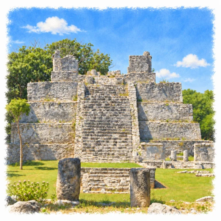
On the Caribbean shore north of Cancún, El Meco rises around a substantial temple pyramid, where serpent sculptures and columned halls mark a Maya port facing Isla Mujeres.
| Name | El Meco |
| Civilization | Maya |
| Location | North of Cancún, Quintana Roo, Mexico |
| Elevation | Near sea level |
| Years Active | Classic period to c. 1500 CE, with an occupation gap; renewed growth from c. 1000 CE |
| Primary Resources | Fishing, marine resources, and coastal trade |
| Site Type | Port settlement and civic-ceremonial center |
| Key Highlights | El Castillo, serpent sculptures, columned halls |
| INT Airport | Cancún International Airport (CUN) |
| Entry Fee | MX$80 Mexican visitors and residents; MX$145 foreign visitors |
| Best Time to Visit | Early morning, before the exposed plaza becomes hot |
| Field Visit | Visited and documented by Lost Ruins of the Americas |
Unique Features of the El Meco Archaeological Site
- El Castillo: A 12.5-meter pyramid dominates the compact ceremonial center.
- Serpent staircase: Sculpted heads frame the approach to the principal temple.
- Island orientation: The pyramid faces the sea and southern Isla Mujeres.
- Columned public halls: Open buildings surround the main plaza.
- Rear gathering space: Structure 12 preserves a long interior bench behind El Castillo.
Location & Access
- Nearest Town: Cancún, near Puerto Juárez.
- Directions: Km 2.7 on the Puerto Juárez-Punta Sam road, north of central Cancún.
- Official Website: INAH Zona Arqueológica de El Meco
- Opening Hours: Daily, 8:00 AM to 4:30 PM; last entry at 4:00 PM.
- Entry Fees: MX$80 Mexican visitors and residents; MX$145 foreign visitors;.
- Facilities: Parking, toilets, interpretation room, marked paths, rest areas, and a shop.
- Accessibility: A compact walking circuit with uneven ground around the monuments
- Pro Tip: Allow about an hour for the ruins and interpretation room.
Highlights to Help Understand Your Visit
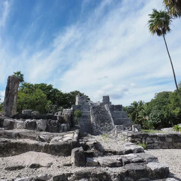
El Meco’s small public core becomes more revealing when the pyramid is read together with its plaza and coastal position.
- Compare the building heights: El Castillo rises well above the low halls around it. That contrast gives the temple a commanding position within a modest area.
- Face the island: The pyramid’s main facade points toward the sea and southern Isla Mujeres, placing the offshore destination within the ceremonial plan.
- Reconstruct the covered rooms: The columns once carried flat roofs. The open ruins preserve the outlines of substantial public interiors.
- Read the plaza as shared space: Small shrines and larger halls surround an open gathering area, linking ceremony with the business of a coastal community.
Key Structures of El Meco
- El Castillo, Structure 1: A pyramid about 12.5 meters high, with four main tiers and a smaller upper platform supporting a two-room temple. Two columns divide its front into three entrances.
- Serpent Staircase: The frontal stairway ends in carved serpent heads at the base of its sidewalls, recalling the larger staircase sculptures at Chichén Itzá.
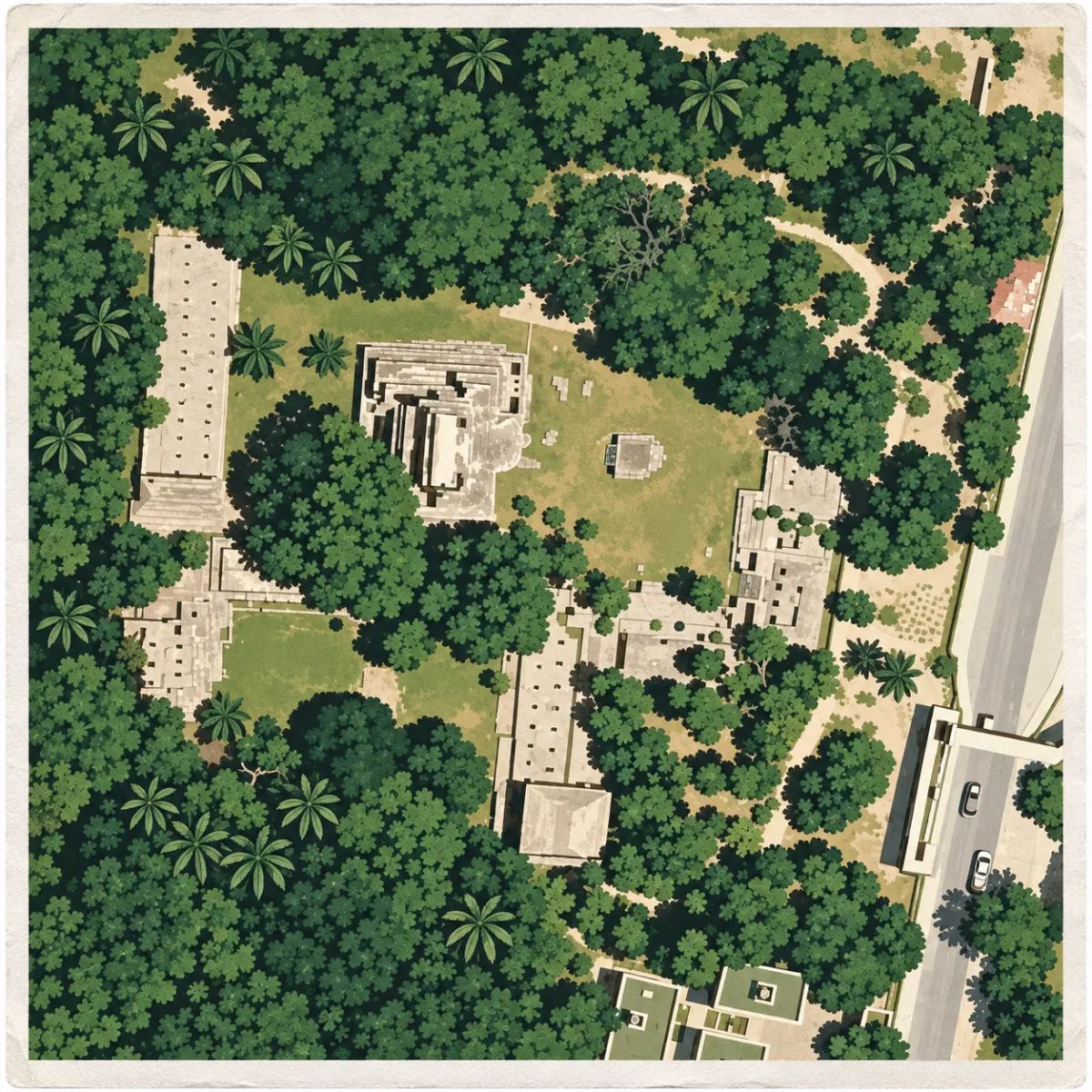
- Plaza A: The main public court lies before El Castillo, with a small central shrine and surrounding buildings used for ceremonies and other communal activities.
- Structures 4, 5, and 8: Columned halls around Plaza A. Their broad interiors and flat-roofed design suggest administrative or public functions.
- Structures 3, 6, and 7: Smaller buildings bordering the main plaza, interpreted as shrines or rooms for objects used in public ceremonies.
- Plaza C and Structure 12: Behind El Castillo, a second court contains three buildings. Structure 12 is a large columned hall with a long bench running beside its rear wall.
History and Legends
El Meco’s history includes an abandonment and a return. An early Maya fishing settlement, possibly occupied from the third century CE, fell out of use before people resettled the shore around the eleventh century. Facing Isla Mujeres, the later town grew beside the crossing between the mainland and the island. Most of the surviving public architecture belongs to this renewed occupation, when El Meco became increasingly involved in the coastal networks of northeastern Yucatán.
As maritime exchange expanded, El Meco developed into a port with a substantial public center. Boats could move along the mainland coast or cross toward the island, and the settlement likely helped organize that traffic. Isla Mujeres was also a religious destination during the Late Postclassic, giving the crossing significance beyond the movement of goods. Trade and pilgrimage may have reinforced one another here. The sea supplied food as well as connections, and studies of human remains indicate comparatively good health among El Meco’s inhabitants relative to some neighboring coastal populations.
The growing community raised El Castillo above its principal plaza. An earlier pyramid survives within the later building, showing that the monument took shape through successive construction phases. Its four main tiers carry a smaller platform and a two-room temple, approached by a stairway with carved serpent heads. The facade faces east toward the sea and the southern end of Isla Mujeres. That orientation suggests a relationship between the mainland temple and the island’s ceremonial landscape, although the precise rituals connecting them are not known.
Experiences Around El Meco
The ruins are only part of the story. Puerto Juárez faces the sheltered crossing to Isla Mujeres, with fishing boats, ferry traffic, and low waterfront restaurants along the mainland shore.
–
Around Puerto Juárez, stop for pescado tikin xic, fish seasoned with achiote and sour orange, or ceviche at one of the seafood restaurants near the ferry docks.
–
Across the water on Isla Mujeres, walk from the town center to the Malecón Oriente, where the promenade faces the open Caribbean beyond the busy ferry waterfront.
Around the pyramid, public life occupied buildings at a much lower level. The columned halls beside Plaza A provided covered spaces where officials may have received people or managed communal affairs. Smaller neighboring rooms served as shrines or storage for ceremonial objects. Behind El Castillo, Structure 12 opened onto another court, with a long bench lining its rear wall. Together, the courts and halls reveal the organization behind the port: a place where movement across the water was supported by gatherings, administration, and ceremony on land.
El Meco’s final Maya occupation reached the opening of the sixteenth century. The settlement was abandoned in the era of Spanish arrival, when the coastal network that had supported its prosperity was being disrupted. Its end belongs to this later transformation of the Caribbean coast, rather than the much earlier decline of the Classic-period cities inland. The temple and public halls ceased to serve an active port community, but their arrangement still preserves its close relationship with the island across the bay.
How to Get There & Where to Go Next
How to Visit El Meco
From Cancún International Airport:
- Airport to north Cancún: Take an authorized taxi or prebooked transfer toward Puerto Juárez.
- Continue toward Punta Sam: Follow the coastal road to El Meco at Km 2.7; allow roughly 35-50 minutes from the airport, depending on traffic.
- Enter at the visitor center: Follow the signed pedestrian route from the ticket office to the archaeological circuit.
Tip: El Meco is on the mainland; no ferry crossing is needed.
Nearby Ruins You Can Visit
San Miguelito and El Rey extend the coastal Maya story within Cancún; Chichén Itzá offers a longer inland trip to a much larger ceremonial center.

San Miguelito – A forest path behind the Maya Museum links Palacio Chaak, household platforms, and a temple pyramid within Cancún’s modern Hotel Zone.
Chichén Itzá – Farther inland, serpent sculptures, broad colonnades, and monumental temples surround the much larger pyramid also called El Castillo.

El Rey – In the southern Hotel Zone, a straight causeway passes small plazas, columned halls, and a temple pyramid within another Maya coastal settlement.
Traveler Tips
- Open central plaza: Trees shade parts of the circuit, but the main view of El Castillo is exposed to the sun.
- Smaller buildings: Leave time for the columned halls and rear court after viewing the pyramid.
- Monument access: Follow barriers around the structures; the temple should be appreciated from the permitted visitor route.
Elsewhere in the Americas
While El Meco grew as a coastal port, other American societies were shaping settlements around mountain slopes, cliff alcoves, and highland ceremonial centers.

In Colombia’s Sierra Nevada, the Tairona developed Ciudad Perdida across steep forested slopes, joining circular house platforms and broad terraces with drainage channels.

Beneath Colorado’s sandstone cliffs, Ancestral Puebloan families built Mesa Verde‘s cliff dwellings, fitting clusters of stone rooms and ceremonial kivas into sheltered alcoves.

Insider Explorer Advice
El Castillo gives El Meco more presence than the size of the visitor circuit suggests. Begin with the view across the main plaza, where the low surrounding buildings make the pyramid’s height easier to appreciate, then follow the smaller halls around it. The site fits comfortably into a day based in Cancún, but its coastal setting deserves some thought before leaving. Knowing that boats once connected this community with Isla Mujeres changes the reading of the place, as the compact ruins belonged to a network extending well beyond the cleared ground around the temple.
Summary: El Meco preserves the temple and public courts of a Maya port whose position opposite Isla Mujeres connected coastal trade with island ceremony.