
Teotenango
MEXICO / STATE OF MEXICO / MATLATZINCA
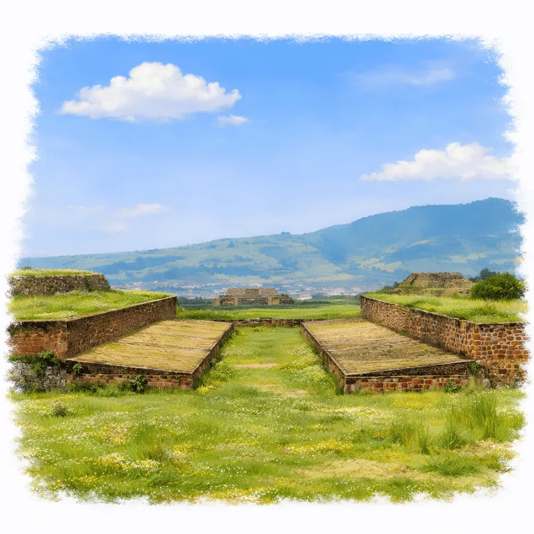
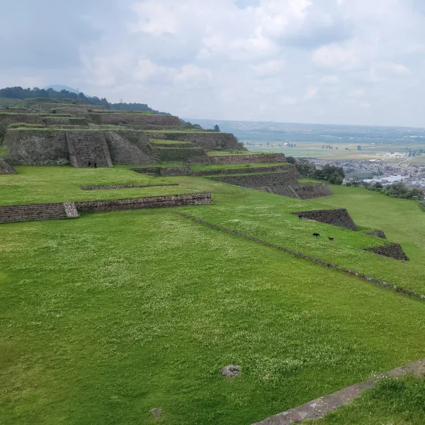
Atop a broad plateau overlooking the Toluca Valley, Teotenango organizes a walled hilltop city, where Matlatzinca terraces, plazas, and gates control access along a single fortified approach.
| Name | Teotenango |
| Civilization | Teotenanca, Matlatzinca, Aztec (Mexica) |
| Location | Tenango del Valle, State of Mexico, Mexico |
| Elevation | 2,700 meters (8,858 feet) above sea level |
| Years Active | c. 250 to 1550 CE |
| Primary Resources | Basaltic andesite, maize, ceramics, regional agricultural goods |
| Site Type | Fortified civic-ceremonial center and military stronghold |
| Key Highlights | Plaza del Jaguar, ballcourt, Serpent Structure, defensive walls, site museum |
| Entry Fee | Free admission to the archaeological zone |
| Best Time to Visit | Clear afternoons for views; early morning for shade |
| Field Visit | Visited & photographed by Lost Ruins of the Americas |
Unique Features of the Teotenango Archaeological Site
- Hilltop Fortifications: Defensive walls and stone platforms encircle the site, offering clear evidence of Teotenango’s strategic role.
- Valley Vantage: Panoramic views of the Toluca Valley provide both visual splendor and tactical insight into its placement.
- Integrated Terracing: Ancient agricultural terraces remain active in parts, seamlessly blending history with local life.
- Open Layout: Unlike many ceremonial cities, Teotenango features wide plazas and open platforms with minimal modern reconstruction.
Location & Access
- Nearest Town: Tenango del Valle
- Directions: From CDMX, take a bus from Observatorio to Tenango. From Tenango center, walk 30 minutes uphill to the site.
- Official Website: INAH, Zona Arqueológica de Teotenango.
- Opening Hours: Tuesday to Sunday, 9:00 to 5:00. Museum Tuesday to Saturday from 9:00 to 5:00 and Sunday from 10:00 to 3:00
- Entry Fees: The archaeological zone as free. The state museum page lists a small separate charge, so carrying cash is advisable.
- Facilities: Museum at base, restrooms, limited signage
- Accessibility: Challenging. A steep climb with stone paths; not wheelchair accessible
- Pro Tip: Begin with the museum before climbing to the ruins. Its displays clarify Teotenango’s changing Teotenanca, Matlatzinca, and Mexica occupation phases.
Highlights to Help Understand Your Visit
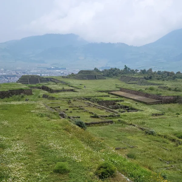
Teotenango isn’t just a ruin on a hill, it’s a layered system of movement, vision, and control. These highlights will help tune your eye before you explore the site.
- Engineered Elevation: The steep climb isn’t just scenic. It was designed to exhaust and impress. Every stair reinforces status.
- Panoramas as Power: Lookouts weren’t just for defense. The valley below was a stage. Teotenango’s placement made its presence inescapable.
- Wide Plazas, Tight Entrances: Movement was channeled. Open spaces contrast with narrow corridors. Rituals and access were carefully staged.
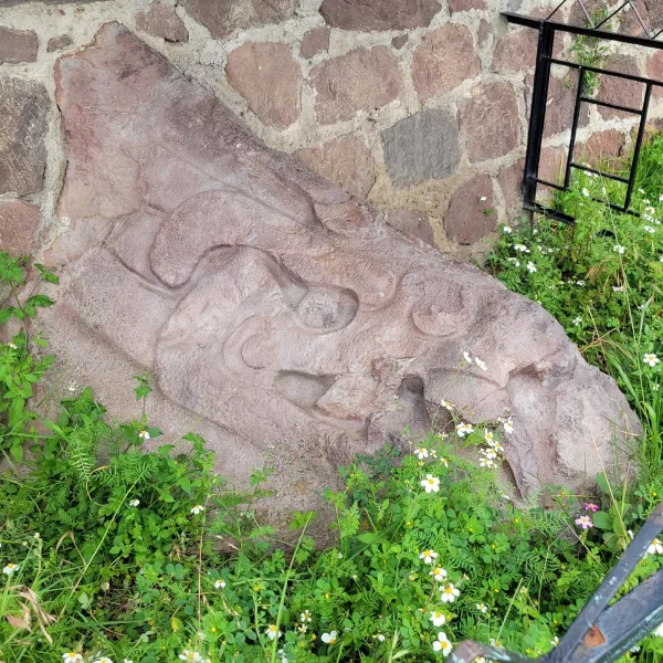
- Stone with Memory: The serpent carving wasn’t decorative. It was a marker. Thresholds here had meaning, even if the structures are gone.
- Active Terraces: Parts of the surrounding hillside are still cultivated. These terraces link modern hands to ancient engineering.

Key Structures of the Teotenango Ruins
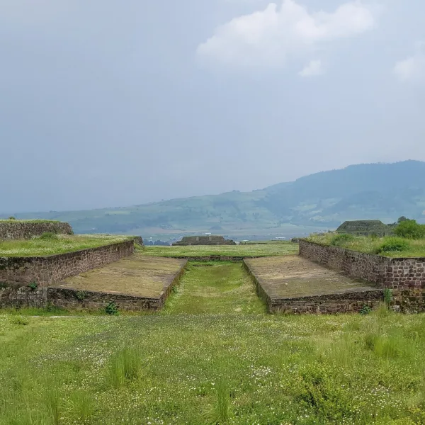
- Main Ballcourt: One of Teotenango’s most intact features, this ballcourt is aligned with celestial events and was likely used for ceremonial and political games tied to cosmology and social hierarchy.
- Plaza Principal: The central sunken plaza is surrounded by stepped platforms and open spaces that once hosted rituals, gatherings, and elite displays of power. Its shape and layout speak to controlled movement and spectacle.
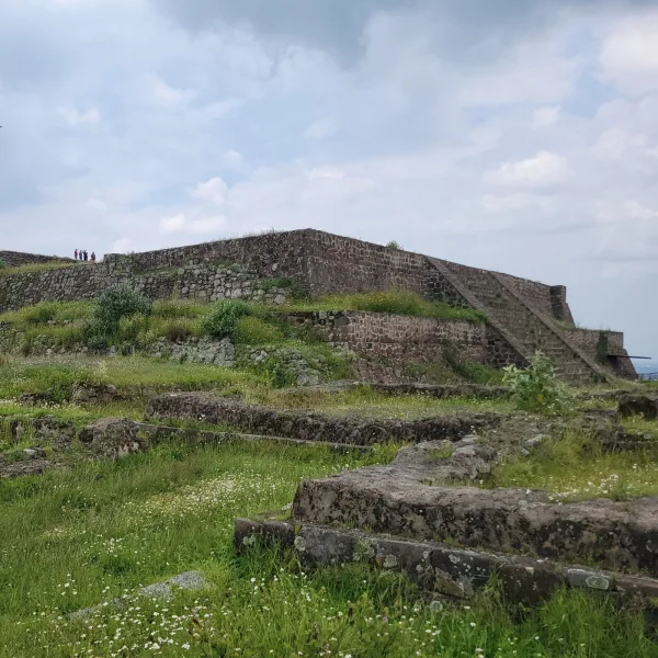
- Pyramid Platform: A large, terraced base that once supported a ceremonial temple. While the upper structure is gone, the foundation reflects religious symbolism and planning aligned with sacred geography.
- Residential Platforms: Elevated foundations where elite families or administrators lived. Their scale and arrangement suggest a stratified community with clear social zoning.
- Sunken Causeway: A broad descending stone path that served as a ceremonial entry route. The causeway’s orientation and slope guide the visitor from lower terraces into the civic-ritual heart of the city.
- Fortification Walls: Massive perimeter walls built of stacked stone form a clear defensive boundary. These structures highlight Teotenango’s strategic position and constant readiness for conflict with rival highland powers.
- Drainage Channels: Carefully engineered stone-lined channels direct rainwater through the sloped terrain. These features show advanced planning and the adaptation of urban design to steep, elevated ground.
- Steps of the Gods: A steep ceremonial stairway linking key terrace levels. This feature may have been used for processions and ritual ascents toward temple structures, reinforcing vertical hierarchy.
- Carved Serpent Head: Positioned at the base of a prominent stairway, this large stone carving served as a visual guardian and ritual threshold. Its presence suggests a blend of cosmological symbolism and political control.
- Small Altars: Scattered throughout the site, these low circular and rectangular stone platforms may have been used for offerings, minor ceremonies, or ancestral veneration tied to specific terraces.
- Observation Points: Multiple corners of the site offer panoramic viewpoints across the surrounding region. These were both practical, for surveillance, and symbolic, framing Teotenango as a dominant presence in the highlands.
History and Legends
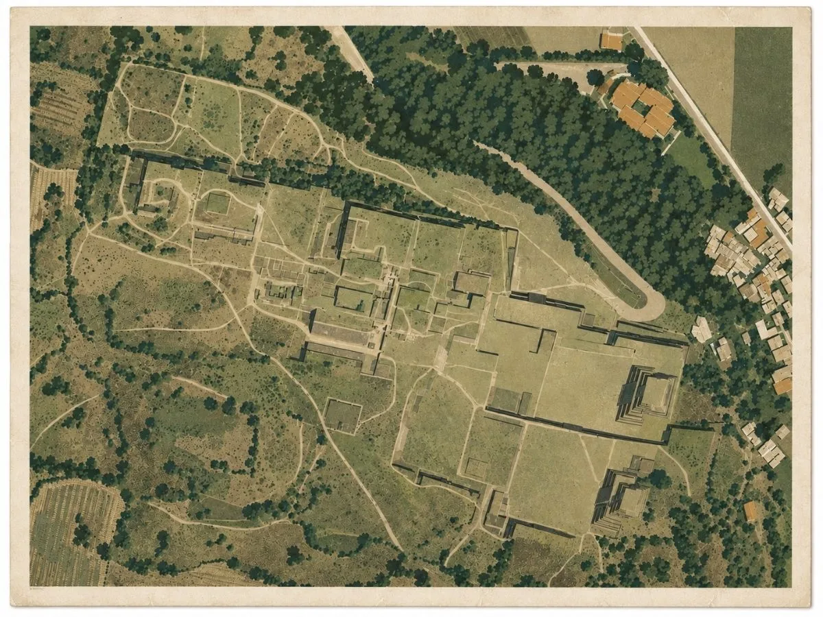
Teotenango, meaning “place of the divine wall” in Nahuatl, was an important hilltop city in the central highlands of Mexico. Though its earliest occupation likely dates back to the Otomi and Mazahua cultures around 900 CE, it reached its architectural and political zenith under the Matlatzinca, a Nahua-speaking people who controlled the valley before the Mexica expansion.
The site’s elevated position gave it natural defensive strength. Fortified with stone walls and terraces, Teotenango served not only as a ceremonial center but also as a strategic outpost. Its long sunken roads and layered platforms suggest an organized civic plan and a population accustomed to hilltop life. The ballcourt, central plazas, and step pyramids speak to the city’s importance as both a sacred and social hub.
In the late Postclassic period, the Mexica (Aztecs) expanded into the Toluca Valley. The Matlatzinca resisted, and Teotenango became a fortified frontline. Eventually, the Mexica overwhelmed the defenders, incorporating the city into their growing tribute empire. This final phase of occupation left layers of cultural fusion visible in the remaining architecture.
Experiences Around Teotenango
The ruins are only part of the story. Cultivated fields and volcanic hills spread across the southern Toluca Valley below Cerro Tetépetl.
–
In Tenango del Valle, look for the town’s traditional waxwork, where artisans shape fruit, flowers, birds, and elaborate candles by hand.
–
The town’s Porfirian-era Municipal Theater adds an unexpected piece of ornate architecture to the historic center.
After the Spanish conquest, Teotenango was abandoned, and a new town, Tenango del Valle, was established downhill. The ancient city’s stones were quarried for colonial buildings, but much of its structure remains. Oral traditions in the region speak of buried tunnels, hidden staircases, and sacred artifacts sealed within the hill. While many of these remain unverified, recent surveys suggest that much of Teotenango is still unexplored. Buried under vegetation or integrated into active farmland.
How to Get There & Where to Go Next
How to Visit Teotenango
– Step-by-step access to the site –
- From CDMX: Go to Observatorio Bus Terminal
- Bus to Tenango del Valle: Take a direct bus toward Toluca, ask for Tenango ~1.5 hours.
- Walk from town center: Uphill walk from plaza to site gate ~30 minutes.
Tip: Arrive early for cooler temps; no shade at the summit and the climb can be exposed.
Nearby Ruins You Can Visit
These ridge-top cities shared a world of stepped platforms, defensive stonework, and shifting regional alliances. Echoes of Teotenango’s own skybound domain.

Malinalco – Carved into cliffside rock, its ceremonial complex guarded the highlands with mythic precision.

Teotihuacan – Much older, but its sacred geometry and warrior symbolism helped shape the ideology of later Aztec sites.
Chalcatzingo – A mountain-ringed site with Olmec-style carvings, rain god iconography, and early plaza planning rooted deep in Mexico’s highland past.
Traveler Tips
- Wear sturdy shoes, the site is large, and the climb can be slippery in the rainy season.
- There’s limited shade, bring a hat and water, especially if visiting midday.
- The small museum at the base is worth a visit for context before the climb.
- Local vendors may sell snacks and crafts near the parking area, but not at the ruins themselves.
- No signage in English. consider researching beforehand or hiring a guide at the town center.
Elsewhere in the Americas…
As Teotenango developed as a fortified highland center in central Mexico, other cultures across the Americas were shaping their own centers of power and identity:

In central U.S., the Mississippian center of Cahokia built massive mounds and ceremonial plazas tied to regional authority.
Insider Explorer Advice
Approaching from CDMX via Observatorio station, the bus winds through highland fields. Just before reaching Tenango, Teotenango appears. Rising above the town like a spine of stone, the ruins reveal themselves without warning. From Malinalco, it’s an easy return day trip. A perfect pairing of ridge-top citadels. The uphill walk from Tenango takes about 30 minutes, but it’s worth every step. What awaits is a sprawling site, far larger than expected, with panoramic views and quiet paths lined with carved stones. The agricultural terraces beyond the park limits are still in use. A living border between past and present.
Summary: Teotenango is where the Matlatzinca held the heights. A hilltop memory of resistance, resilience, and skybound ceremony.