
Moray
PERU / CUSCO / INCA
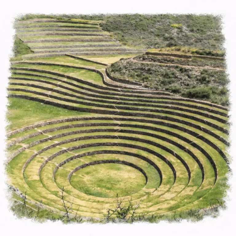
High in the Sacred Valley, Moray organizes concentric circular terraces, where descending rings create controlled microclimates used for Inca agricultural experimentation.
| Name | Moray |
| Civilization | Inca, with earlier pre-Inca occupation |
| Location | Mullak’as Misminay, Maras District, Cusco Region, Peru, Sacred Valley of Peru |
| Elevation | 3,385 – 3,500 m (11,106 – 11,500 ft) |
| Years Active | Pre-Inca occupation; principal Inca use 1400 to 1530s CE |
| Primary Resources | Stone, irrigation water, terraced soils, agricultural crops |
| Site Type | Agricultural and ceremonial terrace complex |
| Key Highlights | Concentric terraces, microclimates, scenic highland views |
| INT Airport | Alejandro Velasco Astete International Airport (CUZ) |
| Entry Fee | Boleto Turístico del Cusco: S/70 partial or S/130 integral |
| Best Time to Visit | Morning or late afternoon, dry season (May–September) |
| Field Visit | Visited & photographed by Lost Ruins of the Americas |
Unique Features of the Moray Archaeological Site
- Concentric Ring Design: The site consists of circular terraces carved into a natural depression, with each level carefully aligned to the slope.
- Soil Importation: Layers of soil were brought in from different regions, showing Inca efforts to simulate varied agricultural zones.
- Temperature Calibration: The 30-meter depth of the main ring produces measurable climate variation from top to bottom.
- Drainage Engineering: Subsurface canals and gravel foundations control moisture and prevent waterlogging across terraces.
- Minimal Ornamentation: Unlike ceremonial centers, Moray lacks carvings, plazas, or temples. Its precision lies in purpose, not display.
Location & Access
- Nearest Town: Maras, approximately 7 kilometers from the archaeological site.
- Directions: From Cusco, take a combi or bus to Urubamba and ask to stop at the Maras turnoff. From there, hire a mototaxi or walk (~1 hr) to the site.
- Official Website: Cultura de Cusco, Moray
- Opening Hours: 7:00 AM to 5:00 PM.
- Entry Fees: Boleto Turístico del Cusco, Partial Circuit III S/70 or Integral Ticket S/130
- Moray is included in Circuit III: Sacred Valley, together with Pisac, Ollantaytambo, and Chinchero.
- Facilities: Ticket office, marked paths, viewpoints, interpretive signs, guided services, craft vendors, and a first-aid point.
- Accessibility: Partial. A level approach reaches the entrance and main overlook, but the wider walking route is not fully step-free.
- Nearby Sites: Pisac, Ollantaytambo, Chinchero, Machu Picchu, Tipón
- Pro Tip: Combine Moray with the Salineras de Maras for a rewarding half-day or full-day trek

Highlights to Help Understand Your Visit
Moray isn’t a city or fortress. It is a question etched into the ground. These clues help make sense of its purpose.
- Engineering as Experiment: Every terrace level was built to test something: temperature, soil, light, or water. This site wasn’t decoration. It was deliberate.
- Circles Within Cycles: The geometry isn’t just for beauty. It reflects Inca thinking about nature’s rhythms, including seasons, elevation, and control over time.
- Hidden, Yet Elevated: Moray sits in a depression but reveals itself as you approach. It was engineered for both concealment and panoramic observation.
- Drainage is the Foundation: Look at how dry the terraces stay. Without that subsurface system, none of this would’ve lasted a season.
- No Homes, No Temples: This wasn’t built for living or worship. It was a field lab. Its silence says as much as its shape.
Key Structures of the Moray Ruins
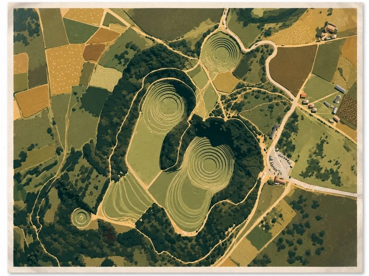
- Main Circular Complex: The largest depression at Moray, about 30 meters deep, featuring more than a dozen concentric terraces that form a perfect amphitheater. It was used for controlled agricultural experimentation.
- Eastern Oval Terraces: A smaller, elliptical set of terraces east of the main ring. These are believed to test alternate sun and wind exposures or host different crop varieties.
- Southern Depression: An isolated, partially excavated bowl that suggests the site may have extended further or been mirrored across zones.
- Terrace Retaining Walls: Massive stone blocks form seamless curves that manage soil pressure and drainage while holding the agricultural levels intact across centuries.
- Embedded Stair Stones: Strategically placed protruding stones used by Inca engineers to descend or ascend between terrace levels without disrupting planted rows.
- Drainage and Moisture System: Sophisticated subsurface canals and gravel beds beneath the terraces ensure moisture control and prevent erosion or saturation damage.
- Upper Viewing Rim: A raised perimeter path offering full visual context of the geometric and agricultural layout. It was also likely used for observation and oversight.
- Western Terraced Ledge: A subtle slope with narrower terraces, possibly designed to simulate high-altitude growing conditions or specific stress environments.
- Soil Layering Zones: Excavations reveal imported soil layers from different eco-regions. This is evidence of intentional Inca efforts to simulate diverse agricultural environments.
History and Legends
Moray does not rise above the landscape like a fortress or temple. It drops into it. On the high plateau near Maras, Inca builders took natural depressions and reshaped them with great rings of concentric agricultural terraces, creating stepped bowls that descend toward broad floors at their centers. Stone retaining walls hold deep beds of soil, stairways cut through the terrace rings, and channels carried water into cultivated ground that had been carefully fitted to the contours of each hollow. Moray was not carved from an untouched plain. The Incas took existing landforms and turned them into controlled growing spaces unlike anything else around Cusco.
Those descending rings created noticeably different conditions from one level to another. Depth, exposure to sunlight, wind, moisture, and the orientation of individual terraces all affected the environment in which plants grew. These different microclimates are the foundation of Moray’s best-known interpretation: that the Incas used the terraces to experiment with crops and help adapt them to different ecological conditions. Calling Moray an “agricultural laboratory” is useful as shorthand, but it should not suggest a modern research station with a documented experiment assigned to every terrace. What survives is the physical evidence of unusually varied growing environments deliberately organized within a small area.
Making those environments work required careful control of water. Channels and reservoirs brought water toward the terraces, while irrigation and drainage were designed together so that the deeply enclosed bowls could be cultivated without simply filling with runoff. Water could be directed across the rings and carried away again, while the retaining walls held cultivated soils on steep artificial slopes. The striking circles are therefore only the visible part of the achievement. Beneath their geometry was a working system of soil, moisture, drainage, and stone construction.
Maize and potatoes belong to the agricultural world in which Moray developed, and both have become closely associated with interpretations of the site. Even the name has been connected, although not conclusively, with aymoray, a term associated with the maize harvest, and with moraya, a form of dehydrated potato. Moray has consequently been proposed as a place where crops could be tested or acclimatized before being grown under different Andean conditions. There is no surviving Inca record telling us which crop grew on which terrace, so claims that specific varieties were created here go beyond the evidence. The stronger point is visible in the site itself: the Incas built a landscape capable of producing different growing conditions within the same complex.
Agriculture may not have been Moray’s only purpose. One Andean interpretation connects the site with tinkuy, the meeting of complementary elements, and pairs Moray as a feminine place with nearby Wañin Marka as masculine. The terraces have also been interpreted as having ceremonial importance alongside their agricultural use. Neither idea survives as a direct Inca explanation of Moray, but they fit a landscape where earth, water, cultivation, and carefully ordered space were brought together so deliberately. Moray’s great circles therefore make sense first as an extraordinary piece of Inca agricultural engineering, while leaving room for meanings that extended beyond the practical work of growing crops.
Experiences Around Moray
High Andean farmland spreads across a rolling plateau, with snowcapped peaks rising beyond fields of potatoes, barley, and quinoa.
–
At the Salineras de Maras, look down across thousands of salt pools fed by a natural spring, then pick up pink Maras salt sold by the local cooperative.
–
Nearby Misminay offers community-run visits centered on farming and weaving, including natural dyes, backstrap looms, and traditional Andean cooking.
How to Get There & Where to Go Next
How to Visit Moray
Step-by-step access to the site
- From Cusco: Combi to Urubamba 1.5 hours.
- Highway Drop-off: Ask to stop at the Maras turnoff.
- Local Transfer: Hire moto-taxi or taxi to Moray, 15–20 minutes.
- Optional Return Hike: Walk down past Maras and Salineras, 2–3 hours.
Tips: Return transport may be irregular — consider negotiating a round-trip fare at the start.
Nearby Ruins You Can Visit
These highland sites share Moray’s balance of practical design and spiritual geometry. Landscape becomes laboratory, and form follows purpose across altitudes.

Ollantaytambo – Terraces become fortresses in this living Inca town, echoing Moray’s blend of structure and slope.
Machu Picchu – A royal Inca sanctuary built with the same elite masonry and cosmological precision.

Tipón – Masterful water channels and stepped agriculture reveal Inca experiments in a different mountain setting.
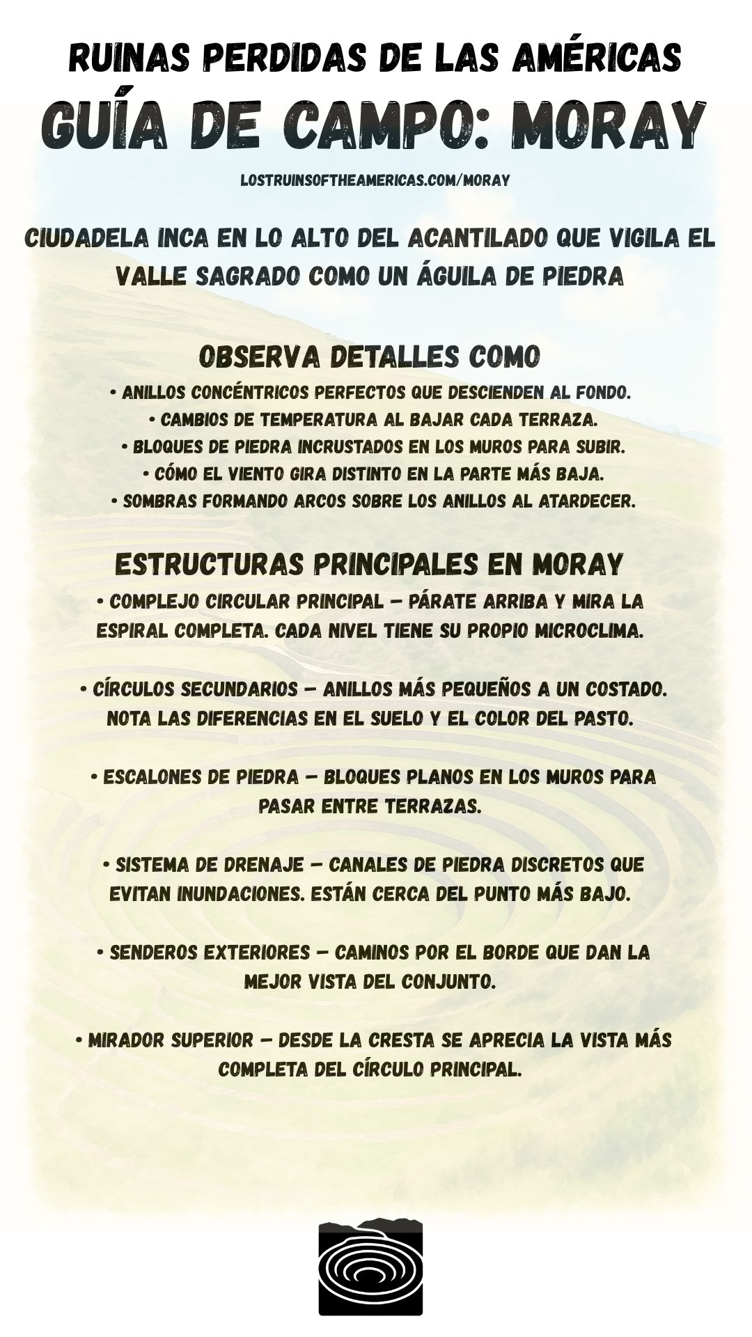
Download Field Guide
Español
English

Traveler Tips
- Bring water and sun protection, the site is exposed, with minimal shade.
- Footing can be uneven on lower terraces; sturdy shoes recommended.
- Vendors near the entrance offer snacks, drinks, and artisan goods.
- Pair your visit with Maras salt mines for a full day of stunning variety in terrain and purpose.
Elsewhere in the Americas…
While Moray was active, civilizations across the Americas were building their own centers of power, artistry, and defense:


In Colombia, Ciudad Perdida developed as a terraced ceremonial center built into the Sierra Nevada mountains.
Insider Explorer Advice
Moray is a full-day adventure if done on local terms. From Cusco, catch a combi to Urubamba and ask to be dropped at the Maras turnoff. From there, walk up or hire a mototaxi to the site. After exploring Moray’s surreal terraces, the descent through the Maras salt flats to the Urubamba River offers a dramatic and scenic change of pace. The loop is varied, quiet, and deeply rewarding. Though the final descent is steep, it is manageable. At the river road, it’s easy to flag down a return combi or taxi. With timing and sun on your side, this full loop captures the Sacred Valley’s diversity in a single day.
Summary: Moray’s design isn’t just beautiful. It is purposeful. This highland spiral is where Inca science and sacred space meet in carved concentricity.