
Tipón
PERU / CUSCO / INCA
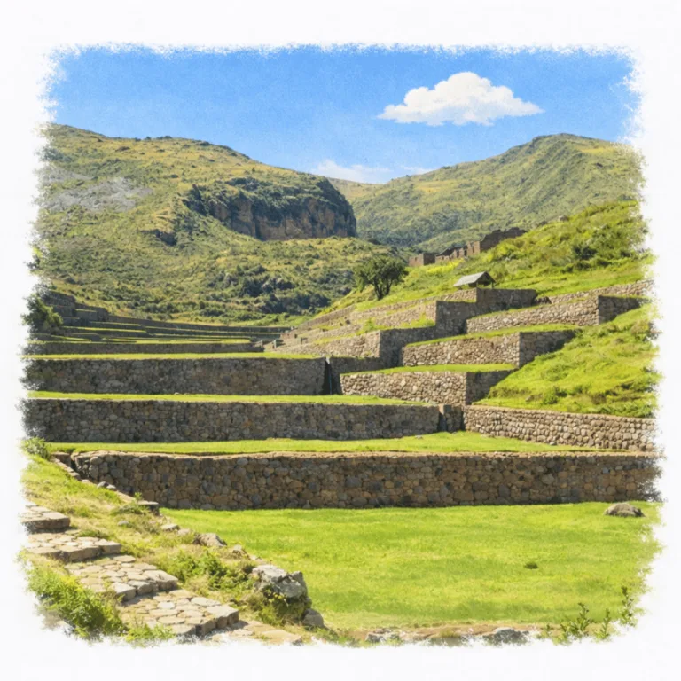
Along a series of descending Andean terraces, Tipón organizes finely cut stone channels, where precisely graded water flows through fountains and basins in one of the most sophisticated hydraulic systems of the Inca world.
| Name | Tipón |
| Civilization | Inca, with earlier pre-Inca occupation |
| Location | Sacred Valley ,Choquepata, Cusco Region, Peru |
| Elevation | 3,250 – 3,960 m (10,660 – 12,990 ft) |
| Years Active | c. 1200 to 1534 CE |
| Primary Resources | Stone, water, maize |
| Site Type | Royal estate and ceremonial hydraulic center |
| Key Highlights | Terracing, ritual waterworks, panoramic canal path |
| INT Airport: | Alejandro Velasco Astete International Airport (CUZ) |
| Entry Fee | Cusco Tourist Ticket, Partial Circuit II S/70 or Integral Ticket S/130 |
| Best Time to Visit | Dry season mornings (May–August) |
| Field Visit | Visited & photographed by Lost Ruins of the Americas |
Unique Features of the Tipón Archaeological Site
- Water Management Systems: Interconnected stone channels, aqueducts, and fountains engineered to precision. Many still active.
- Terraced Agriculture: Expansive stepped fields descending in symmetrical formation, used for high-altitude cultivation.
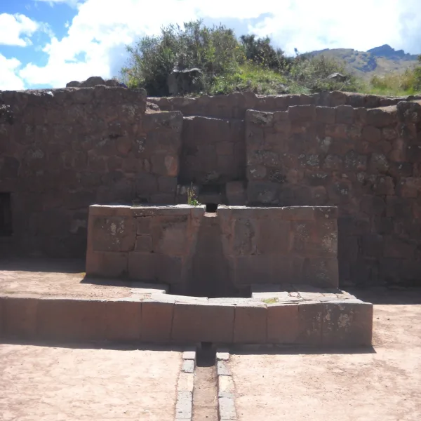
- Ceremonial Fountains: Flowing springs that empty into carved platforms, likely used for ritual purification or offerings.
- Unending Canal: A single channel snakes up the mountainside — its source still elusive even after hours of climbing.
Location & Access
- Nearest City: Oropesa, Cusco Region
- Directions: Frequent combis depart from Cusco. Confirm with the driver to stop at the road to Tipón ruins. From the drop-off, walk uphill for about 20 minutes to reach the site entrance.
- Official Website: Cultura de Cusco, Tipón
- Opening Hours: 7:00 AM to 4:30 PM
- Entry Fee: Admission is included in the Cusco Tourist Ticket. Partial Circuit II costs S/70 and is valid for two days; the Integral Ticket costs S/130 and is valid for ten days.
- Facilities: Restrooms at the lower gate; no food or water vendors inside
- Accessibility: Limited. Rocky ground, slopes, terraces, and a wooden stairway over exposed bedrock prevent flat or direct wheelchair access.
- Nearby Sites: Pisac, Ollantaytambo, Moray, Chinchero, Machu Picchu
- Pro Tip: Bring sun protection and water; most of the site is exposed and hiking-intensive.
Highlights to Help Understand Your Visit
Tipón isn’t just beautiful. It’s a coded experience of Inca worldview, hydrology, and sacred order. Watch how stone, slope, and water speak in silence.
- low is the Message: Water doesn’t just move here. It performs. Every channel and fountain was part of a ceremonial act honoring life and the cosmos.
- Terraces with Purpose: These weren’t just farms. They were laboratories for altitude-based agriculture and ritualized land use.
- The Hidden Source: Follow the upper canal and realize. The source isn’t just distant; it’s sacred. That mystery was the point.
- Stone as Language: Walls here aren’t massive like Sacsayhuamán, but they’re precise, symbolic, and whisper control through symmetry.
- No Central Plaza: This isn’t a fortress or market town. The layout is devotional, not administrative, built to align water, worship, and mountain.
Key Structures of the Tipón Ruins
- Main Agricultural Terraces: Broad, perfectly leveled platforms that descend along the slope in a precise grid, used for experimental cultivation at varying altitudes.
- Royal Enclosure: A walled complex likely used by Inca elites, featuring housing units, plazas, and ritual spaces.
- Altar Fountain: A central ceremonial platform where water flows into a carved basin, interpreted as a site for offerings or purification rites.
- Upper Canal Path: A continuous water channel that climbs the hillside for over an hour. Its exact mountain source remains unmarked and likely sacred.
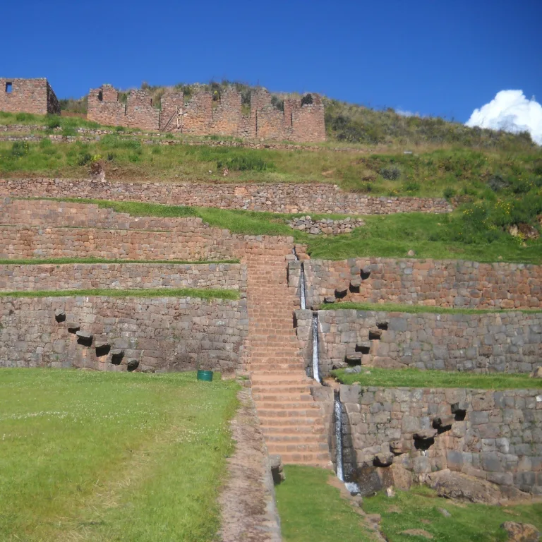
- Secondary Aqueduct Network: A branching system of channels distributing water to terraces and drain systems, showing redundancy and precision in design.
- Lower Residential Area: Foundations of multi-room structures thought to house site caretakers, builders, or agricultural workers.
- Sun Temple Platform: A raised area with commanding views and solar alignment. Its layout suggests seasonal astronomical significance.
- Drainage Galleries: Subterranean watercourses built to handle overflow during seasonal rains, integrated seamlessly into terrace walls.
- Stone Staircases: Dozens of narrow stairways connect terrace levels, designed with water runoff channels alongside the steps.


History and Legends
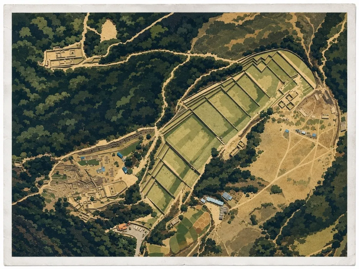
Water is the first thing that explains Tipón. High on the mountainside southeast of Cusco, springs emerge above a steep slope that earlier peoples were already using before the Incas arrived. Under Inca rule, that slope was transformed into a carefully organized landscape of terraces, walls, buildings, roads, and channels. Thirteen monumental terraces form the core of the site, stepping down the mountain while a network of waterways carries water through the complex from higher ground.
The Incas did far more than irrigate fields here. They gathered water from springs and the nearby river system, directed it through stone-lined channels and underground conduits, stored it in reservoirs, and released it through carefully built outlets. Water could be sent toward particular terraces, drained away when there was too much, or divided into separate streams before continuing downhill. The effect is still easy to follow on the ground. Water appears, disappears, changes direction, drops between levels, and then spreads across the cultivated slope. The entire hillside was engineered around controlling its movement.
Some of that movement was clearly meant to be seen. At Tipón’s principal fountains, water is divided with unusual precision before flowing onward through finely built stonework. Peruvian authorities identify Tipón as both an administrative and ceremonial center, and researchers have long interpreted its waterworks as having ritual as well as practical importance. In the Inca world, those roles did not have to be separate. A spring could feed crops, supply a residence, demonstrate control over an essential resource, and carry sacred meaning at the same time. At Tipón, agriculture, engineering, and ceremony were built into the same flowing system.
Experiences Around Tipón
The ruins are only part of the story. Terraced hills and cultivated fields shape Cusco’s South Valley, with the Andes rising above the Huatanay basin.
In Oropesa, buy a freshly baked pan chuta, the town’s large, lightly sweet bread traditionally cooked in clay ovens.
Continue to the Lucre-Huacarpay wetlands for a walk beside the lagoons, where reed beds and open water attract herons, waterbirds, and migratory species.
A later tradition connected Tipón with Viracocha Inca and his father, Yawar Waqaq. Garcilaso de la Vega wrote of a royal residence prepared for an older Inca somewhere between Muyna and Quepicancha, describing gardens, streams, and the comforts of an elite retreat. He did not name that place Tipón, but later Cusco historians identified his description with the complex, and the association became part of Tipón’s historical tradition. Other accounts also connect Viracocha with the surrounding area. The link cannot be treated as a proven foundation story, but it fits the character of a landscape where controlled water, cultivated terraces, and high-status architecture were brought together on a remarkable scale.
Tipón extends well beyond the fountains that made it famous. Walls cross the upper slopes, channels continue across the mountain, and roads and occupied areas connect the terraces with a much larger Inca landscape. That scale matters because Tipón was never just a decorative water garden. People built, cultivated, managed water, lived, and gathered here. The Incas reshaped an entire mountainside so that water could serve the fields, the settlement, and ceremonial life at once, and much of that system can still be read simply by following the flow from one terrace to the next.
How to Get There & Where to Go Next
How to Visit Tipón
Step-by-step access to the site
- Start in Cusco: Take a combi from Avenida de la Cultura toward Tipón or Oropesa (15–20 min).
- Confirm stop: Ask the driver to let you off at the Tipón archaeological zone entrance road.
- Walk to gate: From drop-off, walk uphill 15–20 minutes to reach the site entrance.
- By taxi: A round-trip taxi from Cusco costs 60–80 soles with wait time included..
Tips: Visit in the early morning for cooler temperatures and quieter trails — most of the site is exposed to sun and wind.
Nearby Ruins You Can Visit
These Inca sites share Tipón’s sacred engineering, places where stone, ceremony, and mountain worship shaped an empire’s southern corridor.

Ollantaytambo – Terraces become fortresses in this living Inca town, echoing Moray’s blend of structure and slope.

Machu Picchu – A royal Inca sanctuary built with the same elite masonry and cosmological precision.

Pisac: Inca terraces climb above a ceremonial ridge, with cliffside tombs cut into the mountain across the Sacred Valley.
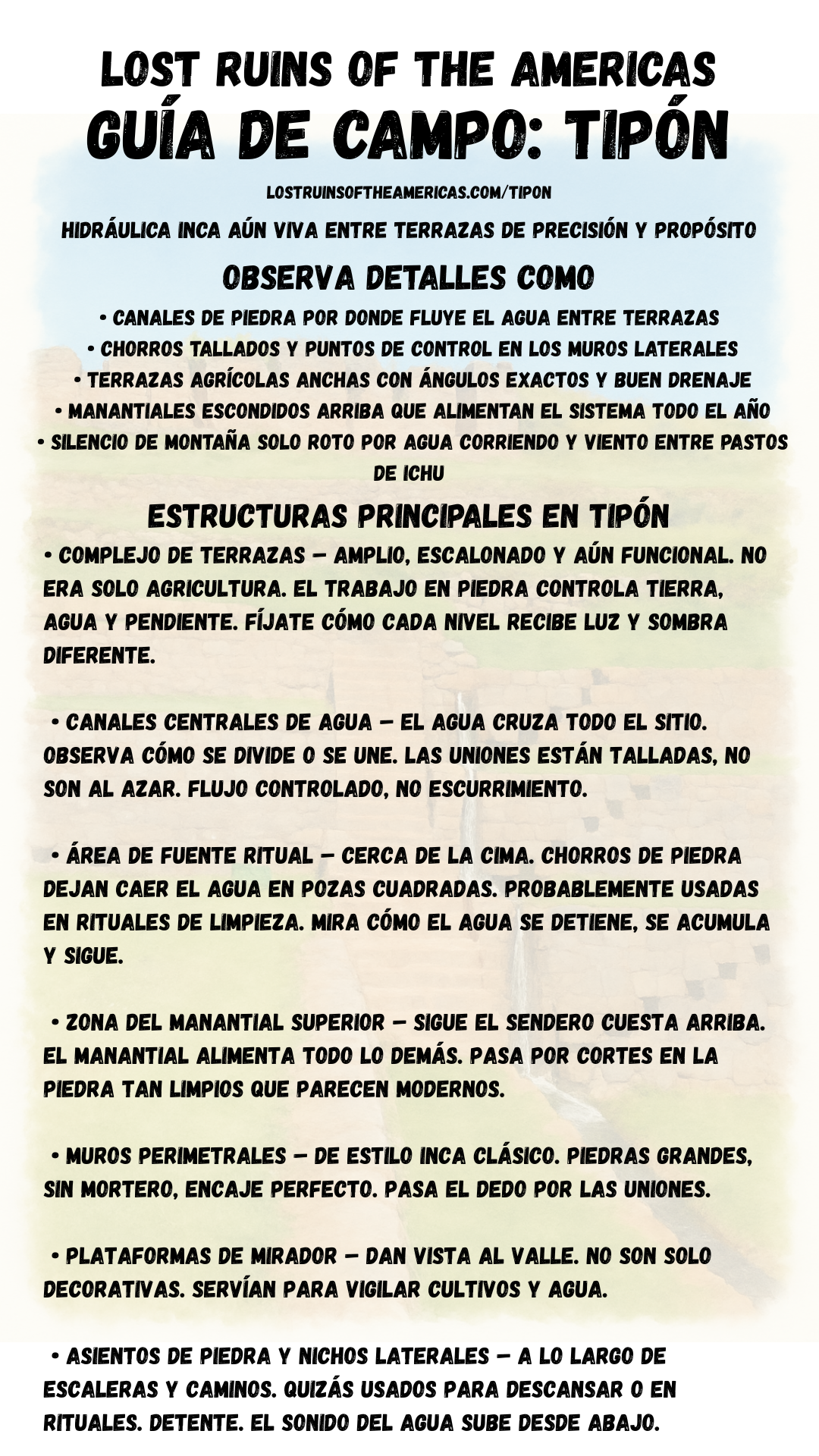
Download Field Guide
Español
English


Traveler Tips
- Arrive early to avoid sun exposure, there’s little shade on the upper terraces.
- Wear trail shoes, paths are steep and uneven in sections.
- Bring water and snacks, no vendors operate within the ruin zone.
- The upper canal trail is unmarked, allow extra time if hiking beyond main site.
- Restrooms only at lower entrance, none inside ruins.
Elsewhere in the Americas…
While Tipón flourished in the Andes, cities across the Americas were reaching their final heights, or resisting collapse, in the face of shifting empires and looming invasion:

In central Mexico, the Aztec Empire ruled from Tenochtitlan, dominating tribute networks across the region.

Cholula continued as a sacred pilgrimage site, with its massive pyramid and layered temples drawing ritual traffic from across central Mexico.

In Colombia, Ciudad Perdida developed as a terraced ceremonial center built into the Sierra Nevada mountains.
Insider Explorer Advice
The easiest way to reach Tipón is via combi from Cusco. They run frequently and offer cheap fares. Confirm with the driver to drop you at the ruin entrance road. From there, it’s a 20-minute uphill walk. It is not difficult, but it gains elevation quickly. Once inside, follow the main canal up the mountain. It’s a gradual, meditative climb with panoramic views and almost no foot traffic. Though you may never find the canal’s true source, the journey offers some of the best perspectives in the Sacred Valley.
Summary: Tipón is where stone breathes and water remembers. An elevated echo of Inca reverence made real in flow and form.