
Pisac
PERU / CUSCO / INCA
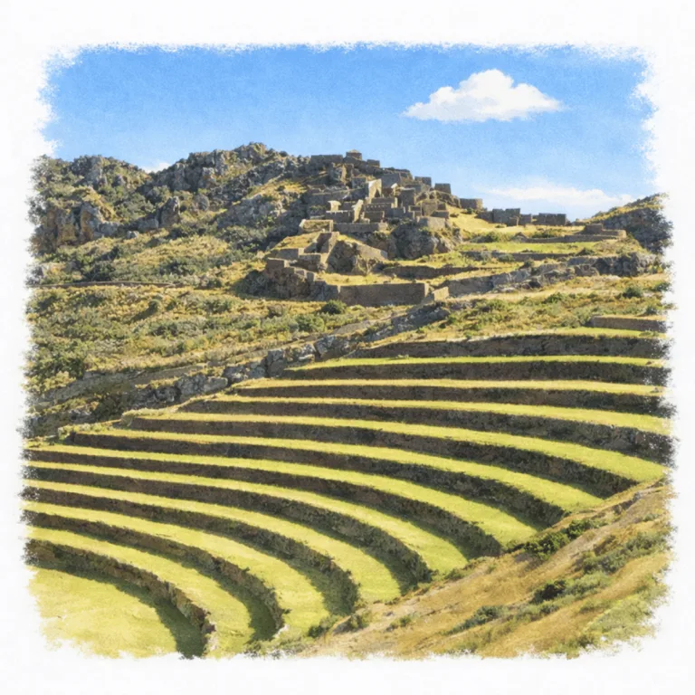
High above the Sacred Valley, Pisac organizes sweeping agricultural terraces, where curved stone walls follow the mountain’s contours to maximize cultivation across steep slopes.
| Name | Pisac |
| Civilization | Inca |
| Location | Sacred Valley, Calca Province, Cusco Region, Peru |
| Elevation | 3,300 – 3,500 m (10,827 – 11,483 ft) |
| Years Active | c. 1440 – 1530 CE |
| Primary Resources | Granite, maize, water channels |
| Site Type | Terraced agricultural complex with ceremonial and military sectors |
| Key Highlights | Terraces, Temple of the Sun, funerary caves, mountain views |
| INT Airport | Teniente FAP Alejandro Velasco Astete International Airport (CUZ), Cusco |
| Entry Fee | S/70 Boleto Turístico Parcial III; S/130 Boleto Turístico Integral |
| Best Time to Visit | Morning; plan for full downhill walk |
| Field Visit | Visited & photographed by Lost Ruins of the Americas |
Unique Features of the Pisac Archaeological Site
- Mountain Ridge Alignment: The site arcs along a high ridgeline, offering panoramic views over the Sacred Valley.
- Descending Exploration: Uniquely, Pisac allows visitors to descend through zones, from ceremonial to agricultural, all the way back to town.
- Strategic Fortification: Natural cliffs combine with Inca masonry for high-altitude defense and surveillance.
- Funerary Cliff Tombs: Hundreds of ancient burial sites are carved into sheer cliff walls, visible from key vantage points.
Location & Access
- Nearest Town: Pisac, 33 km from Cusco
- Directions: Take a combi or taxi from Cusco (~1 hour). The site sits above town, most visitors taxi up and walk down.
- Official Website: Dirección Desconcentrada de Cultura de Cusco, Parque Arqueológico de Pisaq.
- Opening Hours: 7:00 AM to 4:30 PM.
- Entry Fees: S/40 for the Boleto Turístico Parcial III or S/70 for the Boleto Turístico Integral. Foreign visitors pay S/70 for the Boleto Turístico Parcial III or S/130 for the Boleto Turístico Integral. The partial ticket remains valid for two days and includes Pisac, Ollantaytambo, Chinchero, and Moray.
- Facilities: Restrooms at upper entrance; basic signage, no vendors onsite
- Accessibility: Limited. Narrow mountain terrain, rock-cut steps, and steep stone stairways prevent level access through the archaeological park.
- Nearby Sites: Ollantaytambo, Moray, Chinchero, Machu Picchu, Tipón
- Pro Tip: Start early and make a full downhill day of it. The path down is unforgettable
Highlights to Help You Understand Your Visit
Pisac isn’t just scenic, it’s a statement in stone. Watch for these clues as you descend through the site:
- A Designed Descent: You move downward through sectors, from sacred temples to farming terraces. It’s intentional, a path of purpose.
- Stone That Breathes: Many walls are curved, not flat, a subtle adaptation to the mountain itself, not a flaw.
- Hollowed Cliffs: Look across the ravine. Those cavities aren’t caves. They’re tombs, once filled with elite ancestors watching the valley.
- Channels and Flow: Water was controlled with care. Note how aqueducts pass near temples, a sacred current, not just plumbing.
- Warfare Without Walls: The steep terrain is the defense. No perimeter fortifications needed. The mountain is the fortress.
Key Structures of the Pisac Ruins
- Temple of the Sun: A finely cut semicircular shrine with sacred niches and astronomical alignment. Its position and polish mark it as Pisac’s spiritual heart.
- Intihuatana: A carved ritual stone believed to function as a solar gnomon, connecting ceremonial observation with the mountain skyline.
- Military Zone: Clustered on high ridges and accessed by narrow paths, this fortified sector controlled movement across the valley’s eastern flank.
- Terraced Agricultural Zone: Massive stair-stepped terraces with stone retaining walls, engineered to regulate microclimates and maximize crop yield.
- Residential Quarters: Narrow stone houses and storage spaces line the ridgeline, likely homes for farmers, workers, or priests serving the elite core.
- Water Channels and Ritual Fountains: Carefully routed stone aqueducts carry spring water through sacred areas, blending utility with ceremony.
- Funerary Caves: Hundreds of tombs carved into the cliffside across from the main complex. These form one of the largest known Inca burial fields.
- Watchtowers (Pukaras): Small, circular lookout posts guard the high points of the ridge, keeping visual control over trails and terraces below.
- Trail Network: The original stone paths connect each sector, often steep, always strategic, and offering controlled access through the site’s layers.
History and Legends
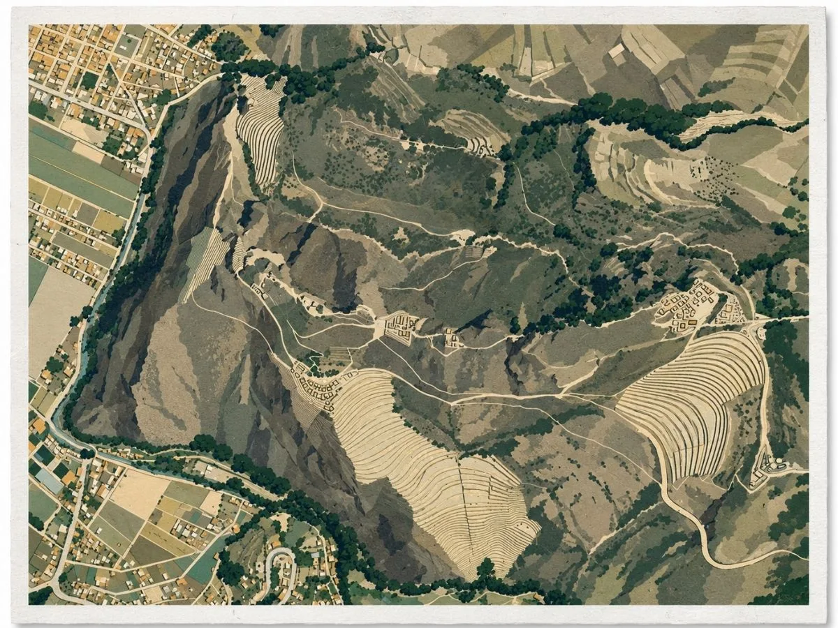
Pisac took shape during the great Inca expansion of the fifteenth century, when Pachacuti established a royal estate on the mountain above the Vilcanota Valley. The sixteenth-century chronicler Pedro Sarmiento de Gamboa connected Pisac with the ruler, and modern archaeological work has strengthened that identification. The setting helps explain the choice. From the ridge, the Incas overlooked a productive section of the valley while remaining connected to routes leading east through Paucartambo toward the tropical lowlands. Pisac was not built as one compact city. Its terraces, residential groups, ceremonial spaces, roads, and waterworks were spread across a steep mountainside and tied together as parts of a single royal landscape.
The terraces show how completely the Incas reshaped that landscape. Long retaining walls curve across slopes that offered little natural level ground, while stairways and channels climb between them. Peruvian authorities identify Pisac as an important agricultural center where maize was cultivated, with potatoes also possibly grown on the estate. That production mattered because a royal property had to support far more than a ruler’s residence. Fields, labor, storage, roads, and elite buildings all belonged to the system that maintained Pachacuti’s household and, after his death, the royal kin group responsible for his estate and cult.
Higher on the mountain, the construction becomes more refined around Intiwatana, one of Pisac’s principal ceremonial sectors. Here finely fitted walls surround and incorporate natural rock, with architecture shaped to the narrow contours of the ridge. The surviving evidence does not tell us exactly what ceremonies took place there, but Peruvian cultural authorities identify strong astronomical symbolism in the sector and connect it with the broader Andean understanding of sacred landscape and celestial cycles. Nearby paths, terraces, and short passages cut through rock show how deliberately Inca builders worked with the mountain itself instead of treating it as a surface to be flattened.
Across the Kitamayu ravine, the dead occupied an equally striking part of Pisac’s terrain. Tombs were cut into the steep mountainside opposite the main settlement, forming an extensive funerary area now commonly known as Tankanamarka. Many of those burials were disturbed and looted over the centuries, so much of their original archaeological information has been lost. Even in damaged form, the cemetery changes the way the site is read. Pisac was not only a place of farming, administration, and ceremony. The living and the dead occupied facing slopes within the same carefully organized mountain landscape.
The Spanish conquest brought an end to the political system that had sustained royal estates such as Pisac, but it did not empty the valley of its people. During the colonial reorganization of the Andes under Viceroy Francisco de Toledo, the population was resettled on the valley floor around 1569, where the present town developed beneath the Inca complex. That shift is still visible today. The old estate remains stretched across the heights, while the later town occupies the valley below. Few parts of Pisac make its history clearer than that physical separation between the Inca ridge settlement and the community reorganized under Spanish rule.
Experiences Around Pisac
The ruins are only part of the story. Steep green mountains close around this end of the Sacred Valley, with farm terraces climbing toward high Quechua communities.
On Sundays, Plaza Constitución fills with potatoes, corn, herbs, fruit, and other produce brought down from surrounding communities, alongside the town’s better-known craft stalls.
A few streets away, the Jardín Botánico Felipe Marín Moreno brings together medicinal plants, native shrubs, and other Andean species in a small garden established in the heart of town
How to Get There & Where to Go Next
How to Visit Pisac
Step-by-step access to the site
- Depart from Cusco – Take a taxi or combi from Calle Puputi (approx. 1 hr).
- Arrive in Pisac town – Most visitors stop at the plaza or main road junction.
- Take a taxi to the upper entrance – 15–20 min uphill ride via switchback road.
- Walk down through the ruins – Allow 2–3 hrs for full descent and exploration.
Tip:Start early to avoid heat and crowds. The downhill walk is long but rewarding, with few rest points.
Nearby Ruins You Can Visit
Pisac was part of a broader Inca strategy to fortify and organize the Sacred Valley. These nearby sites reflect different aspects of that imperial vision.

Ollantaytambo – Terraces become fortresses in this living Inca town, echoing Moray’s blend of structure and slope.

Machu Picchu – A royal Inca sanctuary built with the same elite masonry and cosmological precision.

Tipón – Masterful water channels and stepped agriculture reveal Inca experiments in a different mountain setting.
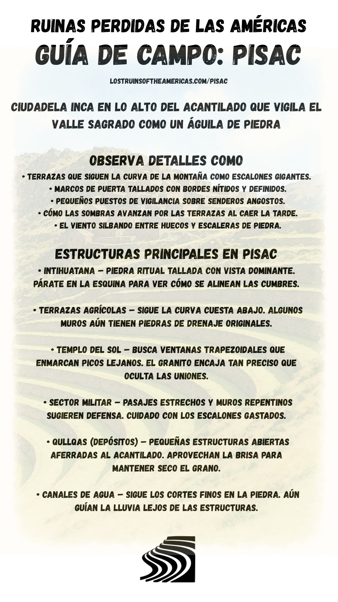
Download Field Guide
Español
English

Traveler Tips
- Start your visit at the upper entrance by taxi, it allows for a mostly downhill journey back to Pisac town.
- Wear shoes with grip, there are many stairs are narrow, steep, and worn smooth.
- Bring snacks and water, there are no vendors inside the ruin zone.
- Midday heat can be intense, sun protection is essential, even when it’s cloudy.
- Don’t miss the chance to explore Pisac town’s market after your descent.
Elsewhere in the Americas…
While this Pisac was active, civilizations across the Americas were building their own centers of power, artistry, and defense:


In Colombia, Ciudad Perdida developed as a terraced ceremonial center built into the Sierra Nevada mountains.

In the central U.S., Mississippian cultures built major centers like Cahokia, shaping trade and ceremonial networks.
Insider Explorer Advice
This may be the most rewarding Inca walk in the Sacred Valley. By starting high and walking down, you engage the site as it was meant to be experienced: a procession through function, meaning, and altitude. Each switchback unveils another structure, each turn delivers a wider view. You pass tombs, terraces, and temples in silence, far from crowds. Make a day of it. Start early, descend slowly, and treat every ledge as a lookout. Pisac isn’t a single destination. It’s a downward journey into Inca order and landscape grace.